IMD issues five-day rain alert for Delhi-NCR as monsoon advances slowly
Synopsis
The southwest monsoon is stalled short of fully covering northwestern India, but the IMD's five-day alert signals relief is coming for heat-hit Delhi-NCR. The real turning point could be a Bay of Bengal weather system expected in four to seven days — if it develops as projected, monsoon rains could intensify sharply in the first week of July.
Key Takeaways
IMD has issued a five-day weather alert for Delhi-NCR , forecasting light showers on 27 June and between 1 and 2 July .
Gusty winds of up to 50 kmph are expected in western Rajasthan between 28 June and 2 July .
Uttarakhand is likely to see thunderstorms with lightning between 30 June and 2 July .
The monsoon pause is attributed to the absence of strong low-pressure systems over the Bay of Bengal .
A tropical weather system developing over the eastern Indian Ocean could intensify monsoon rainfall in the first week of July .
INSAT-3DS satellite imagery confirms clear skies persist over Delhi-NCR, Haryana, Punjab, and western UP.
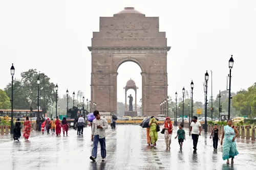
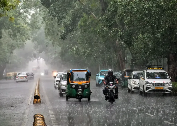
The India Meteorological Department (IMD) has issued a five-day weather alert for Delhi-NCR, forecasting intermittent rainfall on 27 June and again between 1 and 2 July, as the southwest monsoon continues its gradual northward advance across the subcontinent. While the monsoon has not yet fully established itself over northwestern India, the incoming showers are expected to bring meaningful relief from the persistent heat gripping the national capital and neighbouring regions including Noida and Ghaziabad.
What the IMD Forecast Says
According to the weather department, Delhi's skies will remain partly cloudy over the next five days, with daytime sunshine giving way to afternoon gusty winds and isolated evening showers. Similar conditions are expected across adjoining areas in the Delhi-NCR belt. The IMD has also flagged weather changes across Punjab, Haryana, and Chandigarh.
In Rajasthan, western districts are under a rain alert for 27 June, with the possibility of thunderstorms, lightning, and gusty winds reaching up to 50 kmph between 28 June and 2 July. Eastern Rajasthan faces similar conditions through 2 July. Uttarakhand is expected to see thunderstorms with lightning and rain between 30 June and 2 July.
Why the Monsoon Is Moving Slowly
Meteorologists attribute the current pause in monsoon activity to the absence of strong low-pressure systems over the Bay of Bengal. Such systems are critical for drawing moisture inland and spreading rainfall across central and northern India. Without them, the moisture-laden southwesterly winds remain relatively weak, producing scattered rather than widespread rainfall.
Recent satellite imagery from INSAT-3DS shows dense monsoon cloud cover over central India, the Bay of Bengal, northeastern states, and parts of southern India. However, large parts of Delhi-NCR, Haryana, Punjab, western Uttar Pradesh, and Rajasthan continue to record relatively clear skies, confirming that the monsoon has not yet fully covered these regions.
How Monsoon Advance Is Officially Determined
The IMD clarified that the official advance of the monsoon is determined by a combination of wind patterns, moisture levels, and sustained rainfall over a large area — not simultaneous rainfall in every district. As a result, a state can officially fall under monsoon influence even as several cities within it continue to experience hot and dry conditions for a few more days.
Conditions Becoming Favourable for Wider Coverage
The weather office indicated that conditions are turning favourable for the southwest monsoon to advance into more parts of Gujarat, Madhya Pradesh, Chhattisgarh, Jharkhand, Bihar, Uttar Pradesh, and Uttarakhand over the next three to four days.
Weather models suggest a large tropical weather system is expected to develop over the eastern Indian Ocean and move into the Bay of Bengal over the next four to seven days. If the system develops as projected, it could strengthen monsoon flow and trigger the formation of a low-pressure area over the Bay of Bengal along with a middle-tropospheric vortex over western India — potentially intensifying rainfall during the first week of July and accelerating the monsoon's progress across the remaining parts of northwest India, including Delhi-NCR.
Point of View
But the operative phrase is 'intermittent' — scattered showers are not the same as monsoon onset. The department's own explanation that a state can officially fall under monsoon influence while its cities remain hot and dry underscores how the monsoon headline can outrun ground reality. The real variable here is the Bay of Bengal system: if it fails to develop as modelled, the first week of July could disappoint. Northern India's agriculture and water reservoirs are watching closely, and a delayed monsoon deepens stress on both.
NationPress
27 Jun 2026
Frequently Asked Questions
When will it rain in Delhi-NCR according to the IMD?
The IMD has forecast light showers in Delhi-NCR on 27 June and again between 1 and 2 July 2024. Skies will remain partly cloudy over the five-day period, with gusty winds expected in the afternoons.
Why has the southwest monsoon not yet reached Delhi?
The monsoon's northward advance has slowed due to the absence of strong low-pressure systems over the Bay of Bengal, which are needed to draw moisture inland and trigger widespread rainfall. Without these systems, southwesterly winds remain weak, producing only scattered showers over northwestern India.
Which states are under IMD rain alert besides Delhi?
Besides Delhi-NCR, the IMD has flagged weather alerts for Rajasthan, Punjab, Haryana, Chandigarh, Uttarakhand, and parts of Uttar Pradesh. Western Rajasthan faces thunderstorms and winds up to 50 kmph between 28 June and 2 July.
When could monsoon rains intensify over northern India?
Weather models indicate a tropical system developing over the eastern Indian Ocean could move into the Bay of Bengal in four to seven days. If it forms as projected, rainfall activity is expected to intensify in the first week of July, accelerating monsoon coverage over northwest India including Delhi-NCR.
How does the IMD officially declare monsoon onset over a region?
The IMD determines monsoon onset based on wind patterns, moisture levels, and sustained rainfall across a large area — not simultaneous rainfall in every district. This means a state can officially come under monsoon influence even while some of its cities remain hot and dry for a few more days.