IMD red alert for Delhi-NCR: Thunderstorms, 80 kmph gusts forecast on June 12

Synopsis
Delhi-NCR's brief morning relief masks a serious threat: the IMD's red alert warns of thundersqualls up to 80 kmph, hailstorms, and heavy rain across the northwestern belt. With a western disturbance and cyclonic circulation combining over Haryana, this is not routine pre-monsoon activity — and the actual southwest monsoon is still two weeks away.
Key Takeaways
The IMD issued a red alert — its highest warning level — for Delhi-NCR on 12 June .
Thunderstorms with wind gusts up to 80 kmph are forecast across Delhi , Haryana , Punjab , and Rajasthan .
The weather shift is driven by a western disturbance , a cyclonic circulation over Haryana , and an associated trough.
Delhi recorded a maximum temperature of 38.7°C on Thursday, with a heat index of nearly 44°C .
The southwest monsoon is expected to reach Delhi between 25 June and 30 June .
Residents have been advised to stay indoors, avoid trees, and keep away from water bodies during the storm.
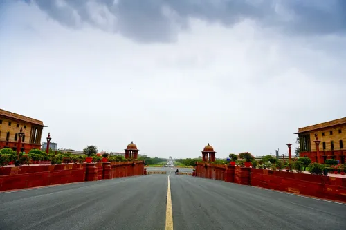
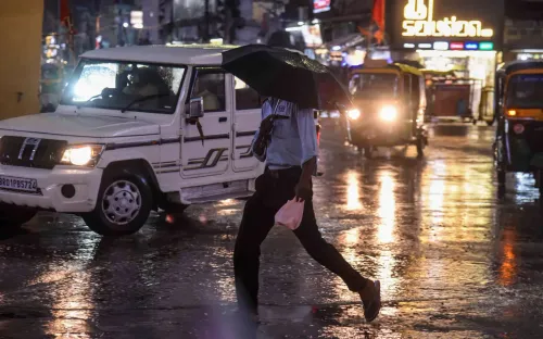
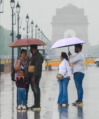
The India Meteorological Department (IMD) issued a red alert for Delhi-NCR on 12 June, warning of severe thunderstorms, heavy rainfall, lightning, and strong surface winds expected to batter the region through the day. Residents woke to overcast skies and cool winds — a sharp contrast to the intense heat of recent days — as the highest-level weather warning signalled potential risk to life and property.
What the IMD Has Forecast
According to the weather department, Delhi and adjoining areas are likely to experience moderate to heavy rainfall accompanied by thunderstorms and lightning. Surface wind speeds are expected to range between 40 and 50 kmph, with gusts reaching up to 60 kmph in several localities.
Across the broader northwestern belt — covering Haryana, Punjab, and Rajasthan — the IMD has forecast thundersqualls with wind speeds of 60–70 kmph, gusting up to 80 kmph. Isolated hailstorm activity has also been predicted in parts of the region.
What Triggered the Weather Shift
Meteorologists attributed the sudden change to a combination of weather systems: a western disturbance, a cyclonic circulation over Haryana, and an associated trough extending across the region. These systems are expected to sustain rainfall and thunderstorm conditions over the next several days.
The weather deterioration began late Thursday night, when strong winds and rain swept through parts of Delhi, Noida, and Gurugram, bringing gusty conditions and lightning. On Thursday, Delhi had recorded a maximum temperature of 38.7 degrees Celsius, with high humidity pushing the heat index — the 'feels-like' temperature — to nearly 44 degrees Celsius.
Safety Advisories Issued
The IMD has urged residents to stay indoors as far as possible and avoid sheltering under trees or near weak and temporary structures. People have been advised to stay away from water bodies during thunderstorms and high winds.
A red alert — the IMD's highest warning tier — signals conditions severe enough to pose direct risks to life and property, requiring immediate precautionary action from both authorities and the public.
Monsoon Arrival Timeline
The current spell of pre-monsoon thunderstorm activity is separate from the southwest monsoon, which is expected to reach Delhi and NCR between 25 June and 30 June. The monsoon is then forecast to advance further into northwestern states, including Haryana, Punjab, Himachal Pradesh, Jammu and Kashmir, and Ladakh.
With weather systems still active, residents across Delhi-NCR and the wider northwestern region should expect continued disruption over the coming days.
Point of View
The capital faces a prolonged window of weather volatility. Authorities would do well to audit storm-drain readiness and power-line vulnerability before the monsoon's formal arrival compounds the risk.
NationPress
26 Oct 2026
Frequently Asked Questions
What does the IMD red alert for Delhi-NCR on June 12 mean?
A red alert is the IMD's highest weather warning, indicating severe conditions that pose a direct risk to life and property. For Delhi-NCR on 12 June, it signals heavy thunderstorms, lightning, and wind gusts of up to 80 kmph, requiring immediate precautionary action from residents and authorities.
Which areas are affected by the IMD thunderstorm warning?
Delhi and its adjoining NCR areas are under a red alert, while the warning extends across the broader northwestern belt including Haryana, Punjab, and Rajasthan. Isolated hailstorm activity is also predicted in parts of these regions.
What caused the sudden weather change in Delhi-NCR?
Meteorologists attribute the activity to a western disturbance, a cyclonic circulation over Haryana, and an associated trough extending across the region. These systems together are sustaining conditions favourable for heavy rainfall and thunderstorms over the next several days.
When will the southwest monsoon reach Delhi?
The southwest monsoon is expected to arrive in Delhi and NCR between 25 June and 30 June. It is then forecast to advance into Haryana, Punjab, Himachal Pradesh, Jammu and Kashmir, and Ladakh. The current thunderstorm activity is separate from the monsoon.
What safety precautions has the IMD advised for Delhi residents?
The IMD has asked residents to stay indoors as far as possible, avoid sheltering under trees, keep away from weak or temporary structures, and stay clear of water bodies during thunderstorms and high winds. The advisory applies throughout the day on 12 June.