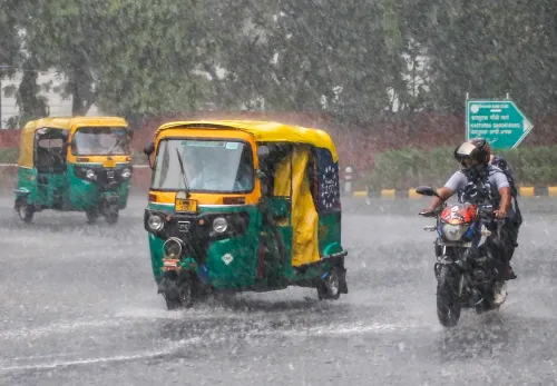
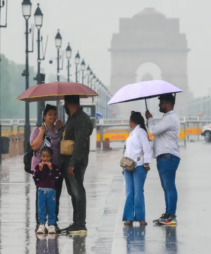
IMD yellow alert Delhi: Thunderstorms, gusty winds forecast for 13 June

Synopsis
A fresh western disturbance has pushed Delhi's temperatures to 7.2 degrees below the previous day — and the IMD is now warning of thunderstorms and 40–50 kmph gusts on Saturday. After days of punishing heat well above seasonal norms, the capital's weather is shifting fast, with the yellow alert signalling that conditions could deteriorate rapidly through the afternoon.
Key Takeaways
The IMD issued a yellow alert for Delhi on 13 June (Saturday) , warning of scattered thunderstorms and gusty winds.
Wind speeds may reach 40–50 kmph , with light rainfall expected in isolated areas during the afternoon or evening.
Maximum temperature forecast at 37°C ; minimum at 23°C — cooler than recent days.
On 12 June , Safdarjung recorded 22.8°C — 5.2°C below the seasonal average and 7.2°C lower than the previous day.
A fresh western disturbance over northwest India is driving the atmospheric instability and moisture influx.
The IMD has advised residents to monitor forecasts closely as conditions may change rapidly.
The India Meteorological Department (IMD) has issued a yellow alert for Delhi on 13 June (Saturday), warning residents of scattered thunderstorms, thundersqualls, gusty winds reaching 40–50 kmph, and light rainfall expected during the afternoon or evening hours. The alert comes as a fresh western disturbance continues to influence weather conditions across the National Capital Region (NCR).
What the Yellow Alert Means for Residents
Under the yellow alert, Delhi is expected to see partly cloudy skies through most of the day, with atmospheric instability building toward the afternoon. The IMD has specifically cautioned residents to remain alert during periods of strong winds and thunderstorm activity, as conditions may change rapidly within short intervals.
Temperatures are forecast to remain relatively moderate compared with recent days — the minimum is expected around 23 degrees Celsius and the maximum around 37 degrees Celsius, offering some respite from the prolonged heat that has gripped the capital.
Friday's Sharp Temperature Drop Sets the Stage
The yellow alert follows a marked shift in weather on Friday, 12 June, when Delhi woke to overcast skies and a noticeably cooler morning after overnight rainfall. The city's primary weather observatory at Safdarjung recorded a minimum temperature of 22.8 degrees Celsius — 5.2 degrees below the seasonal average and a sharp decline of 7.2 degrees Celsius from the previous day's reading. This was one of the steepest single-day temperature drops recorded at the station during the pre-monsoon window this year.
Western Disturbance Behind the Weather Shift
The IMD attributes the sudden cooling and increased cloud cover to a fresh western disturbance tracking across northwest India. Such systems introduce moisture and atmospheric instability into an otherwise dry pre-monsoon environment, creating conditions favourable for thunderstorm development and intermittent rainfall.
Notably, western disturbances are not uncommon during the pre-monsoon period and frequently trigger dust storms, thundersqualls, and brief but intense rainfall spells across Delhi-NCR. The current system follows a pattern of similar weather events recorded across the region in recent days, which had already brought scattered showers and gusty winds — providing temporary relief from heatwave conditions that had kept temperatures significantly above normal for several consecutive days.
Broader Context: Relief After Prolonged Heat
Delhi had endured an extended stretch of intense heat in the days preceding this weather shift, with temperatures staying well above seasonal norms. The current western disturbance is expected to keep conditions cooler over the next few days, according to the weather department.
The IMD is actively monitoring the evolving situation and has urged residents to stay updated through official forecasts, given the potential for rapid changes in weather through the remainder of the day.
Point of View
But rapid, unpredictable swings driven by western disturbances. A 7.2-degree single-day temperature drop is significant, and the IMD's yellow alert reflects genuine uncertainty about how quickly conditions can deteriorate. What often goes underreported is the infrastructure risk: thundersqualls at 40–50 kmph are sufficient to down trees and disrupt power supply in parts of the NCR. The focus on temperature comfort tends to crowd out the more actionable warning — stay off the roads during afternoon thunderstorms.
NationPress
29 Jul 2026
Frequently Asked Questions
What does the IMD yellow alert for Delhi on 13 June mean?
A yellow alert issued by the India Meteorological Department signals that residents should 'be aware' of potentially hazardous weather. For Delhi on 13 June, it specifically warns of scattered thunderstorms, thundersqualls, gusty winds up to 40–50 kmph, and light rainfall, primarily expected during the afternoon or evening.
What caused the sudden drop in Delhi's temperature on 12 June?
The IMD attributes the sharp temperature drop to a fresh western disturbance affecting northwest India. The Safdarjung observatory recorded 22.8°C on 12 June — 5.2°C below the seasonal average and 7.2°C lower than the previous day — as the system brought increased cloud cover and moisture into the region.
How high could wind speeds get in Delhi today?
According to the IMD forecast, wind speeds may reach 40–50 kmph during thunderstorm activity on 13 June. Residents have been advised to exercise caution during these periods.
Will the weather improve after 13 June?
The IMD indicates that the western disturbance is expected to keep conditions cooler over the next few days, offering continued relief from the prolonged heatwave. However, the department has urged residents to monitor official forecasts as conditions may evolve quickly.
Which areas of Delhi are most affected by the yellow alert?
The yellow alert covers Delhi broadly, with the IMD warning of thunderstorms and gusty winds across the National Capital Region. Light rainfall is expected in isolated areas, meaning not all parts of the city may receive rain simultaneously.