Jitendra Singh at Geospatial Exhibition for Viksit Bharat 2047
Synopsis
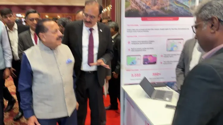
Union Science and Technology Minister Dr. Jitendra Singh toured a Government–Industry Synergy exhibition on geospatial transformation on 30 October 2026, underscoring India's push to build a robust spatial-data economy aligned with the Viksit Bharat 2047 national vision.
Key Takeaways
Jitendra Singh visited the geospatial transformation exhibition on 30 October 2026 , themed 'Co-Creating the Geospatial Economy for Viksit Bharat 2047.' The event united government, industry, and academia to build institutional frameworks and attract investment in geospatial technologies.
The National Geospatial Policy 2022 liberalised data-access norms and created the Geospatial Data Promotion and Development Committee to drive private-sector growth.
Geospatial infrastructure underpins critical sectors including agriculture, urban planning, disaster management, and logistics across India.
The sector is linked to India's Viksit Bharat 2047 goal of becoming a $30-trillion developed economy by the centenary of independence.
State-level geospatial data portals and new high-resolution satellite data-sharing guidelines are anticipated in upcoming parliamentary sessions.
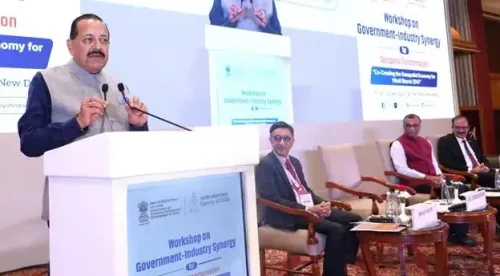
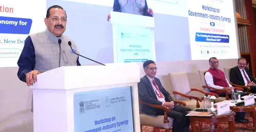
India's push to build a world-class geospatial economy took centre stage on Friday, 30 October 2026, as Union Science and Technology Minister Dr. Jitendra Singh walked through an exhibition showcasing Government–Industry Synergy for Geospatial Transformation — a vivid display of how satellites, maps, and spatial data are becoming the backbone of Viksit Bharat 2047.
What the Exhibition Floor Showed
The exhibition was organised under the theme 'Co-Creating the Geospatial Economy for Viksit Bharat 2047' and brought together government agencies, private industry players, and academic institutions under one roof. Displays highlighted innovations and emerging opportunities in geospatial technologies, from precision agriculture and urban planning tools to disaster-response mapping platforms.
Dr. Singh noted that the gathering was designed to strengthen institutional frameworks, encourage investment, and unlock new business opportunities — a deliberate signal that India's geospatial ambitions are no longer confined to government labs but are actively inviting private capital and startup energy.
The Policy Engine Behind the Showcase
The exhibition sits squarely on the foundation of the National Geospatial Policy 2022, which liberalised access to geospatial data and established a dedicated Geospatial Data Promotion and Development Committee to accelerate private-sector participation. Before that policy shift, high-resolution mapping data was tightly restricted; the liberalisation effectively opened the door for Indian startups and enterprises to build location-intelligence products that previously required foreign technology or cumbersome approvals.
Successive administrations have treated geospatial infrastructure as foundational digital public infrastructure — as critical to governance as roads or power grids. Applications span agriculture yield-mapping, smart-city planning, logistics optimisation, and rapid disaster assessment. The current government has tied all of these threads to the Viksit Bharat 2047 vision: India's ambition to be a fully developed, $30-trillion economy by the centenary of independence.
Why the Tri-Sector Push Matters
The deliberate framing of 'government, industry, and academia' in one room is not ceremonial. India's geospatial sector has historically been dominated by public agencies, with private firms limited to downstream applications. The new collaborative model aims to pool public data assets, private engineering talent, and academic research — reducing India's dependence on imported satellite and mapping services. Analysts watching the sector expect the next concrete steps to include state-level geospatial data portals and fresh guidelines on sharing high-resolution satellite imagery, with potential announcements in upcoming parliamentary sessions.
For a nation that is rapidly urbanising, climate-stressing its agricultural belts, and building new infrastructure corridors, getting the spatial data layer right is not a nice-to-have. It is infrastructure for every other infrastructure decision. Dr. Singh's walkthrough today was a reminder that the government is treating it exactly that way.
Point of View
Private enterprise as the scaling engine. Whether the promised deregulation and data-sharing norms translate into actionable guidelines before the next election cycle will be the real test of this ambition.
NationPress
30 Oct 2026
Frequently Asked Questions
What is the Viksit Bharat 2047 geospatial vision?
Viksit Bharat 2047 is India's national goal to become a fully developed economy by 2047, the centenary of independence. Within this vision, the geospatial sector is being developed as foundational digital infrastructure — enabling agriculture, urban planning, disaster management, and logistics — with the government actively partnering with industry and academia to build a robust domestic ecosystem.
What is the National Geospatial Policy 2022?
The National Geospatial Policy 2022 liberalised access to geospatial and mapping data in India, ending decades of tight government control. It established the Geospatial Data Promotion and Development Committee to foster private-sector participation, encouraging Indian startups and companies to build location-intelligence products domestically.
What did Dr. Jitendra Singh do at the geospatial exhibition?
Dr. Jitendra Singh, Union Minister of State (Independent Charge) for Science and Technology, walked through an exhibition on 30 October 2026 showcasing Government–Industry Synergy for Geospatial Transformation. The exhibition highlighted innovations, emerging opportunities, and collaborative initiatives bringing together government, industry, and academia.
Why is geospatial technology important for India?
Geospatial technology provides the spatial data layer that supports agriculture yield-mapping, smart-city planning, infrastructure development, disaster response, and logistics. India's rapid urbanisation and climate pressures make accurate, accessible mapping data increasingly critical for government planning and private enterprise alike.
What are the next expected steps in India's geospatial policy?
Analysts and policymakers are watching for the roll-out of state-level geospatial data portals and fresh guidelines on sharing high-resolution satellite imagery, both of which are anticipated to be addressed in upcoming parliamentary sessions.