PM Modi at VivaTech 2026: India's GI Platform Has 1,600+ Data Layers
Synopsis
Prime Minister Modi told VivaTech 2026 in Paris that India has integrated over 1,600 geographic data layers onto a single GI-based map, creating a unified, data-driven infrastructure planning platform — a milestone rooted in the PM Gati Shakti National Master Plan launched in 2021.
Key Takeaways
PM Narendra Modi announced at VivaTech 2026 in Paris that India has integrated more than 1,600 geographic data layers on a single GI-based map.
The platform is described as an 'integrated data-driven whole of government planning platform for infrastructure.' The system is rooted in the PM Gati Shakti National Master Plan , launched in October 2021 , which created a GIS-enabled multi-modal infrastructure coordination tool.
The National Geospatial Policy (2022) expanded data access for public and private stakeholders, underpinning the platform's scale.
Union Minister Ashwini Vaishnaw amplified the remarks on X, signalling the government's intent to project the platform as a global model for digital public infrastructure.
Adoption across state governments and further parliamentary updates on Gati Shakti milestones remain key developments to watch.
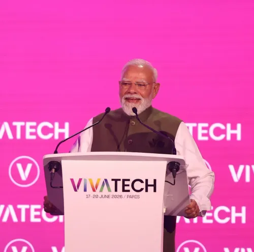
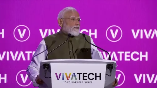
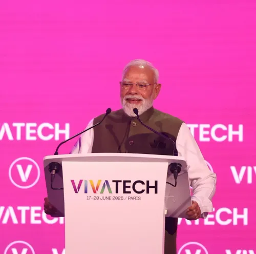
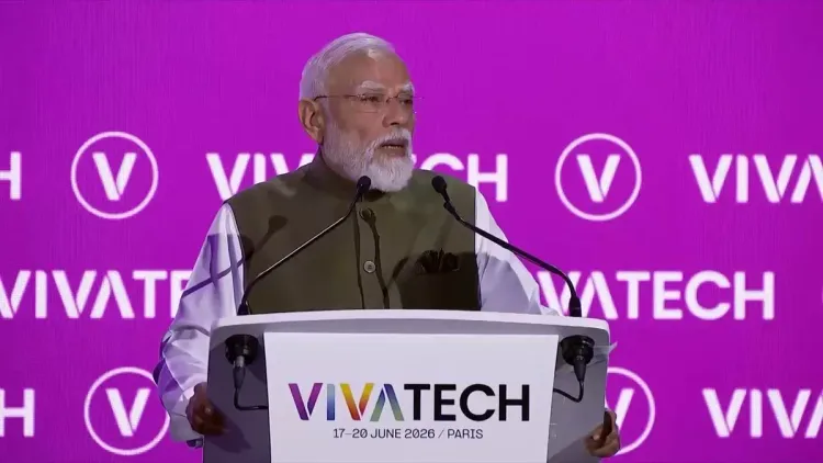
Prime Minister Narendra Modi on Thursday, 18 June 2026, told an audience at VivaTech 2026 in Paris, France that India has integrated more than 1,600 geographic data layers onto a single GI-based map, describing it as a whole-of-government planning platform for infrastructure. Union Minister Ashwini Vaishnaw shared the remarks on X, amplifying the Prime Minister's address at one of Europe's largest technology and innovation gatherings.
Context
Speaking at VivaTech 2026, Prime Minister Modi stated: 'We have integrated more than 1,600 geographic data layers on a single GI-based map. We have created an integrated data-driven whole of government planning platform for infrastructure.' The remarks position India's geospatial infrastructure stack as a flagship example of digital public infrastructure at a prominent international forum.
VivaTech, held annually in Paris, is a major global technology fair where governments and corporations showcase digital innovations. India has used the platform in recent years to present its digital governance achievements to an international audience of investors, policymakers, and technologists.
Policy Backdrop
The platform PM Modi described is rooted in the PM Gati Shakti National Master Plan, launched in October 2021. Gati Shakti was designed as a GIS-enabled system to integrate infrastructure data across central ministries, replacing fragmented, siloed planning with a single shared map-based view for multi-modal coordination.
A complementary National Geospatial Policy, released in 2022, expanded access to geospatial data for both public agencies and private developers, laying the regulatory foundation for the kind of large-scale data integration the Prime Minister referenced. Together, these two policy instruments form the backbone of India's data-driven infrastructure planning architecture under the broader Digital India framework.
The integration of more than 1,600 data layers — spanning road networks, railways, ports, waterways, utilities, and land records — represents the operational depth of this platform, enabling planners across ministries to identify bottlenecks, coordinate approvals, and track project progress on a unified interface.
Stakeholders and Impact
The primary beneficiaries of the platform are central government ministries responsible for infrastructure delivery — including Roads, Railways, Ports, Power, and Telecom — which previously operated on separate data systems, leading to coordination gaps and project delays. By consolidating data, the platform aims to reduce duplication and accelerate decision-making.
Infrastructure developers, both public-sector undertakings and private players, stand to benefit from cleaner, more accessible project data. For international audiences at VivaTech, the demonstration also serves a diplomatic and economic purpose: positioning India as a destination for technology-linked infrastructure investment.
Minister Vaishnaw, who oversees the Electronics and IT portfolio, has been a consistent advocate for India's digital public infrastructure model, making his amplification of these remarks a signal of the government's intent to project this platform as a replicable global standard.
What's Next
Attention will now turn to how widely the integrated platform has been adopted across all central ministries and whether state governments are being onboarded onto the same system. Parliamentary and cabinet updates on Gati Shakti's rollout milestones will be closely watched as indicators of how deeply the 'whole of government' vision has been operationalised beyond the central level.
India's presentation at VivaTech 2026 also sets the stage for potential bilateral conversations with European partners on geospatial data standards and digital infrastructure cooperation, areas where India has been seeking to deepen engagement with the European Union.
Point of View
600-layer milestone reflects India's broader strategy of using high-profile European technology forums to attract investment and build regulatory partnerships. For Minister Vaishnaw, amplifying this message reinforces his ministry's centrality to India's governance-technology narrative ahead of what is expected to be a period of intensified Digital India outreach. The deeper question is whether the platform's 'whole of government' ambition has translated into measurable reductions in project delays — a metric that will determine whether the international showcase translates into domestic credibility.
NationPress
18 Sept 2026
Frequently Asked Questions
What is the GI-based map PM Modi mentioned at VivaTech 2026?
PM Modi was referring to the integrated geospatial platform built under the PM Gati Shakti National Master Plan, which consolidates more than 1,600 geographic data layers — covering roads, railways, ports, utilities, and land records — onto a single GIS-based map for coordinated infrastructure planning across central ministries.
What is PM Gati Shakti and when was it launched?
PM Gati Shakti National Master Plan was launched in October 2021 as a GIS-enabled platform to integrate infrastructure data across central government ministries, replacing siloed planning with a unified, map-based coordination system for multi-modal infrastructure delivery.
Why did PM Modi speak at VivaTech 2026 in Paris?
VivaTech is one of Europe's largest annual technology and innovation fairs. India has used the platform to showcase its digital public infrastructure achievements to an international audience of investors, policymakers, and technologists, positioning itself as a leader in data-driven governance.
What is India's National Geospatial Policy?
India's National Geospatial Policy, released in 2022, expanded access to geospatial data for both public agencies and private sector players. It provided the regulatory foundation for large-scale data integration efforts like the Gati Shakti platform.
What did Ashwini Vaishnaw post about PM Modi's VivaTech speech?
Union Minister Ashwini Vaishnaw shared PM Modi's remarks on X, quoting the Prime Minister's statement about integrating more than 1,600 geographic data layers on a single GI-based map and creating a whole-of-government infrastructure planning platform.