MP heatwave: 44 districts to hit 42-43°C as storms lash north, east

Synopsis
Madhya Pradesh is caught between two weather extremes: thunderstorms with 60 kmph winds are battering Gwalior and Chambal even as 44 districts brace for 42–43°C heat. The IMD warns the split is temporary — from 9 May, heat intensity is set to surge statewide as the storm system fades.
Key Takeaways
44 districts in Madhya Pradesh , including Bhopal , Indore , and Ujjain , are forecast to reach 42–43°C on 7 May 2025 .
Narsinghpur recorded the state's highest maximum temperature at 42.2°C ; Amarkantak was the coolest at 33°C .
The IMD has issued storm alerts with winds of 40–50 kmph for 11 districts , including Gwalior , Morena , and Rewa .
Gusty winds of 67 kmph were recorded at Gwalior Airport ; rainfall of 9.5 mm was logged at Gohad .
Heat intensity is expected to rise sharply from 9–10 May as a fresh weather system becomes active.
The turbulent conditions are attributed to a western disturbance , cyclonic circulation , and a trough line .
Madhya Pradesh is experiencing a stark split in weather on 7 May, with heatwave conditions gripping most of the state even as thunderstorms and rainfall batter isolated pockets in the Gwalior, Chambal, and Jabalpur divisions, according to the Meteorological Centre, Bhopal. Daytime temperatures are forecast to surge to 42–43 degrees Celsius across 44 districts, including Bhopal, Indore, Ujjain, and Jabalpur, even as parts of northern and eastern MP brace for gusty winds and lightning.
Temperature Extremes Across the State
Narsinghpur recorded the state's highest maximum temperature at 42.2 degrees Celsius, while Amarkantak remained the coolest at 33 degrees Celsius. On the minimum temperature front, Bhopal dipped 5.3 degrees below normal, and Amarkantak logged the state's lowest minimum at 16.1 degrees Celsius. Sheopur registered the highest minimum temperature at 26.2 degrees Celsius.
Gwalior and Rewa districts recorded departures of up to 5.8 degrees Celsius below normal, while the Bhopal, Indore, and Jabalpur divisions reported temperatures ranging from 1.6 to 2.9 degrees below average. Despite these below-normal readings, meteorologists warn the respite is short-lived.
Storm Alerts and Rainfall Recorded
The weather office has issued alerts for thunderstorms, lightning, and gusty winds of 40–50 kmph across 11 districts — Gwalior, Morena, Bhind, Datia, Niwari, Tikamgarh, Chhatarpur, Panna, Satna, Rewa, and Mauganj. Moderate thunderstorms with wind speeds of up to 60 kmph are expected over Sheopur Kalan, Kuno National Park, and southern parts of Morena district during Thursday evening.
In the past 24 hours, rainfall was recorded at Gohad (9.5 mm), Balaghat (9.4 mm), and Waraseoni (7.2 mm). Gusty winds reached 67 kmph at Gwalior Airport and 30 kmph in Betul. Light thunderstorms are additionally forecast over Betul, Chhindwara, Pandhurna, Pench, southern Seoni, western Gwalior, Shivpuri, and northern Guna district.
What Is Driving the Turbulent Weather
The India Meteorological Department (IMD) attributed the unsettled conditions to the combined influence of a western disturbance, a cyclonic circulation, and a trough line. This combination has produced a split-weather pattern that is unusual for early May, when most of central India is typically in the grip of dry, intense heat.
A rapid rise in temperatures has been specifically forecast for Niwari, Chhatarpur, Tikamgarh, Narmadapuram, Ratlam, Neemuch, and Mandsaur districts in the coming days.
Heat to Intensify From May 9
While thunderstorms and light rain may persist in northern and eastern districts for the next two days, the IMD has warned that heat intensity is likely to increase significantly from 9–10 May. A fresh weather system is expected to become active from 10 May, with its full impact likely over the subsequent two days.
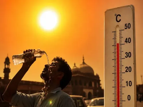
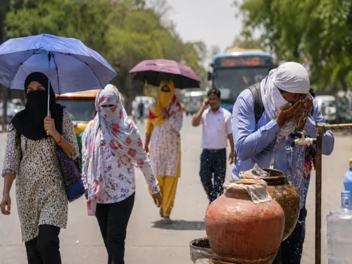
Residents across the state have been advised to stay hydrated, remain indoors during peak afternoon hours, and exercise caution during thunderstorm spells. With a volatile mix of extreme heat and storm activity forecast through mid-May, authorities are urging communities in both affected zones to stay alert.
Point of View
Scorching heat in the centre and west — is a reminder that 'heatwave' and 'thunderstorm alert' are no longer mutually exclusive in the Indian summer. The more concerning signal is the IMD's warning of a sharp heat surge from 9 May, after the brief storm activity subsides. With 44 districts already touching 42–43°C and a fresh weather system incoming, public health infrastructure in smaller districts like Niwari and Mandsaur — which lack the cooling resources of Bhopal or Indore — deserves closer attention than the weather bulletin alone provides.
NationPress
23 Jun 2026
Frequently Asked Questions
Which districts in Madhya Pradesh are under heatwave alert on 7 May 2025?
The IMD has forecast daytime temperatures of 42–43 degrees Celsius across 44 districts, including Bhopal, Indore, Ujjain, and Jabalpur. A rapid temperature rise has been specifically flagged for Niwari, Chhatarpur, Tikamgarh, Narmadapuram, Ratlam, Neemuch, and Mandsaur.
Which districts have thunderstorm and lightning alerts in MP?
The IMD has issued thunderstorm and gusty wind alerts for 11 districts: Gwalior, Morena, Bhind, Datia, Niwari, Tikamgarh, Chhatarpur, Panna, Satna, Rewa, and Mauganj. Wind speeds of 40–50 kmph are expected in these areas on Thursday.
When will the heatwave intensify in Madhya Pradesh?
Meteorologists have warned that heat intensity will increase significantly from 9 and 10 May 2025. A fresh weather system is expected to become active from 10 May, with its full impact felt over the following two days.
What caused the unusual split weather pattern in MP?
The IMD attributed the combination of thunderstorms in some districts and intense heat in others to the simultaneous influence of a western disturbance, a cyclonic circulation, and a trough line — an unusual convergence for early May.
What precautions have authorities advised for MP residents?
Residents have been advised to stay hydrated, avoid prolonged outdoor exposure during peak afternoon hours, and remain cautious during thunderstorm spells. Both heat-affected and storm-affected zones have been urged to stay alert through mid-May.