Nagaland GIS Centre drives evidence-based planning; solar mapping, drone innovation pushed
Synopsis
Nagaland's GIS and Remote Sensing Centre is quietly doing the unglamorous work that makes governance smarter — mapping villages, zonating landslide hazards, charting hydropower potential. Now, with a push for solar mapping, indigenous drone manufacturing, and DGCA-certified training launching in August 2026, Kohima is making a credible bid to become a Northeast India hub for drone technology.
Key Takeaways
The Nagaland GIS and Remote Sensing Centre (NGISRSC) in Kohima has built an extensive geospatial database covering Village Resource Mapping, landslide hazard zonation, hydropower assessment, and urban mapping.
Principal Secretary Y.
Kikheto Sema urged state departments to use NGISRSC's in-house capabilities instead of relying on external agencies.
Sema called for a comprehensive solar power potential assessment integrated with Nagaland's existing and proposed power-grid network.
58 personnel have been trained so far in FPV drone operations, repair, GIS mapping, and cinematography at the Drone Centre of Excellence.
DGCA-certified drone training courses are set to begin in August 2026 , enabling nationally recognised credentials for Nagaland's drone workforce.
The Principal Secretary advocated indigenous drone design and manufacturing tailored to Nagaland's terrain to build regional self-reliance.
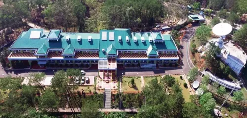
The Nagaland GIS and Remote Sensing Centre (NGISRSC) in Kohima has substantially advanced evidence-based governance and sustainable development across the state through wide-ranging deployment of geospatial technologies, officials said on Friday, 24 July 2026. The Centre's growing capabilities drew a high-level visit from Principal Secretary and Development Commissioner Y. Kikheto Sema, who called for deeper integration of the Centre's resources into state and Central programme delivery.
Key Initiatives at NGISRSC
The Senior Project Director of the NGISRSC briefed Sema on the Centre's portfolio of geospatial work, which spans statewide Village Resource Mapping, hydropower potential assessment, urban mapping down to building-footprint level, landslide hazard zonation, aquatic resource mapping, traffic studies, and multiple thematic geospatial projects. Together, these initiatives have built what officials described as an extensive geospatial database underpinning informed decision-making across Nagaland's departments.
What the Principal Secretary Said
Sema commended the Centre for its technical depth and infrastructure, while urging state departments to draw on NGISRSC's in-house capabilities rather than outsourcing to external agencies. He specifically recommended a comprehensive solar power potential assessment for Nagaland, integrated with the existing and proposed power-grid network, to enable scientific and sustainable energy planning for the state.
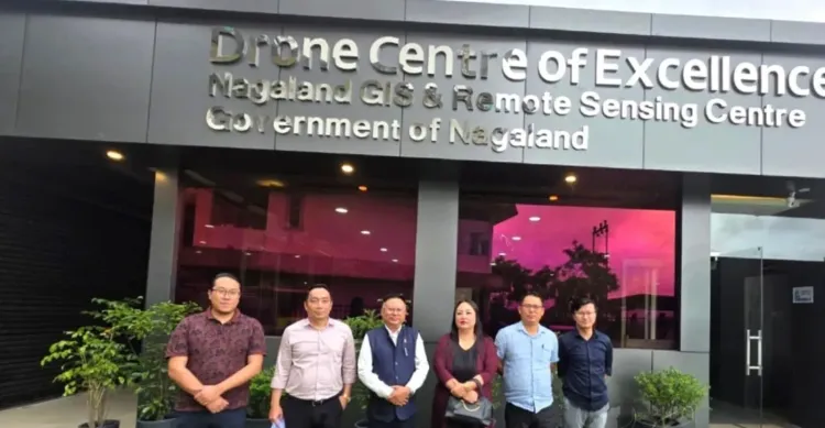
Notably, Sema also highlighted the strategic importance of the Drone Centre of Excellence, describing the drone sector as an emerging source of employment and entrepreneurship for Nagaland's youth. He called for expanded skill-development programmes to train young people as remote pilots, drone technicians, geospatial survey professionals, instructors, and entrepreneurs.
Drone Innovation and Indigenous Manufacturing
The Principal Secretary stressed the need to promote research, innovation, and indigenous drone design and manufacturing — specifically systems adapted to Nagaland's challenging terrain and operational requirements. Such a push, he observed, would strengthen technological self-reliance and position Nagaland as a regional hub for drone technology, training, and related services.
Sema toured the Centre's training facilities, drone assembly laboratory, prototyping unit, and repair and maintenance laboratory, and was briefed on the complete lifecycle of drone development — from design and assembly through testing, deployment, and servicing.
Training Programmes and DGCA Certification
Officials informed the Principal Secretary that 58 personnel have already been trained under programmes covering FPV Drone Operations, Drone Repair and Maintenance, Drone GIS Mapping, and Drone Cinematography. DGCA-certified drone training courses are scheduled to commence in August 2026, marking a significant step toward nationally recognised credentials for Nagaland's drone workforce.
As DGCA-certified programmes go live next month, the NGISRSC's dual mandate — geospatial intelligence for governance and drone skill-building for youth — is set to expand further, with the state eyeing a larger role in India's fast-growing drone economy.
Point of View
But the real test is institutional adoption — state departments have historically defaulted to external consultants even when in-house capacity exists, and Sema's visit, while encouraging, is not the first such call to change that pattern. The solar mapping initiative is timely given India's renewable energy targets, but Nagaland's grid infrastructure constraints mean the assessment will only be useful if paired with a credible transmission investment plan. With just 58 trained drone personnel and DGCA certification still weeks away, the Centre's workforce pipeline is nascent; scaling it fast enough to anchor a 'regional hub' ambition will require sustained budget commitment beyond a single high-level visit.
NationPress
22 Oct 2026
Frequently Asked Questions
What is the Nagaland GIS and Remote Sensing Centre (NGISRSC)?
The NGISRSC is a state-level geospatial agency based in Kohima that provides mapping, remote sensing, and spatial data services to support government planning and development. Its work spans Village Resource Mapping, landslide hazard zonation, hydropower assessment, urban mapping, and drone-based surveys.
What did Principal Secretary Y. Kikheto Sema recommend during his visit?
Sema urged state departments to use NGISRSC's in-house expertise instead of outsourcing to external agencies. He also recommended a comprehensive solar power potential assessment integrated with Nagaland's power-grid network, and called for expanded drone skill-development programmes and indigenous drone manufacturing.
When will DGCA-certified drone training begin in Nagaland?
DGCA-certified drone training courses at the NGISRSC's Drone Centre of Excellence are scheduled to commence in August 2026. So far, 58 personnel have been trained under non-certified programmes covering FPV operations, repair, GIS mapping, and cinematography.
Why is indigenous drone manufacturing important for Nagaland?
Nagaland's mountainous and difficult terrain requires drone systems specifically adapted to local operational conditions, which off-the-shelf commercial drones may not fully address. Developing indigenous designs would reduce dependence on external suppliers and position the state as a regional hub for drone technology and training.
How does the NGISRSC contribute to sustainable development in Nagaland?
The Centre provides geospatial data and analysis that inform decisions on resource management, disaster risk, energy planning, and urban development. Its databases on hydropower potential, landslide hazard zones, and village resources give state departments scientific grounding for both Central and state-sponsored programmes.