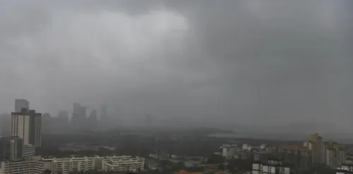
China AI model targets typhoon rapid intensification forecasting

Synopsis
A Chinese AI model deployed at the Hong Kong Observatory and China's National Meteorological Centre can now predict typhoon rapid intensification — one of meteorology's hardest problems — just as Hong Kong braces for up to seven storms this season, some potentially reaching super typhoon strength due to El Niño.
Key Takeaways
Professor Li Qinglan of the Shenzhen Institutes of Advanced Technology (SIAT) , affiliated with the Chinese Academy of Sciences , is leading the AI typhoon forecasting project.
The model was deployed at the Hong Kong Observatory and China's National Meteorological Centre approximately three weeks ago .
It provided real-time tracking of Typhoon Jangmi , which made landfall in Japan on June 3, 2026 , causing flight cancellations by Cathay Pacific Airways and Hong Kong Airlines .
Rapid intensification is defined as sustained wind speed rising by 15 m/s (49.2 ft/s) in 24 hours , or 10 m/s in 12 hours .
The Hong Kong Observatory forecasts four to seven typhoons through October 2026 , with El Niño raising the risk of super typhoon formation.
Competing AI weather efforts include Google DeepMind 's GraphCast and work by the Shanghai AI Laboratory .
An artificial intelligence model jointly deployed at the Hong Kong Observatory and China's National Meteorological Centre is tackling one of meteorology's most stubborn problems: predicting the rapid intensification of typhoons. The system, developed under the leadership of Professor Li Qinglan of the Shenzhen Institutes of Advanced Technology (SIAT), went live approximately three weeks ago and has already been tested against a real storm.
Real-world debut with Typhoon Jangmi
The AI model delivered real-time updates on the progression of Typhoon Jangmi, which formed late last month and made landfall in Japan on June 3. The storm forced Cathay Pacific Airways and Hong Kong Airlines to cancel or reschedule flights to Japan, underscoring the operational consequences of inadequate early warning.
Professor Li Qinglan confirmed in a statement issued by SIAT last week that the system was installed around three weeks ago. SIAT is affiliated with the Chinese Academy of Sciences.
Why rapid intensification is so hard to forecast
Rapid intensification is defined as a tropical cyclone's maximum sustained winds increasing by 15 metres per second (49.2 feet per second) within a 24-hour period, or by 10 m/s within 12 hours. The phenomenon is rare and notoriously unpredictable.
'Rapid intensification rarely happens, and is highly unpredictable, making preventive measures and responses extremely likely to be delayed,' Li said. Traditional numerical weather prediction technology, she noted, could not accurately reflect the evolution of typhoon intensity, while the statistical-dynamic method failed to capture the non-linear characteristics of typhoon intensity changes.
Why it matters: El Niño and a busy typhoon season
The timing is critical. The Hong Kong Observatory has forecast four to seven typhoons between now and October, warning that the El Niño phenomenon could push some storms to super typhoon intensity. A failure to predict rapid intensification even hours in advance can leave coastal populations and aviation networks dangerously exposed.
The AI system's ability to model non-linear intensity changes addresses precisely the gap that has historically made super typhoons so devastating — the window between 'manageable storm' and 'catastrophic event' can close within a single day.
The competitive backdrop
China's push into AI-driven meteorology follows broader global momentum. Google DeepMind and the United States National Hurricane Centre have both invested in machine-learning approaches to tropical cyclone forecasting, with DeepMind's GraphCast model drawing significant attention for outperforming traditional numerical models on multi-day forecasts. The Shanghai AI Laboratory is also active in the space, signalling that AI weather forecasting has become a strategic priority across Chinese research institutions.
The deployment at two major national forecasting bodies simultaneously suggests the technology has cleared internal validation thresholds — a meaningful step beyond the research-paper stage.
What's next
With the peak of the 2026 typhoon season still ahead, the model's performance on future storms will serve as a live benchmark. Forecasters and aviation operators across the Asia-Pacific region will be watching closely to see whether AI-driven rapid intensification alerts translate into measurably earlier warnings and fewer last-minute flight disruptions.
Point of View
Not just publishing papers. What mainstream coverage underplays is the geopolitical dimension: superior typhoon forecasting confers a measurable civil-defence and naval advantage in a region where the South China Sea is both a storm nursery and a strategic theatre. The framing around El Niño also matters; if AI tools demonstrably outperform legacy models during an intense season, it accelerates the case for replacing — not merely supplementing — numerical weather prediction infrastructure globally. The real test is not Jangmi, which has already passed, but the next storm that rapidly intensifies with little warning.
NationPress
18 Sept 2026
Frequently Asked Questions
What does the new Chinese AI model do for typhoon forecasting?
The AI model predicts rapid intensification — when a typhoon's maximum sustained winds surge by 15 metres per second within 24 hours or 10 m/s within 12 hours. It was deployed at the Hong Kong Observatory and China's National Meteorological Centre to address a gap that traditional numerical and statistical-dynamic methods have historically failed to fill.
Who developed the AI typhoon forecasting system?
The system was developed under Professor Li Qinglan at the Shenzhen Institutes of Advanced Technology (SIAT) , which is affiliated with the Chinese Academy of Sciences . The project is a collaboration with both the Hong Kong Observatory and the National Meteorological Centre on the mainland.
How did the AI model perform on Typhoon Jangmi?
The model provided real-time updates on Typhoon Jangmi's progression. Jangmi formed late last month and made landfall in Japan on June 3, 2026, prompting Cathay Pacific Airways and Hong Kong Airlines to cancel or reschedule flights — a disruption that better early warnings could help mitigate in future storms.
How many typhoons is Hong Kong expecting in 2026?
The Hong Kong Observatory has forecast four to seven typhoons between now and October 2026. It has also warned that the El Niño phenomenon increases the likelihood that some of these storms could reach super typhoon intensity.
How does this compare to other AI weather forecasting efforts?
Google DeepMind's GraphCast model and the United States National Hurricane Centre have both pursued AI-driven tropical cyclone forecasting. China's Shanghai AI Laboratory is also active in the field, making AI-based meteorology a competitive frontier between major technology powers.