


Cyclone Akvan: Chennai, Tamil Nadu brace for thunderstorms and gusty winds
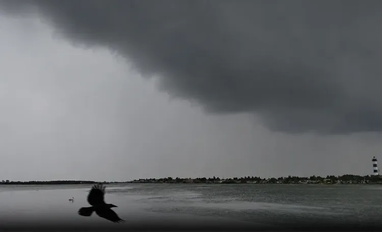
Synopsis
Cyclone Akvan has formed over the Bay of Bengal and is intensifying rapidly — it is projected to strike the Andhra Pradesh coast between Nellore and Tuni at noon on 20 November with winds gusting to 145 kmph. Even before landfall, its outer bands are already set to lash Chennai and coastal Tamil Nadu with thunderstorms and 40–50 kmph gusts, putting millions of residents on alert.
Key Takeaways
Cyclone Akvan formed over the Bay of Bengal on 18 November 2026 , intensifying from a deep depression at around 5.30 pm.
The RMC Chennai has forecast moderate rainfall and winds of 40–50 kmph in Chennai , Tiruvallur , and Chengalpattu on Thursday.
Akvan is expected to make landfall between Nellore and Tuni on the Andhra Pradesh coast around noon on 20 November .
Landfall wind speeds are projected at 120–130 kmph , gusting up to 145 kmph , classifying it as a very severe cyclonic storm .
Light to moderate rain is also forecast for southern Tamil Nadu , Puducherry , and Karaikal ; Tamil Nadu will not be a direct landfall zone.
Chennai maximum temperatures are expected between 31 and 32°C ; isolated spots may run 2–3°C above normal between 19 and 21 November .
Cyclone Akvan, which formed over the Bay of Bengal on 18 November 2026, is set to bring heavy rainfall, thunderstorms, lightning, and gusty winds to several parts of Tamil Nadu — including Chennai and neighbouring districts — over the next two days. The Regional Meteorological Centre (RMC), Chennai, has issued forecasts warning of unsettled weather conditions as the system intensifies.
Weather Forecast for Chennai and Surrounding Districts
The RMC has forecast moderate rainfall at isolated places in Chennai, Tiruvallur, and Chengalpattu districts on Thursday, 20 November, with sustained wind speeds expected to reach 40 to 50 kmph. Chennai and its suburbs are likely to experience partly cloudy skies on Wednesday and generally overcast conditions on Thursday.
Maximum temperatures in Chennai are expected to remain between 31 and 32 degrees Celsius, while the minimum temperature is likely to hover around 23 to 24 degrees Celsius on both days. Daytime temperatures could run two to three degrees Celsius above normal at isolated places between 19 and 21 November.
Impact Across Tamil Nadu, Puducherry and Karaikal
Light rainfall accompanied by thunderstorms is also forecast for parts of southern Tamil Nadu, northern coastal districts, Puducherry, and Karaikal. On Wednesday, isolated areas in southern Tamil Nadu are expected to receive light showers, while predominantly dry weather is likely to persist across the rest of the state.
Notably, while Cyclone Akvan is not forecast to make landfall in Tamil Nadu, its passage over the Bay of Bengal is sufficient to disrupt weather patterns along the coast. This is a recurring dynamic during cyclone season — systems targeting the Andhra Pradesh or Odisha coasts often trigger significant rainfall in northern Tamil Nadu's coastal belt.
Cyclone Akvan's Track and Projected Landfall
According to weather department data, the deep depression that lay over the southeast Bay of Bengal moved north-northwestward and intensified into Cyclone Akvan at around 5.30 pm on Tuesday, 18 November. The system subsequently moved over the central and west-central parts of the south Bay of Bengal.
Akvan is expected to intensify into a very severe cyclonic storm and make landfall along the Andhra Pradesh coast between Nellore and Tuni at around noon on 20 November. At the time of landfall, sustained wind speeds of 120 to 130 kmph, gusting up to 145 kmph, are anticipated — placing it firmly in a category that warrants high public alert.
The system is expected to gain further strength on Thursday morning before curving northwestward toward the Andhra Pradesh coastline.
Preparedness and What to Expect Next
Residents in coastal Tamil Nadu and Puducherry have been advised to remain alert over the next 48 hours. While the most intense impact is projected for the Andhra Pradesh coast, the outer rain bands of Cyclone Akvan will continue to influence weather across Tamil Nadu's coastal districts through the landfall window. Authorities are monitoring the system's progression closely, and further advisories are expected as the cyclone approaches the coast.
Point of View
But it absolutely is one by impact. The northern coastal districts and Chennai sit squarely in the system's outer rain bands, and the 40–50 kmph gusts forecast for Thursday are enough to disrupt urban infrastructure in a city that has repeatedly struggled with waterlogging. The key accountability question is whether the authorities in both Tamil Nadu and Andhra Pradesh have used the 48-hour warning window effectively to evacuate low-lying coastal populations near Nellore and Tuni — where winds gusting to 145 kmph will not be a statistical abstraction.
NationPress
18 Nov 2026
Frequently Asked Questions
What is Cyclone Akvan and where is it now?
Cyclone Akvan is a cyclonic storm that formed over the Bay of Bengal on 18 November 2026, intensifying from a deep depression around 5.30 pm. It is currently moving north-northwestward over the central and west-central Bay of Bengal and is expected to intensify into a very severe cyclonic storm by Wednesday evening.
Where will Cyclone Akvan make landfall?
According to weather department forecasts, Cyclone Akvan is expected to make landfall along the Andhra Pradesh coast between Nellore and Tuni at around noon on 20 November 2026. It will not make direct landfall in Tamil Nadu.
How will Cyclone Akvan affect Chennai and Tamil Nadu?
Although Cyclone Akvan will not make landfall in Tamil Nadu, its outer rain bands are likely to bring moderate rainfall, thunderstorms, lightning, and winds of 40–50 kmph to Chennai, Tiruvallur, and Chengalpattu on Thursday. Light showers are also expected in southern Tamil Nadu, Puducherry, and Karaikal.
How strong will Cyclone Akvan be at landfall?
At the time of landfall, Cyclone Akvan is expected to generate sustained wind speeds of 120–130 kmph, with gusts reaching up to 145 kmph, qualifying it as a very severe cyclonic storm under Indian meteorological classification.
What temperatures are forecast for Chennai during the cyclone period?
Chennai's maximum temperature is expected to remain between 31 and 32 degrees Celsius, with the minimum around 23 to 24 degrees Celsius. Daytime temperatures could be 2 to 3 degrees Celsius above normal at isolated places between 19 and 21 November.