

Cyclone Akvan alert: Coastal Andhra braces for landfall by Friday

Synopsis
Cyclone Akvan is no longer a distant threat — it is on a direct track toward the Andhra coast, expected to strike between Nellore and Visakhapatnam by Friday afternoon as a very severe cyclonic storm packing gusts up to 145 kmph. With 13 NDRF teams already deployed and extremely heavy rainfall forecast for Thursday and Friday, the next 72 hours are critical for millions of coastal residents.
Key Takeaways
Cyclonic storm Akvan is set to intensify into a severe cyclonic storm by Wednesday morning and a very severe cyclonic storm by Thursday evening .
Landfall is expected between Nellore and Visakhapatnam by Friday afternoon .
Wind speeds at landfall projected at 120–130 kmph , gusting up to 145 kmph ; squally winds of 100–110 kmph to begin along the coast from Wednesday evening .
13 NDRF teams and 11 SDRF teams have been placed on standby across coastal Andhra Pradesh.
Fishermen warned against venturing to sea; farmers advised to take precautionary measures immediately.
Emergency helplines active: Mana Mithra at 9552300009 and toll-free numbers 112 , 1070 , and 18004250101 .
Coastal Andhra Pradesh is on high alert as cyclonic storm 'Akvan', currently churning over the southern and west-central Bay of Bengal, is set to intensify into a severe cyclonic storm by Wednesday morning, 19 November 2026. The storm is projected to make landfall between Nellore and Visakhapatnam by Friday afternoon, packing gale-force winds of 120–130 kmph, potentially peaking at 145 kmph.
Current Position and Projected Track
As of Tuesday night, the Andhra Pradesh State Disaster Management Authority (APSDMA) confirmed that Akvan had remained stationary over its current position for approximately three hours before resuming a north-northwesterly track. The cyclone is currently centred 590 km from Chennai, 650 km from both Machilipatnam and Visakhapatnam, and 780 km from Gopalpur in Odisha.
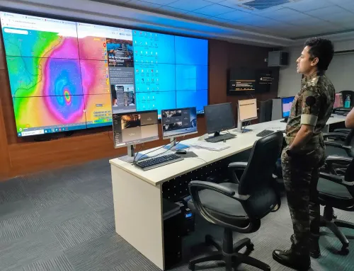
According to Prakhar Jain, Managing Director of the APSDMA and CEO of the Real-Time Governance Society (RTGS), the system is expected to further intensify into a very severe cyclonic storm by Thursday evening before striking the coast on Friday. This rapid escalation — from severe to very severe within roughly 24 hours — signals a compact but potent weather system.
Wind and Rainfall Warnings
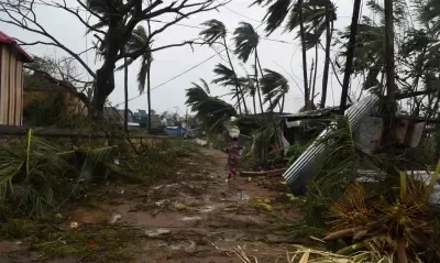
Squally winds of 100–110 kmph are anticipated along the coastal belt from Wednesday evening onwards. From Thursday through landfall, wind speeds are likely to sustain at 120–130 kmph, with gusts touching 145 kmph. Coastal districts face the risk of extremely heavy rainfall on Thursday and Friday, while several inland areas could see heavy to very heavy precipitation as well.
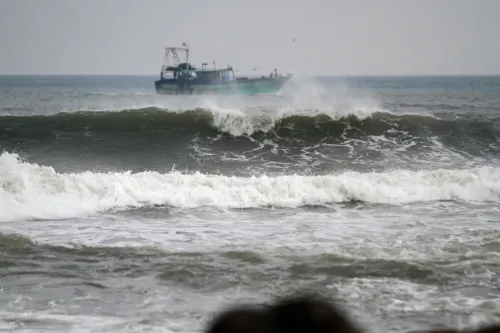
Farmers have been advised to take immediate precautionary measures to protect standing crops. Fishermen have been issued a strict advisory against venturing into the sea until the system clears.
Rescue and Relief Preparedness
Authorities have deployed 13 NDRF teams and 11 SDRF teams, in addition to local fire service units, all placed on standby ahead of the storm's anticipated landfall. District administrations are receiving continuous real-time instructions through coordination between the RTGS and APSDMA.
'Residents in coastal areas have been urged to avoid stepping outside unless absolutely necessary. The public is advised not to panic, as the state government stands with them. Should any issues arise due to the cyclone, they can be reported immediately to the authorities,' Jain said, citing the 'Mana Mithra' helpline at 9552300009.
Emergency Contacts and Public Advisory
Residents can reach the State Disaster Management Authority via toll-free numbers 112, 1070, or 18004250101 for emergency assistance or information. Authorities have urged calm while emphasising that evacuation and relief infrastructure is in place. This comes amid a broader pattern of intensifying Bay of Bengal cyclones in the pre-winter months, underscoring the growing frequency of high-intensity systems hitting India's eastern seaboard.
Point of View
Where institutional warnings historically arrive late. Andhra Pradesh's 'Mana Mithra' helpline is a step forward, but the state's real test is in the 36 hours before landfall, when weather windows for movement close and the most vulnerable are still ashore.
NationPress
17 Nov 2026
Frequently Asked Questions
Where is Cyclone Akvan expected to make landfall?
Cyclone Akvan is expected to make landfall between Nellore and Visakhapatnam on the Andhra Pradesh coast by Friday afternoon. At landfall, wind speeds are projected at 120–130 kmph, with gusts potentially reaching 145 kmph.
How intense will Cyclone Akvan be when it hits land?
Akvan is forecast to reach 'very severe cyclonic storm' intensity by Thursday evening before making landfall on Friday. This is two categories above its current classification as of Tuesday night.
What precautions should coastal residents in Andhra Pradesh take?
Residents in coastal areas have been urged to avoid stepping outside unless absolutely necessary. Fishermen should not venture into the sea, and farmers are advised to protect standing crops. For emergencies, residents can call the Mana Mithra helpline at 9552300009 or toll-free numbers 112, 1070, or 18004250101.
How many rescue teams have been deployed for Cyclone Akvan?
A total of 13 NDRF teams, 11 SDRF teams, and local fire service units have been placed on standby across coastal Andhra Pradesh. The APSDMA and RTGS are continuously monitoring the storm and issuing real-time instructions to district administrations.
Which districts in Andhra Pradesh are most at risk from Cyclone Akvan?
Coastal districts of Andhra Pradesh — particularly those between Nellore and Visakhapatnam — face the highest risk. These areas are expected to experience extremely heavy rainfall on Thursday and Friday, along with severe gale-force winds from Wednesday evening onwards.