

Cyclone Akvan to hit Andhra Pradesh coast on Nov 20 as very severe storm

Synopsis
Cyclonic Storm Akvan is on course to strike the Andhra Pradesh coast near Nellore and Tuni around noon on 20 November as a very severe cyclonic storm with winds up to 145 kmph. With rapid intensification expected over the next 72 hours and extremely heavy rain forecast from 19 November, authorities have little time — and coastal communities even less.
Key Takeaways
Cyclonic Storm Akvan formed from a deep depression over the Bay of Bengal and was centred 610 km from Chennai as of 16 November 1730 hrs IST .
The storm is forecast to make landfall between Nellore and Tuni on Andhra Pradesh coast around noon on 20 November as a very severe cyclonic storm.
Winds at landfall are projected at 120–130 kmph , gusting to 145 kmph .
Extremely heavy rainfall is likely on 19 and 20 November ; heavy rains start from 18 November along Coastal Andhra Pradesh.
Fishermen have been asked not to venture to sea; SDMA urges low-lying residents to relocate to higher ground on official instruction.
Emergency helplines: Mana Mitra WhatsApp 9552300009 , 112 , 1070 , 18004250101 .
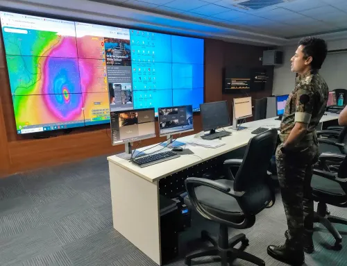
Cyclonic Storm Akvan is set to cross the Andhra Pradesh and Yanam coasts between Nellore and Tuni around noon on 20 November as a very severe cyclonic storm, packing sustained winds of 120–130 kmph gusting up to 145 kmph, the India Meteorological Department (IMD) said on Monday. The storm, which intensified from a deep depression over the Southeast and adjoining Southwest Bay of Bengal, was centred at 1730 hrs IST on 16 November about 610 km from Chennai and 670 km from Visakhapatnam.
Storm Track and Intensification Timeline
Moving in a west-northwesterly direction at 10 kmph, Akvan is expected to intensify into a severe cyclonic storm by the evening of 17 November and further escalate into a very severe cyclonic storm by the evening of 19 November. At the time of the IMD advisory, the system also lay about 660 km from Machilipatnam and 790 km from Gopalpur in Odisha.
The landfall window — around noon on 20 November — leaves coastal communities approximately four days to prepare, a relatively narrow margin given the storm's projected rapid intensification over the next 72 hours.
Rainfall Alert for Coastal Andhra Pradesh
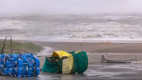
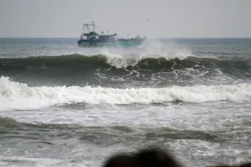
Heavy rains are forecast to begin across parts of Coastal Andhra Pradesh from 18 November, with extremely heavy rainfall likely on 19 and 20 November — coinciding with the storm's peak intensity and landfall. Fishermen have been warned not to venture into the sea until further notice. The IMD advisory covers a wide coastal belt, and low-lying areas face the dual threat of high winds and flooding.
What the Disaster Management Authority Said
Prakhar Jain, Managing Director of the Andhra Pradesh State Disaster Management Authority (SDMA) and CEO of the Real Time Governance Society (RTGS), urged residents to remain calm, avoid rumours, and stay updated through official weather advisories from the IMD and RTGS. Jain advised keeping mobile phones charged and storing important documents in waterproof covers, along with preparing an emergency kit with at least a week's supply of food and drinking water.
He also warned against standing under trees, hoardings, or electricity poles during the storm, and said residents in low-lying, flood-prone areas should relocate to higher ground as soon as authorities issue the instruction. For cyclone-related assistance, Jain said people can reach the 'Mana Mitra' WhatsApp helpline at 9552300009. Emergency services are reachable at 112, 1070, or 18004250101.
Key Safety Precautions Issued by SDMA
The SDMA has outlined a set of precautions for residents. During the cyclone, households should switch off the main electrical supply, disconnect gas connections, and keep all doors and windows firmly shut. Those in structurally unsafe homes are advised to move to designated relief centres before the storm makes landfall. Only boiled and cooled water should be consumed. If a building shows signs of sudden structural stress, residents should seek shelter under a sturdy table or bench.
People caught outdoors during the cyclone must avoid entering damaged or dilapidated buildings. Notably, this is not the first severe cyclone to target the Andhra Pradesh coastline in recent years — the region has experienced repeated cyclonic landfalls, underscoring the need for sustained coastal preparedness infrastructure.
What Happens Next
All eyes are on the storm's intensification over the next 48–72 hours as it tracks over warm Bay of Bengal waters. State authorities are expected to ramp up evacuation advisories and open relief centres ahead of the 20 November landfall. The IMD is issuing updated bulletins at regular intervals, and the SDMA has urged the public and farming communities to monitor official channels closely.
Point of View
Which has seen repeated cyclonic hits in recent years. The four-day warning window is adequate on paper, but the real question is whether evacuation of low-lying and fishing communities — historically the most resistant to displacement — can be completed before the storm's rapid intensification phase peaks on 19 November. The dual landfall threat across Nellore and Yanam also complicates multi-district coordination. Accountability will rest on how quickly relief centres are operationalised and whether the SDMA's public communication cuts through before panic sets in.
NationPress
16 Nov 2026
Frequently Asked Questions
When and where will Cyclone Akvan make landfall?
Cyclone Akvan is expected to cross the Andhra Pradesh and Yanam coasts between Nellore and Tuni around noon on 20 November 2026 as a very severe cyclonic storm. Winds at landfall are projected at 120–130 kmph, gusting to 145 kmph.
How strong will Cyclone Akvan be at landfall?
Akvan is forecast to reach very severe cyclonic storm intensity by the evening of 19 November, just before landfall. It will carry sustained winds of 120–130 kmph with gusts up to 145 kmph when it strikes the Andhra Pradesh coast on 20 November.
Which areas of Andhra Pradesh face the highest risk from Cyclone Akvan?
Coastal districts between Nellore and Tuni are directly in the landfall zone. Low-lying and flood-prone areas along the entire Coastal Andhra Pradesh belt face the risk of extremely heavy rainfall on 19 and 20 November. Residents in these areas have been urged to relocate to higher ground on official instruction.
What precautions have authorities advised for Cyclone Akvan?
The Andhra Pradesh SDMA has advised residents to keep mobile phones charged, store documents in waterproof covers, prepare a week's food and water supply, switch off main electrical supply during the storm, and move to relief centres if their homes are unsafe. People should avoid trees, hoardings, and electricity poles during the storm.
What are the emergency helpline numbers for Cyclone Akvan?
For cyclone-related assistance, residents can contact the 'Mana Mitra' WhatsApp helpline at 9552300009. Emergency services can be reached at 112, 1070, or 18004250101, as announced by SDMA Managing Director Prakhar Jain.