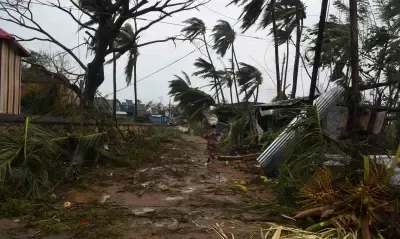


Cyclone alert for Andhra Pradesh, Odisha coasts as Bay depression intensifies

Synopsis
A Bay of Bengal depression is set to become a severe cyclonic storm by 17 November and bear down on the Andhra Pradesh coast — marking the third cyclonic strike in just 20 days. With two earlier storms already killing 15 people and devastating crops, the region is bracing for another potentially devastating hit before it has had a chance to fully recover.
Key Takeaways
A cyclone alert has been issued for Andhra Pradesh and South Odisha coasts as a Bay of Bengal depression moves north-northwestwards.
IMD expects the system to intensify into a severe cyclonic storm by 17 November 2026 over the Westcentral Bay of Bengal.
The storm is expected to approach the North Andhra coast on Thursday or Friday , bringing heavy rain and strong winds.
This will be the third cyclonic storm to cross the Andhra Pradesh coast in 20 days .
Previous storms 'Arnab' (27 October) and 'Murasu' (3 November) killed 15 people and caused widespread damage to infrastructure and crops.
APSDMA MD Prakhar Jain has urged the public and farmers to take immediate precautionary measures.
A cyclone alert has been issued for Andhra Pradesh and the South Odisha coast as a depression over the Bay of Bengal is expected to intensify into a severe cyclonic storm by 17 November 2026, according to the India Meteorological Department (IMD). Coastal communities and fishermen have been advised to follow official IMD warnings and take precautionary measures immediately.
Current Position and Projected Track
As of Sunday morning, the depression lay centred at 1130 hours over the Southeast and adjoining Southwest Bay of Bengal, moving north-northwestwards at 15 kmph. At that point, it was approximately 620 km east-northeast of Trincomalee (Sri Lanka), 800 km east-southeast of Chennai, 960 km south-southeast of Visakhapatnam, and 1,070 km south-southeast of Gopalpur (Odisha).
According to IMD, the system is very likely to intensify into a cyclonic storm over the central parts of the South and adjoining Westcentral Bay of Bengal by Monday, 16 November, and further strengthen into a severe cyclonic storm over the Westcentral Bay of Bengal by Tuesday, 17 November. It is thereafter expected to move northwestwards towards the Andhra Pradesh coast over the subsequent two days.
What State Authorities Are Saying
The Andhra Pradesh State Disaster Management Authority (APSDMA) has confirmed that the severe cyclonic storm is likely to approach the coastal region of North Andhra. Prakhar Jain, Managing Director of APSDMA and Chief Executive Officer of the Real-Time Governance Society (RTGS), stated that North Andhra may experience heavy rainfall accompanied by strong winds on Thursday and Friday. He advised both the public and farmers to take necessary precautionary measures without delay.
A Deadly Pattern: Third Cyclone in 20 Days
Notably, this would be the third cyclonic storm in the Bay of Bengal to cross the Andhra Pradesh coast in just 20 days — an unusually compressed and destructive sequence. Very severe cyclonic storm 'Arnab' struck the Andhra coast near Narsapuram on 27 October, while severe cyclonic storm 'Murasu' crossed the coast between Nellore and Narasapur on 3 November.
The two successive storms resulted in the deaths of 15 people and caused widespread damage to infrastructure and crops across the coastal districts. The region is still in recovery mode from those twin disasters, raising the stakes for disaster preparedness ahead of the approaching system.
What Residents and Fishermen Should Do
IMD has advised fishermen and coastal communities to stay off the sea and monitor official bulletins closely. With North Andhra facing the highest risk of heavy rain and strong winds later this week, district administrations are expected to ramp up evacuation readiness and relief pre-positioning. The human and agricultural toll from the previous two storms underscores the urgency of early action this time.
All eyes are now on the system's intensification over the next 48 hours and the final landfall track, which IMD is expected to refine with updated bulletins.
Point of View
But whether the cumulative infrastructure damage from 'Arnab' and 'Murasu' has compromised the very evacuation routes, shelters, and communication networks that responders now need. IMD's forecasting has been precise; the real variable is execution capacity in an exhausted and damaged coastal belt.
NationPress
15 Nov 2026
Frequently Asked Questions
What is the current status of the Bay of Bengal cyclone as of 15 November 2026?
As of Sunday, 15 November 2026, the system is classified as a depression over the Southeast and adjoining Southwest Bay of Bengal, moving north-northwestwards at 15 kmph. IMD expects it to intensify into a cyclonic storm by Monday and a severe cyclonic storm by Tuesday.
When and where is the cyclone expected to make landfall?
The severe cyclonic storm is expected to move northwestwards towards the Andhra Pradesh coast roughly two days after intensifying on 17 November, placing landfall around 19–20 November. North Andhra is currently identified as the most likely impact zone, with heavy rain and strong winds anticipated on Thursday and Friday.
Why is this cyclone particularly alarming for Andhra Pradesh?
This would be the third cyclonic storm to strike the Andhra Pradesh coast in just 20 days. The earlier storms — 'Arnab' on 27 October and 'Murasu' on 3 November — together killed 15 people and caused widespread infrastructure and crop damage, leaving coastal communities already vulnerable.
What precautions have authorities advised?
APSDMA Managing Director Prakhar Jain has urged the public and farmers to take necessary precautionary measures. IMD has advised fishermen and coastal communities to avoid the sea and follow official weather bulletins regularly.
Which areas are at highest risk from this approaching cyclone?
North Andhra Pradesh carries the highest risk, as identified by APSDMA. South Odisha is also under a cyclone alert. Districts closest to the projected landfall zone are expected to face the worst of the heavy rainfall and strong winds later this week.