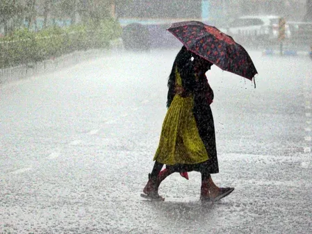
Odisha cyclone alert 2026: State fully prepared, no need to panic, says minister

Synopsis
A Low Pressure Area over the Bay of Bengal is forecast to intensify into a cyclonic storm by 26 October and track toward North Andhra Pradesh and South Odisha coasts by 28 October. Odisha's disaster machinery is fully activated — but the real test will come in the 72-hour window as landfall coordinates sharpen.
Key Takeaways
Odisha minister Suresh Pujari on 23 October 2026 confirmed full state preparedness for the approaching cyclonic system.
IMD forecasts the Low Pressure Area to intensify into a cyclonic storm over the west-central Bay of Bengal by 26 October morning .
The system is expected to move toward North Andhra Pradesh and South Odisha coasts within 2 days of reaching cyclonic storm status.
Fishermen have been advised not to venture into the sea on 26 and 27 October .
Very heavy rainfall is expected in coastal Odisha on 29 October ; lightning and thunder likely on 26 October .
IMD Bhubaneswar director Manorama Mohanty said the precise track will be confirmed once a depression forms.
Odisha Revenue and Disaster Management Minister Suresh Pujari on Friday, 23 October 2026, assured residents that the state government is fully prepared to handle the impending cyclonic system forming over the Bay of Bengal, urging citizens not to panic. Speaking to reporters in Bhubaneswar, Pujari said all concerned departments and district administrations have been placed on high alert, with contingency plans in place for multiple scenarios including the worst-case outcome.
What the Minister Said
"There is no need to worry, nor is there any need to be perturbed. This cyclone will also come and pass. And to ensure there is no significant damage, the State Government has already put in place whatever arrangements are necessary," Pujari stated. He underscored that Odisha carries decades of institutional experience in managing severe weather events and is equipped to respond regardless of the storm's final intensity or landfall point.
IMD's Cyclone Forecast: Track and Timeline
According to the India Meteorological Department (IMD), a Low Pressure Area formed on Friday over the southeast and adjoining east-central Bay of Bengal, driven by an upper-air cyclonic circulation. The IMD projects the system will persist and intensify into a depression by 24 October 2026, deepen into a deep depression by 25 October, and strengthen further into a cyclonic storm over the west-central Bay of Bengal by the morning of 26 October. It is then expected to move west-northwestwards toward the North Andhra Pradesh and adjoining South Odisha coasts over the following two days.
IMD Bhubaneswar director Manorama Mohanty said that once a depression forms, the system's likely track will be more precisely indicated, and that the current trajectory points toward the west-northwest.
Fishing Ban and Rainfall Warnings
Fishermen in Odisha have been advised to avoid venturing into the sea along and off the Odisha coast on 26 and 27 October. Coastal areas are expected to see increasing rainfall intensity from the evening of 27 October, with very heavy rainfall anticipated on 29 October. Coastal districts are also likely to face rain accompanied by lightning and thunder on 26 October.
Odisha's Disaster Preparedness Record
Odisha has repeatedly drawn national and international recognition for its cyclone preparedness — a hard-won institutional strength built after the catastrophic 1999 super cyclone that killed over 10,000 people. Since then, the state has significantly reduced casualties in successive storms through pre-emptive evacuations, shelter construction, and early warning systems. This latest mobilisation follows the same playbook, with the administration activated ahead of the system's projected intensification.
What Residents and Fishermen Should Do Now
Authorities have urged coastal residents to stay alert to official updates from the IMD and state disaster management authorities. Fishermen are strictly cautioned against sea-venturing on the advisory dates. The state's rainfall situation is expected to evolve rapidly from the late evening of 27 October onward, and residents in vulnerable coastal districts should monitor local administration directives closely. The next 72 hours will be critical as the system's intensity and landfall coordinates become clearer.
Frequently Asked Questions
When is the Bay of Bengal cyclone expected to make landfall near Odisha in 2026?
According to the IMD, the system is projected to intensify into a cyclonic storm by the morning of 26 October 2026 and move toward the North Andhra Pradesh and adjoining South Odisha coasts within the subsequent two days, placing a likely landfall window around 27–28 October.
What precautions have Odisha authorities announced for the cyclone?
Fishermen have been advised not to venture into the sea along the Odisha coast on 26 and 27 October. Coastal districts are on alert for heavy rainfall from the evening of 27 October and very heavy rainfall on 29 October. All state departments and district administrations have been put on standby.
What did IMD say about the cyclone's intensity and track?
The IMD said the Low Pressure Area formed on 23 October will likely deepen into a depression by 24 October, a deep depression by 25 October, and a cyclonic storm over the west-central Bay of Bengal by 26 October morning. It is then forecast to move west-northwestward toward North Andhra Pradesh and South Odisha.
Why is Odisha considered well-prepared for cyclones?
Odisha has built a robust cyclone-response system following the devastating 1999 super cyclone, which killed over 10,000 people. Since then, the state has consistently reduced storm casualties through early evacuation, shelter networks, and IMD-linked early warning systems, earning national and international recognition.
Which coastal areas are most at risk from the upcoming cyclonic system?
The IMD currently projects the storm's trajectory toward the North Andhra Pradesh and adjoining South Odisha coasts. Rainfall, lightning, and rough seas are expected to affect Odisha's coastal districts from 26 October onward, with conditions worsening significantly by 29 October.