Geospatial capabilities key to India's economic future: Dr Jitendra Singh
Synopsis
India's Union Minister for Science and Technology declared geospatial capabilities a cornerstone of the country's economic future at a DST-organised workshop, calling for a 'enable, invest and adopt' strategy and pointing to the National Geospatial Policy 2022 as the framework to absorb AI, drones and satellite tech. The stakes: turning a technical mapping function into a strategic national growth engine.
Key Takeaways
Dr Jitendra Singh addressed a Survey of India workshop on 30 October 2026 in New Delhi , calling geospatial capabilities a key determinant of India's future economic growth.
The minister called for stronger public-private partnerships to expand markets and support startups and MSMEs in the geospatial sector.
The National Geospatial Policy 2022 was cited as an open framework capable of integrating geospatial AI and other emerging technologies.
Singh outlined a three-part strategy: 'enable, invest and adopt' — focusing on confidence-building, capability development, and solution adoption.
Waghmare , DST Secretary, highlighted the convergence of satellite, drone, AI and optics technologies as central to India's geospatial infrastructure goals.
The Survey of India has undergone a shift over 12–13 years from traditional surveying to satellite-based mapping and drone technologies.
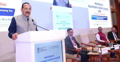
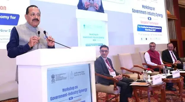
Union Minister of State for Science and Technology and Earth Sciences Dr Jitendra Singh on Friday, 30 October 2026, called for stronger government-industry collaboration to accelerate India's geospatial economy, asserting that geospatial capabilities would be a decisive factor in determining the country's future economic trajectory. The minister was addressing a workshop organised by the Survey of India under the Department of Science and Technology (DST) in New Delhi.
From Mapping Tool to Strategic National Asset
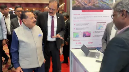
Dr Singh emphasised that geospatial information had evolved well beyond its traditional role in mapping and surveying. It has now emerged, he argued, as a strategic national asset capable of driving broad-based economic growth. The minister also participated in a roundtable discussion with senior government officials and industry leaders, covering opportunities, challenges, and the path forward for the geospatial sector.
Push for Public-Private Partnerships and Startups
A key thrust of the minister's address was the need for robust public-private partnerships to expand markets, develop viable business models, and support the participation of startups and MSMEs. He pointed to the National Geospatial Policy 2022 as an open framework capable of accommodating emerging technologies, including geospatial artificial intelligence (AI).
Dr Singh urged government departments to identify specific areas where they could collaborate with the Survey of India, and asked the Surveyor General to organise virtual meetings to familiarise departments with the organisation's capabilities. He laid out a three-part vision for progress: 'enable, invest and adopt' — enabling to build confidence, investing to develop capability, and adopting geospatial solutions to generate economic growth.
A Decade of Reforms and Technological Transformation
The minister noted that several far-reaching geospatial reforms had been undertaken over the past 12–13 years, describing the process as one that required courage and conviction. He highlighted the transformation of the Survey of India from an organisation focused on traditional, labour-intensive surveying to one now leveraging satellite-based mapping, drones, and computer-based technologies.
DST Secretary Flags AI, Climate and Energy Transition Opportunities
Prof. Umesh V. Waghmare, Secretary of the Department of Science and Technology, said geospatial infrastructure could help organise information on national resources and support their optimal use, including during the energy transition. He highlighted the convergence of satellite and drone technologies, artificial intelligence, optics, and rapid data processing as a transformative combination. Waghmare added that government priorities should be informed by real-world applications and industry requirements, and that geospatial infrastructure could promote indigenous innovation, strengthen global partnerships, and help address challenges such as climate change.
The workshop signals a concerted push to position India's geospatial sector as an economic engine, with both policy reform and institutional capacity-building on the agenda in the months ahead.
Point of View
But the workshop format risks being aspirational without binding commitments. India's geospatial reforms over the past decade have been real — the liberalisation of mapping data access was a genuine policy shift — yet commercial uptake by startups and MSMEs remains uneven. The call to 'enable, invest and adopt' is a sound framework, but the absence of specific budgetary allocations or timelines for inter-departmental adoption leaves the agenda vulnerable to execution gaps. The convergence of AI and satellite data is a genuine opportunity; whether India builds the institutional plumbing to capture it, or cedes ground to global platforms, is the real question this workshop did not fully answer.
NationPress
30 Oct 2026
Frequently Asked Questions
What did Dr Jitendra Singh say about India's geospatial economy?
Dr Jitendra Singh said geospatial capabilities would be a key determinant of India's future economic growth, and called for stronger government-industry collaboration to accelerate the sector. He was speaking at a Survey of India workshop organised under the Department of Science and Technology on 30 October 2026.
What is the National Geospatial Policy 2022 and why does it matter?
The National Geospatial Policy 2022 is an open regulatory framework introduced by the Indian government to govern the collection, storage, and use of geospatial data. Dr Singh highlighted it as a policy architecture flexible enough to accommodate emerging technologies, including geospatial AI and drone-based mapping.
How has the Survey of India changed in recent years?
The Survey of India has transitioned from traditional, labour-intensive surveying to satellite-based mapping, drone technology, and computer-based processing over the past 12–13 years. The minister described this transformation as one requiring courage and conviction, reflecting the scale of institutional change involved.
What role can geospatial infrastructure play in India's energy transition?
According to DST Secretary Prof. Umesh V. Waghmare, geospatial infrastructure can help organise data on national resources and support their optimal use, including during the energy transition. It can also assist in addressing climate change challenges and promoting indigenous innovation.
What is the 'enable, invest and adopt' strategy outlined by Dr Singh?
The 'enable, invest and adopt' framework proposed by Dr Singh involves three steps: enabling institutions and stakeholders to build confidence in geospatial solutions, investing to develop technical capability, and adopting those solutions to generate tangible economic growth. He urged government departments to partner with the Survey of India as a first step.