IIT Mandi launches Himalayan landslide early warning system for monsoon season
Synopsis
IIT Mandi has built what is arguably India's most extensive operational landslide warning system — one that covers the entire Indian Himalayan Region, draws on 26,000 historical landslides and NASA satellite rainfall data, and delivers daily risk forecasts through a web platform every monsoon. In a region where climate-driven slope failures are accelerating, this is a rare instance of frontier research reaching operational scale.
Key Takeaways
IIT Mandi has developed a fully operational Landslide Early Warning System (LEWS) covering the entire Indian Himalayan Region .
The system issues daily landslide risk forecasts during the monsoon season via a web-based platform.
It draws on nearly 26,000 historical landslides from the Geological Survey of India database and NASA's Global Landslide Catalogue .
The P-RIL model dynamically analyses rainfall over the previous 15 days using IMERG satellite datasets .
The project was led by Prof.
Dericks Praise Shukla with research scholars Ankit Singh and Nitesh Dhiman .
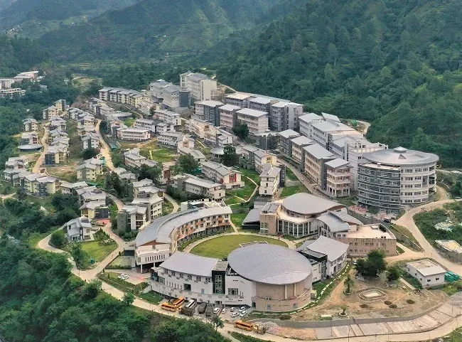
Scientists at the Indian Institute of Technology (IIT) Mandi have developed a fully operational Landslide Early Warning System (LEWS) for the Indian Himalayan Region (IHR), capable of issuing daily landslide risk forecasts during the monsoon season through a web-based platform, the institute announced on Wednesday, 8 July. The system is designed to strengthen disaster preparedness across one of India's most geologically vulnerable zones.
Why the Himalayas Need This Now
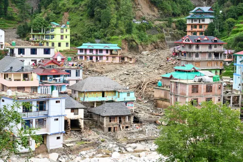
The Indian Himalayan Region ranks among the country's most landslide-prone areas, and shifting climate patterns have accelerated the frequency of slope failures in recent years, resulting in significant loss of life and property. Unlike several existing warning systems that cover only limited geographical pockets, the IIT Mandi platform spans the entire Himalayan belt — making it one of the most extensive operational landslide forecasting systems in India to date.
How the System Works
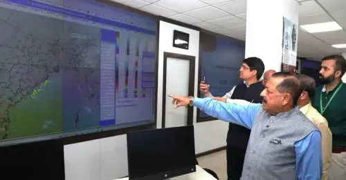
The LEWS combines terrain susceptibility data with real-time rainfall information to forecast and monitor landslide probability. It then issues location-specific alerts to help authorities and disaster management agencies act before a slope failure occurs. The system analyses rainfall recorded over the previous 15 days dynamically, since rainfall patterns shift continuously during the monsoon.
The research team developed the system through a multi-stage methodology. They first identified nearly 26,000 historical landslides from the Geological Survey of India (GSI) database to construct a landslide susceptibility map, integrating multiple triggering factors using ensemble machine learning models. They also built the Probability of Rainfall-Induced Landslides (P-RIL) model using data from NASA's Global Landslide Catalogue and seven rainfall parameters sourced from IMERG satellite datasets.
What the Lead Researcher Said
The project was led by Prof. Dericks Praise Shukla from the School of Civil and Environmental Engineering at IIT Mandi, alongside research scholars Ankit Singh and Nitesh Dhiman. Prof. Shukla said the system 'provides daily landslide forecasts through a web-based application from the beginning of the monsoon season, helping identify high-risk areas in advance and enabling authorities and communities to undertake timely evacuation and preparedness measures.'
He added that satellite-based early warning systems are 'among the most effective investments in disaster risk reduction' as they convert scientific data into timely, actionable information. According to him, a region-wide forecasting platform has the potential to strengthen preparedness, improve emergency response, and enhance coordination among disaster management agencies during periods of elevated landslide risk.
What Comes Next
The web-based platform is already operational, with daily forecasts available through the monsoon season. The system's region-wide coverage positions it as a potential backbone for national-level landslide risk coordination, particularly as the Centre scales up its disaster resilience infrastructure ahead of increasingly erratic monsoon cycles.
Point of View
Yet early warning has remained patchy and localised. IIT Mandi's system is notable precisely because it breaks that geographic constraint — but operational coverage is not the same as operational uptake. The harder question is whether state disaster management agencies in Himachal Pradesh, Uttarakhand, and the Northeast have the bandwidth and protocols to act on daily forecasts in real time. Technology that outpaces institutional capacity tends to sit unused. The Centre's disaster resilience push will only deliver if last-mile alert dissemination — to panchayats, road authorities, and local communities — is built alongside the science.
NationPress
8 Jul 2026
Frequently Asked Questions
What is the IIT Mandi Landslide Early Warning System?
It is a fully operational web-based platform developed by IIT Mandi that issues daily landslide risk forecasts for the entire Indian Himalayan Region during the monsoon season. The system combines terrain susceptibility mapping with real-time satellite rainfall data to generate location-specific alerts for disaster management agencies.
How does the IIT Mandi LEWS generate its forecasts?
The system uses ensemble machine learning models trained on nearly 26,000 historical landslides from the Geological Survey of India database, combined with the P-RIL model that analyses seven rainfall parameters from NASA's IMERG satellite datasets over a rolling 15-day window. This dynamic approach accounts for continuously shifting monsoon rainfall patterns.
Who developed the IIT Mandi landslide warning system?
The system was developed by Prof. Dericks Praise Shukla from the School of Civil and Environmental Engineering at IIT Mandi, along with research scholars Ankit Singh and Nitesh Dhiman.
How does this system differ from existing landslide warning systems in India?
Most existing landslide warning systems in India are limited to smaller geographical areas. The IIT Mandi LEWS covers the entire Indian Himalayan Region, making it one of the country's most geographically extensive operational landslide forecasting platforms.
When is the system operational?
The web-based platform is operational from the beginning of the monsoon season, providing daily forecasts throughout the high-risk period. It was announced on 8 July 2025.