Hurricane Polo bears down on northwestern Mexico as Category 3 storm
Synopsis
Hurricane Polo, packing 195 km/h sustained winds and gusts up to 240 km/h, was closing in on northwestern Mexico on 28 September with a potential Category 3 landfall on Monday. Three Mexican states — Baja California Sur, Sonora and Sinaloa — are on alert, ports are shut, and authorities on both sides of the US-Mexico border are urging immediate evacuations. A major tourism belt and critical coastal infrastructure are directly in the storm's path.
Key Takeaways
Hurricane Polo was a Category 3 storm as of 28 September , with sustained winds of 195 km/h and gusts of 240 km/h .
Possible landfall along Baja California Sur is projected for Monday afternoon , according to Mexico's meteorological service .
Hurricane warnings and watches cover coastal zones across Baja California Sur , Sonora , and Sinaloa .
Coastal areas face waves of 3–5 metres ; northern and central Baja California Sur could receive 25–50 mm of rain.
Mexico's Navy closed ports in several states due to deteriorating maritime conditions.
Authorities have urged residents to evacuate immediately and follow official civil-protection channels for updates.
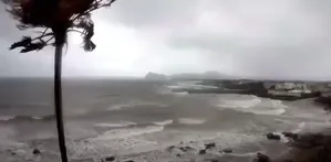
Hurricane Polo, a Category 3 storm on the Saffir-Simpson scale, was bearing down on northwestern Mexico on Sunday, 28 September, prompting authorities in both Mexico and the United States to urge coastal residents to complete emergency preparations without delay. The storm threatened communities across Baja California Sur, Sonora, and Sinaloa with destructive winds, heavy rainfall, and dangerous wave surges.
Storm Position and Intensity
At midday on Sunday, Polo was located approximately 425 kilometres west-southwest of Cabo San Lucas and 460 kilometres southwest of Cabo San Lázaro in Baja California Sur. The hurricane was packing maximum sustained winds of 195 kilometres per hour, with gusts reaching up to 240 kilometres per hour, and was moving northwest at 17 kilometres per hour. While the storm had weakened from a higher category, it remained highly dangerous, according to Mexico's meteorological service, which projected a possible landfall as early as Monday afternoon.
Warning Zones and Alert Levels
Mexican authorities established a hurricane warning zone between Punta Abreojos and Santa Fe, with additional precautionary measures in place from Loreto to Santa Rosalía. Hurricane and tropical-storm warnings also covered the coastal stretch from Punta Abreojos to Punta Eugenia. Authorities were monitoring the coastline from Loreto to San Evaristo and from Santa Rosalía to San Juan Bautista for potential hurricane or tropical-storm conditions. A hurricane watch was also issued for the Sonora coast between Huatabampito and Bahía Kino, while tropical-storm precautions extended from Huatabampito to Topolobampo in Sinaloa.
Official Safety Instructions
Mexico's National Civil Protection Coordination called on residents across the three affected states to take immediate precautions. The US National Hurricane Center separately urged people in Baja California Sur to accelerate steps to protect lives and property. Officials advised residents to stay away from beaches, rocky areas, breakwaters, and other wave-exposed locations, and warned against crossing streams, rivers, or flooded zones where fast-moving water could develop. Families were asked to identify the nearest temporary shelter and evacuation routes, and to prepare emergency bags containing identity documents, medicines, drinking water, and essential supplies.
Infrastructure and Maritime Disruption
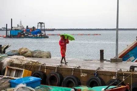
Mexico's Navy closed ports in several states as maritime conditions deteriorated. Northern and central parts of Baja California Sur could receive between 25 and 50 millimetres of rain, while coastal areas were expected to face waves between three and five metres. Sustained local winds away from the storm's core could reach 20 to 40 kilometres per hour, with gusts of 50 to 60 kilometres per hour. Notably, Baja California Sur hosts major tourism centres whose roads, ports, and infrastructure are particularly vulnerable to intense rainfall and storm surges — a pattern repeated regularly during the eastern Pacific hurricane season.
Response on the Ground
Mexico's Civil Protection agency said it was reinforcing its presence in vulnerable areas to anticipate resource requirements and coordinate protection for communities. Residents were instructed to follow any evacuation orders immediately and to rely exclusively on official meteorological and civil-protection channels for guidance. As Monday's projected landfall approached, authorities warned that conditions could deteriorate rapidly with little additional notice.
Point of View
Yet evacuation readiness and port resilience vary sharply between states. The simultaneous advisory from the US National Hurricane Center underscores the cross-border nature of the risk: coastal communities in northwestern Mexico draw visitors and supply chains from the US, and disruptions travel north fast. What's worth watching is whether the Category 3 landfall, if it occurs, triggers a rethink of zoning and construction standards in Cabo San Lucas and similar resort zones that are rebuilt after each major storm but rarely hardened against the next one.
NationPress
28 Sept 2026
Frequently Asked Questions
What category is Hurricane Polo and where is it headed?
Hurricane Polo was a Category 3 storm on the Saffir-Simpson scale as of 28 September 2026, heading toward northwestern Mexico with a projected landfall along Baja California Sur on Monday afternoon. It carried maximum sustained winds of 195 km/h and gusts up to 240 km/h.
Which areas of Mexico are under hurricane warnings for Polo?
Hurricane warnings covered the coastal zone between Punta Abreojos and Santa Fe, and from Punta Abreojos to Punta Eugenia. Additional warnings and watches extended to parts of Sonora — from Huatabampito to Bahía Kino — and tropical-storm precautions reached Topolobampo in Sinaloa.
What safety steps have authorities recommended for Hurricane Polo?
Authorities advised residents to avoid beaches, rocky areas, and breakwaters, and not to cross flooded streams or rivers. Families were told to identify the nearest shelter and evacuation routes, prepare emergency bags with documents, medicine, and water, and follow evacuation orders immediately once issued.
Has Hurricane Polo caused any port closures?
Yes. Mexico's Navy closed ports in several states as maritime conditions deteriorated ahead of the storm. Coastal areas were expected to experience waves between three and five metres, making navigation dangerous.
Why is Baja California Sur particularly vulnerable to Hurricane Polo?
Baja California Sur hosts major tourism centres as well as communities whose roads, ports, and infrastructure are highly susceptible to intense rainfall and storm surges. The region sits directly in the eastern Pacific hurricane belt and has repeatedly faced significant disruption from tropical storms, making it one of Mexico's most exposed coastal zones.