Mayon Volcano erupts in Philippines, 1,325 families evacuated south of Manila
Synopsis
Mayon Volcano has erupted in the Philippines, with PHIVOLCS raising the alert to level 3 out of 5 — meaning magma is near the surface and a major eruption could be weeks away. Over 1,325 families have been displaced, lava flows are active across multiple gullies, and 12 villages face water rationing as the government scrambles to deploy relief.
Key Takeaways
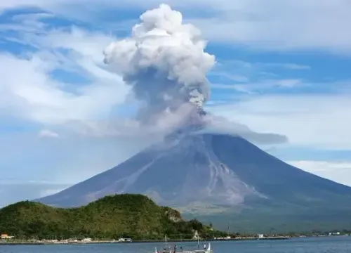
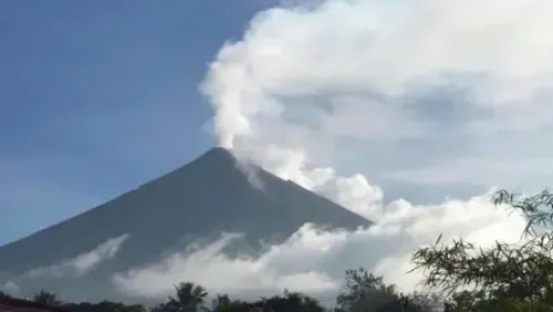
Mayon Volcano erupted on 3 May , south of Manila , Philippines.
PHIVOLCS raised the alert level to 3 out of 5 , indicating magma is near the surface and a hazardous eruption could occur within weeks.
1,325 families have been affected; water supply rationed across 12 villages .
A 6-kilometre Permanent Danger Zone (PDZ) is enforced, with possible expansion to 8 kilometres ; all aircraft barred from the area.
Active hazards include lava flows, pyroclastic density currents, ashfall, rockfalls , and potential lahars during rainfall.
The Department of Social Welfare and Development is distributing food, hygiene kits, and N95 masks at evacuation centres.
Mayon Volcano erupted on Sunday, 3 May, triggering the evacuation of thousands of residents from communities south of Manila, according to the Philippines government news agency. The Philippine Institute of Volcanology and Seismology (PHIVOLCS) has raised the alert level to three out of five, signalling that magma is near or at the surface and a hazardous eruption could follow within weeks.
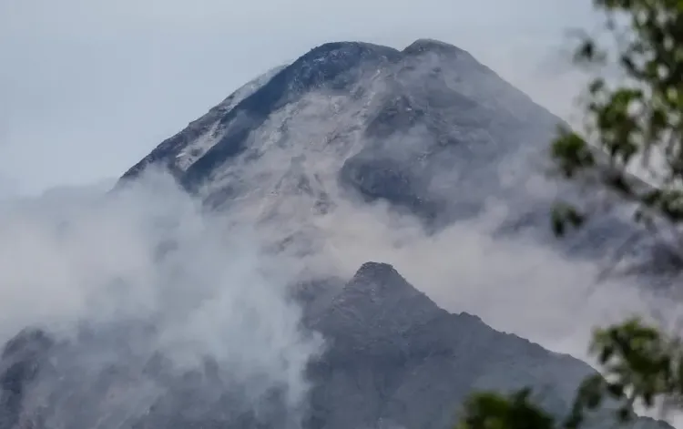
Alert Level and Immediate Danger Zones
PHIVOLCS has enforced a strict 6-kilometre radius Permanent Danger Zone (PDZ) around the active crater, with danger zones potentially expanding to 8 kilometres depending on volcanic activity. All aircraft have been barred from flying close to the volcano. Alert level three, as defined by the institute, indicates that magma intrusion is imminent and activity may escalate rapidly.
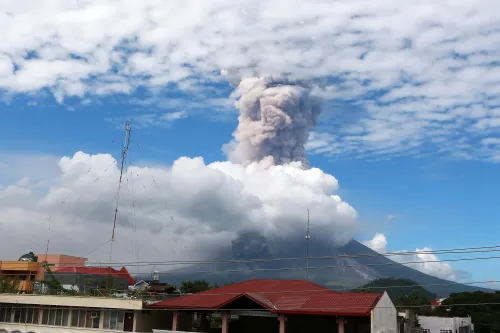
Volcanic Activity Observed
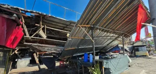
The institute reported active lava effusion with lava flows across multiple gullies, accompanied by episodic minor strombolian activity and short-lived lava fountaining. Successive pyroclastic density currents (PDCs) and ashfall have been recorded on the southwestern slope of the volcano. Authorities have also flagged risks of rockfalls, landslides, avalanches, ballistic fragments, lahars during heavy rainfall, and moderate-sized explosions.
Families Affected and Water Supply Disruption
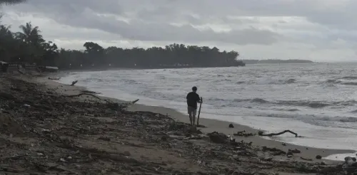
A total of 1,325 families have been affected by the eruption. Water supply is being rationed to 12 villages, including Quitago, Maguiron, Inamnan Pequeno, Iraya, San Francisco, Travesia, San Rafael, Inamnan Grande, Calzada, Morera, Poblacion, and Ilawod, according to the government news agency. The Department of Public Works and Highways has deployed water filtration units and sanitation teams to clear roads and assist affected residents.
Government Relief and Emergency Response
The Office of Civil Defence-Bicol is assessing immediate needs, including potable water, face masks — including N95 respirators — and medicine for respiratory illnesses. The Department of Social Welfare and Development is distributing hygiene kits, family food packs, and ready-to-eat meals at evacuation centres. Damage to livestock and farmlands is being assessed in coordination with the Department of Agriculture. Authorities are expected to continue monitoring volcanic activity closely, with the possibility of further evacuations if the alert level is raised.
Point of View
And the 2018 eruption displaced over 90,000. An alert level 3 is not a false alarm; it is a documented precursor phase. What deserves scrutiny is the speed and adequacy of relief logistics: water rationing across 12 villages with 1,325 families displaced is a significant strain, and the assessment of farmland and livestock damage will have lasting economic consequences for communities that are already among the most vulnerable in the Bicol region. The real test is whether government agencies can coordinate faster than the volcano escalates.
NationPress
21 Jun 2026
Frequently Asked Questions
What is the current alert level for Mayon Volcano?
PHIVOLCS has set the alert level at 3 out of 5, meaning magma is near or at the surface and a hazardous eruption could occur within weeks. A 6-kilometre Permanent Danger Zone has been enforced around the crater.
How many people have been evacuated due to the Mayon Volcano eruption?
A total of 1,325 families have been affected and are being evacuated from communities south of Manila. Twelve villages are also facing water supply rationing as part of emergency measures.
What volcanic hazards are currently active at Mayon?
Active hazards include lava effusion with flows across multiple gullies, pyroclastic density currents, ashfall on the southwestern slope, lava fountaining, and risks of rockfalls, landslides, and lahars during heavy rainfall.
What relief measures is the Philippine government providing?
The Department of Social Welfare and Development is distributing hygiene kits, family food packs, and ready-to-eat meals at evacuation centres. The Office of Civil Defence-Bicol is sourcing potable water, N95 masks, and respiratory medicines for displaced residents.
Is it safe to fly near Mayon Volcano?
No. PHIVOLCS has explicitly prohibited all aircraft from flying close to Mayon Volcano due to the active eruption and associated hazards such as ballistic fragments and ash clouds.