Narayani River crosses danger level in Nepal, Gandak flood risk rises for India
Synopsis
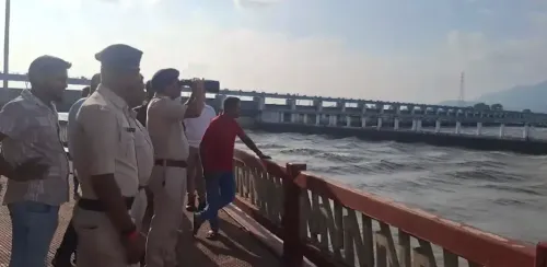
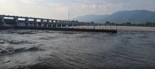
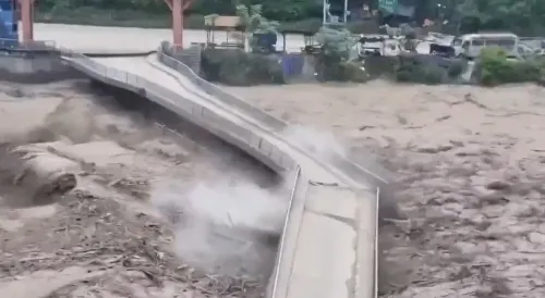
The Narayani River in Nepal has surged to 11 metres — two full metres above its 9-metre danger mark — and could peak at 13 metres by late morning on 27 September. With Chitwan, Nawalparasi East, and Nawalparasi West all bordering India, the flood pulse is set to travel downstream through the Gandak, putting Indian states on alert even as 25 houses have already been swept away in Parbat district.
Key Takeaways
Nepal's NDRRMA issued a special flood warning on 27 September 2026 after the Narayani River crossed its 9-metre danger level, reaching 11 metres .
Water could peak at 13 metres at the Devghat monitoring station around 11 am on Sunday, remaining above danger level until evening.
The Kali Gandaki , Seti , Madi , Marsyangdi , Daraundi , and Chepe rivers are all flowing above warning levels.
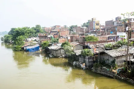
Three border districts — Chitwan , Nawalparasi East , and Nawalparasi West — face the highest inundation risk, with direct implications for India's Gandak downstream.
25 houses swept away in Parbat district ; 3 people missing after a landslide in Palpa district .
Heavy rainfall across Nepal has been ongoing since 24 September , with no immediate let-up forecast.
Nepal's National Disaster Risk Reduction and Management Authority (NDRRMA) issued a special flood warning on Sunday, 27 September 2026, after the Narayani River crossed its danger level in southern Chitwan and Nawalparasi districts, with water levels continuing to rise. The transboundary river — known as the Gandak in India — poses a downstream flood threat to neighbouring Indian states as well.
How High the Water Has Risen
According to a special flood forecast and advisory bulletin issued by the Centre of Hydrology and Water Resources Research (CHWRR) at 7:45 am on Sunday, the Narayani's water level had climbed to approximately 11 metres — well above the designated danger threshold of 9 metres. The CHWRR warned that the water level at the Devghat flood monitoring station in Chitwan district was expected to keep rising through the morning, potentially peaking at around 13 metres near 11 am.
'There is a high likelihood that the water level will remain above the danger level until the evening,' the CHWRR said, adding that high flows are also expected to continue in the Narayani's tributaries through the afternoon.
Tributaries Also in Flood Alert
The Kali Gandaki River, one of the Narayani's major tributaries, has recorded flows significantly above its danger level. The Seti, Madi, Marsyangdi, Daraundi, and Chepe rivers are flowing above their warning levels and continue to rise. The Budhi Gandaki and Trishuli rivers have also approached their warning levels, with discharge continuing to increase. Residents living along all these rivers and their tributaries have been urged to remain on high alert until the evening.
Districts Bordering India at Highest Risk
The CHWRR has identified Chitwan, Nawalparasi East, and Nawalparasi West — all three of which share a border with India — as facing a high risk of flooding and inundation in low-lying and flood-prone areas. Nepali authorities have advised residents to evacuate riverbanks and move to higher ground immediately, and to avoid unnecessary movement near bridges, embankments, and other vulnerable locations.
This comes amid incessant rainfall that has battered several parts of Nepal since 24 September, following devastating floods in the Bhotekoshi and Trishuli rivers earlier in the season.
Casualties and Damage Already Reported
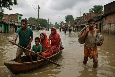
A rainfall-triggered landslide buried a house in Bhaskatta, Mathagadhi Rural Municipality in Palpa district in western Nepal early Sunday, leaving three people missing, according to Nepal Police. A rescue team has been deployed to the site. Separately, flooding in the Kali Gandaki River swept away 25 houses in the Farse area of Jaljala Rural Municipality-8 in Parbat district. Of approximately 80 houses in the settlement, 25 have been destroyed and the remainder are at risk. Police confirmed that no human casualties have been reported from the settlement and that all residents have been relocated to a safe location.
What Happens Next
Authorities have instructed residents to follow flood-related information and instructions issued by local administrations, security agencies, and other relevant bodies. The cross-border nature of the Narayani-Gandak system means that downstream districts in Bihar and Uttar Pradesh in India will need to monitor river levels closely as the peak discharge moves southward. A prolonged spell of heavy rainfall across the catchment area makes rapid de-escalation unlikely in the immediate term.
Point of View
Which have historically received warnings too late to pre-position relief. With three border districts simultaneously under high-risk status and eight river systems above warning levels, this is not a localised event — it is a systemic stress test of India-Nepal disaster diplomacy.
NationPress
27 Sept 2026
Frequently Asked Questions
Why has the Narayani River flood triggered a warning for India?
The Narayani River in Nepal is the same river as the Gandak in India — a transboundary system that flows across the Nepal-India border into Bihar and Uttar Pradesh. When river levels surge in Nepal, the flood pulse travels downstream into Indian territory, raising inundation risk for communities along the Gandak.
How high has the Narayani River risen above the danger level?
As of 7:45 am on 27 September, the water level at the Devghat monitoring station in Chitwan stood at approximately 11 metres — two metres above the designated danger level of 9 metres. Authorities projected the river could peak at around 13 metres by 11 am on Sunday.
Which areas in Nepal face the highest flood risk right now?
Chitwan, Nawalparasi East, and Nawalparasi West districts — all bordering India — face the highest risk of flooding and inundation. Residents along the Kali Gandaki, Seti, Madi, Marsyangdi, Daraundi, Chepe, Budhi Gandaki, and Trishuli rivers have also been placed on high alert.
What damage has already occurred in Nepal from the current floods?
Flooding in the Kali Gandaki River swept away 25 of approximately 80 houses in the Farse area of Parbat district, though all residents were evacuated safely with no casualties reported. A separate landslide in Palpa district left three people missing after a house was buried early Sunday.
What should people along the Narayani and Gandak do right now?
Nepali authorities have urged residents near the Narayani and its tributaries to move away from riverbanks immediately and relocate to higher ground. They have been advised to avoid travel near rivers, bridges, and embankments, and to follow instructions from local administrations and security agencies until at least Sunday evening.