Nepal Gorkha landslide unleashed 3.5-magnitude quake energy, flooded Budhi Gandaki
Synopsis
A landslide in Nepal's Gorkha Himalayas didn't just flood the Budhi Gandaki — it hit with the force of a 3.5-magnitude earthquake, sending 20-to-25-metre surges that swept away the camp of a 341-MW hydropower project. It's the second catastrophic river disaster in six weeks, and the science behind it — glacial debris cascading from 6,000 metres — points to a deepening Himalayan vulnerability that early-warning systems have yet to keep pace with.
Key Takeaways
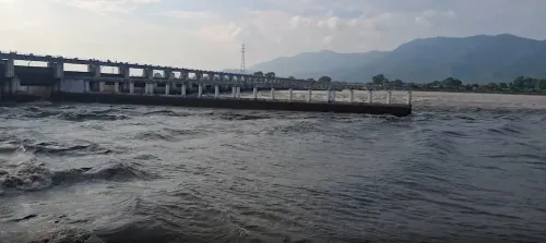
A high-altitude landslide in Gorkha district, Nepal on 11 October 2026 triggered floods along the Budhi Gandaki River , releasing energy equivalent to a 3.5-magnitude earthquake .
The largest flood surge reached an estimated 20 to 25 metres in height, sweeping away the construction camp of the 341-MW Budhi Gandaki Hydroelectric Project .
At least five people are missing; hydropower projects, roads, and bridges were destroyed.
The avalanche originated at approximately 6,000 metres altitude in the Tibetan Tethys Himalaya ; the landslide occurred near 5,500 metres .
This was Nepal's second major flood disaster in roughly six weeks , following 26 August floods on the Bhote Koshi and Trishuli rivers that killed nearly 1,500 people and left over 5,000 missing .
The findings are from a preliminary report by Nepal's Department of Mines and Geology ; a fuller investigation is pending.
A catastrophic landslide in the high Himalayas of Nepal's Gorkha district on 11 October 2026 triggered devastating floods along the Budhi Gandaki River, releasing energy equivalent to a 3.5-magnitude earthquake, according to a preliminary technical assessment by Nepal's Department of Mines and Geology. The disaster left at least five people missing and caused widespread destruction to hydropower infrastructure, roads, and bridges.
How the Disaster Unfolded
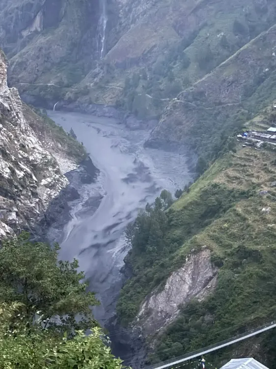
The incident began at approximately 4:20 am in the upper reaches of the Ungdilung Khola, a tributary of the Budhi Gandaki River, in Chumnubri Rural Municipality — an area bordering China, situated between Chamar Himal and Syerangi Himal. According to the department's report, an avalanche originated at roughly 6,000 metres altitude in the Tibetan Tethys Himalaya, a zone characterised by relatively weak rock formations, with a landslide occurring at around 5,500 metres.
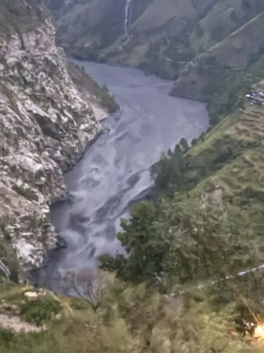
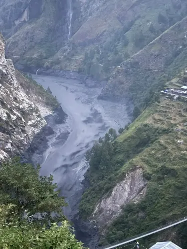
The massive slide — comprising a mixture of snow, water, and glacial debris — swept southward along the Ungdilung Khola, depositing a large volume of debris at the narrow confluence of the Ungdilung Khola and Syar Khola, another Budhi Gandaki tributary, at an altitude of approximately 2,000 metres. The debris repeatedly blocked and released river flows, potentially generating successive flood surges downstream.
Scale of the Flood Surges
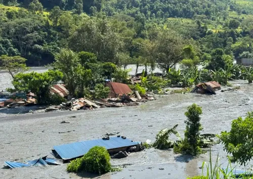
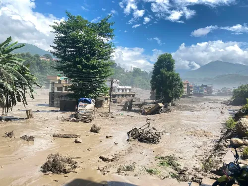
The National Disaster Risk Reduction and Management Authority (NDRRMA), citing the department's findings in a social media post, said the Budhi Gandaki experienced repeated flood surges in a single day. The largest surge reached an estimated height of 20 to 25 metres. The first mud-laden flood reached the Salleri area — where a construction camp for the 341-MW Budhi Gandaki Hydroelectric Project was located — at around 4:30 am. The largest surge arrived at the hydropower camp at approximately 6:30 am, sweeping the camp away entirely.
The report notes that the enormous volume of debris carried by the Ungdilung Khola played a more significant role in generating the largest flood surge than the water that had accumulated behind the blockage of the Syar Khola. Field observations further indicated that the Syar Khola's flow had stopped roughly one hour before the largest surge arrived, with water accumulated over a stretch of around 1.5 kilometres in its upper reaches. Smaller surges reportedly continued even after the peak event had passed.
Infrastructure and Community Damage
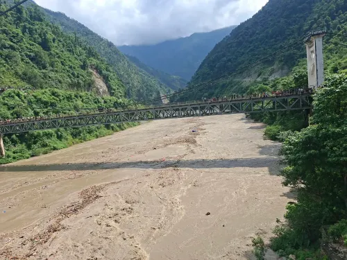
The powerful surge caused major damage downstream, particularly in the Jagat area along the Budhi Gandaki River, where several buildings were affected. Permanent bridges over the Soti Khola and the Budhi Gandaki River were among the damaged structures, the report said. Several hydropower projects, roads, and bridges were destroyed, according to the NDRRMA.
Context: Second Major Disaster in Six Weeks
This comes amid a broader pattern of escalating flood disasters in Nepal's river systems. The 11 October flooding was the second major riverine disaster in roughly six weeks, following catastrophic floods that struck the Bhote Koshi and Trishuli rivers on 26 August. That earlier disaster killed nearly 1,500 people and left more than 5,000 missing, while devastating communities, hydropower plants, roads, and bridges along both rivers. The recurrence underscores the acute vulnerability of Nepal's high-altitude river corridors — and the infrastructure built within them — to glacial and snow-related mass movements, particularly as climate pressures on Himalayan glaciers intensify.
What Comes Next
The department's report is described as a preliminary assessment; a fuller technical investigation is expected. The fate of the 341-MW Budhi Gandaki Hydroelectric Project — a long-planned, high-stakes energy project — will be closely watched, as will any government response regarding early-warning systems for high-altitude glacial and debris-flow events in Nepal's northern river catchments.
Point of View
Likely accelerated by glacial retreat. The destruction of the Budhi Gandaki hydropower camp is particularly telling: Nepal's energy strategy depends heavily on Himalayan rivers, yet the infrastructure sits in corridors that are demonstrably becoming more volatile. Two mass-casualty flood disasters within six weeks of each other, both originating in glacially active zones, demand a serious rethink of where Nepal — and its international project partners — build. A preliminary government report is useful, but the policy question it raises — whether high-altitude hydropower siting and early-warning protocols are adequate — goes unanswered.
NationPress
14 Oct 2026
Frequently Asked Questions
What caused the Budhi Gandaki River floods in Nepal on 11 October 2026?
A massive landslide in Gorkha district's high Himalayas triggered the floods. An avalanche originating at roughly 6,000 metres altitude sent a mixture of snow, water, and glacial debris down the Ungdilung Khola, blocking and repeatedly releasing the Syar Khola tributary and generating successive flood surges in the Budhi Gandaki River.
How powerful was the Nepal Gorkha landslide?
According to a preliminary assessment by Nepal's Department of Mines and Geology, the landslide released energy equivalent to a 3.5-magnitude earthquake. The largest resulting flood surge reached an estimated height of 20 to 25 metres.
What infrastructure was damaged in the Budhi Gandaki flood?
The construction camp for the 341-MW Budhi Gandaki Hydroelectric Project in Salleri was swept away by the largest surge. Several other hydropower projects, roads, bridges — including permanent bridges over the Soti Khola and the Budhi Gandaki River — and buildings in the Jagat area were also damaged or destroyed.
How does this disaster compare to Nepal's earlier 2026 flooding?
The 11 October event was the second major flood disaster in roughly six weeks. On 26 August, floods on the Bhote Koshi and Trishuli rivers killed nearly 1,500 people and left more than 5,000 missing, also devastating communities and infrastructure. The recurrence highlights the acute vulnerability of Nepal's northern river corridors.
What is the current casualty count and what happens next?
At least five people are reported missing following the 11 October flooding, according to the NDRRMA. The Department of Mines and Geology's report is described as preliminary; a fuller technical investigation is expected, and the status of the 341-MW Budhi Gandaki Hydroelectric Project will be a key focus going forward.