Nepal floods 2025: Glacial collapse, not earthquake, triggered China-border disaster
Synopsis
What looked like an earthquake-triggered flood at the China-Nepal border was actually a massive glacial collapse — one powerful enough to fool seismic sensors and government officials alike. The USGS reversed its own initial reading, ICIMOD traced the cause to a rock-ice avalanche blocking the Lhende river, and scientists warn it could take weeks to fully unravel. With Himalayan glaciers having lost a third of their ice in three decades and no binding China-Nepal early-warning agreement in place, this disaster may be a preview of worse to come.
Key Takeaways
Flash floods struck the China-Nepal border on 27 August 2025 , initially attributed to a magnitude 4.4 earthquake in Tibet.
The USGS revised its assessment, confirming the event was a glacial collapse and debris flow — not an earthquake.
ICIMOD identified a massive rock-ice avalanche that blocked the Lhende river and triggered cascading downstream floods.
Himalayan glaciers have reportedly lost nearly one-third of their ice over the past three decades .
Nepal and China have no formal signed agreement for real-time cross-border flood and glacial risk data sharing , despite in-principle agreement and repeated calls by Foreign Minister Khanal .
The Chinese Embassy in Nepal denied dam-collapse allegations, calling them “fake news,” while scientists say full causation will take weeks to establish.
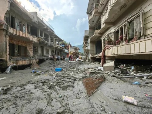
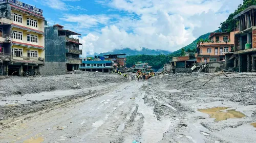
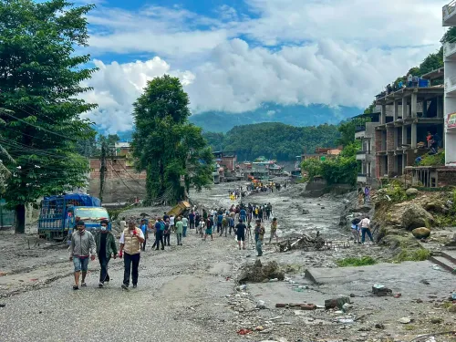
A catastrophic glacial collapse — not an earthquake — triggered the deadly flash floods that struck the China-Nepal border on Wednesday, 27 August, according to revised assessments by the US Geological Survey (USGS) and Kathmandu-based researchers. The disaster has exposed critical gaps in cross-border early-warning systems and reignited debate over Himalayan glacial instability driven by climate change.
How the Trigger Was Misidentified
Initial reports pointed to seismic activity. Nepal Foreign Minister Shisir Khanal told Parliament on Wednesday that an earthquake struck at 8.37 am local time, with a flash flood reported just three minutes later — though he cautioned, “We, however, need to verify this.” The USGS initially recorded a magnitude 4.4 earthquake in the Tibetan territory at that time, lending credibility to the tectonic theory.
But the picture shifted rapidly as additional data came in. The USGS issued a revised statement confirming that further analysis of seismic waves and satellite imagery determined the event was “a glacial collapse and debris flow” — and that no earthquake had occurred. The glacial collapse had generated seismic signals powerful enough to mimic a tectonic event, misleading both automated detection systems and officials on the ground.
What Scientists Now Believe Happened
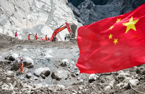
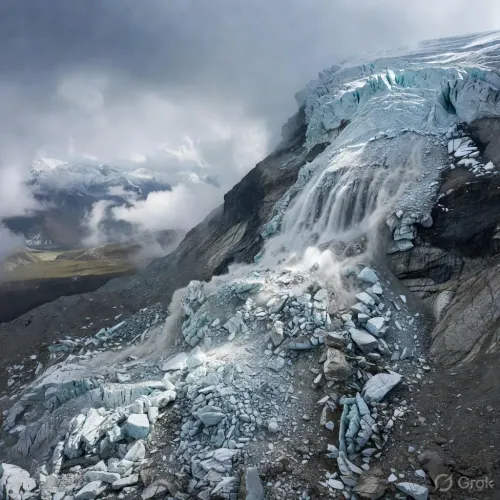
The International Centre for Integrated Mountain Development (ICIMOD), based in Kathmandu, examined satellite imagery and concluded that “a massive rock–ice avalanche occurred in Nepal, blocking the Lhende river and triggering cascading floods downstream.” Their assessment pointed squarely at glacial instability rather than tectonic forces.
A CNN report cited a team of international scientists as saying “a huge chunk of glacier sheared off a mountain and fell into the valley below.” A New Scientist article elaborated further, noting that “warm weather in the past day or so may have melted a lot of snow and some glacier ice, with this liquid water weakening the glacier and causing the entire section flowing down the steep slope to collapse.” However, experts quoted in the same piece cautioned this may be “part of the story,” with other contributing factors yet unidentified. Scientists say it will take weeks to establish the exact causes.
China's Role and the Dam Controversy
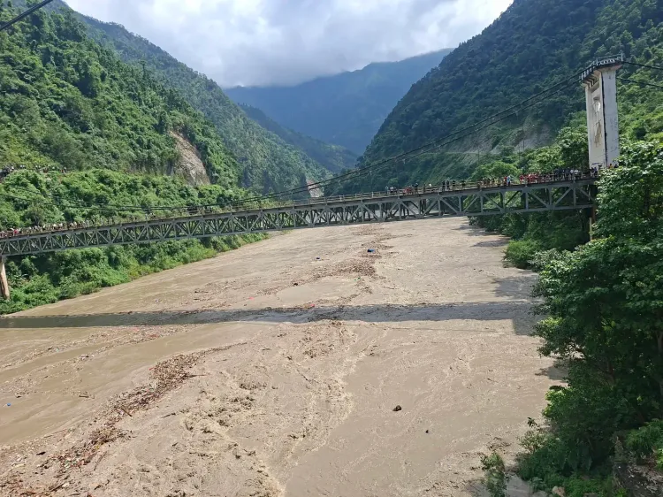
According to Chinese media reports, a mudslide on Wednesday morning caused severe casualties at China’s border port of Gyirong in the city of Xigaze in Tibet — a region that lies north of the Nepal border. The Chinese Embassy in Nepal clarified on Thursday that the “earthquake or earthquake-like glacier collapse occurred on the Nepal side,” and dismissed allegations of a dam collapse as “fake news.”
Notably, studies have flagged that China’s aggressive dam-building programme in Tibet and downstream regions is generating a dangerous combination of ecological fragility and geopolitical tension. The United Nations Framework Convention on Climate Change (UNFCCC) had previously warned — recalling last year’s earthquake on the Tibetan Plateau — that hydrologists, environmental researchers, and geologists have expressed unease over the feasibility and safety of China’s mega-dams in the region.
The Glacial Crisis Behind the Disaster
The broader scientific context is stark. Himalayan glaciers have reportedly lost nearly one-third of their ice over the past three decades, with retreat rates accelerating under rising temperatures. Glacial lake outburst floods (GLOFs) are an increasingly documented hazard across the region.
The disaster has revived longstanding concerns over Nepal’s vulnerability to such events and the absence of a functioning cross-border early-warning mechanism. China and Nepal had reportedly agreed in principle to share real-time data on floods, landslides, and glacial lake outburst risks — but no formal agreement has been signed. Foreign Minister Khanal had raised the issue during his China visit in May, yet implementation remains stalled. According to The Kathmandu Post, “the delay has prompted concern among stakeholders over the absence of a functioning early-warning mechanism in a disaster-prone border region.”
What Comes Next
International scientists are expected to spend weeks piecing together the full sequence of events. The episode has underscored an urgent need for upgraded glacial monitoring infrastructure across the Himalayas and a binding bilateral framework between Nepal and China for real-time disaster data sharing. With Himalayan temperatures continuing to rise, experts warn that similar events — and the confusion they generate — are likely to recur.
Point of View
Not a one-off failure. Meanwhile, the absence of a signed China-Nepal early-warning agreement, years after both sides acknowledged the need, reflects a geopolitical paralysis that is costing lives in one of the world’s most climate-stressed mountain corridors. The UNFCCC’s warnings about Tibetan mega-dam risks remain unresolved, and with Himalayan glacial retreat accelerating, the region is accumulating disaster risk faster than it is building institutional capacity to manage it.
NationPress
11 Oct 2026
Frequently Asked Questions
What caused the Nepal floods at the China border on 27 August 2025?
The floods were caused by a massive rock-ice avalanche that blocked the Lhende river and triggered cascading floods downstream, according to ICIMOD’s satellite imagery analysis. The US Geological Survey also revised its initial earthquake assessment, confirming the seismic signals were produced by a glacial collapse and debris flow, not a tectonic event.
Why was the disaster initially mistaken for an earthquake?
The glacial collapse generated seismic signals powerful enough to mimic a tectonic earthquake, misleading automated detection systems and officials. Nepal’s Foreign Minister Shisir Khanal told Parliament a magnitude 4.4 earthquake had been recorded minutes before the flood, but the USGS later reversed that finding after deeper analysis of seismic wave patterns and satellite imagery.
What is ICIMOD and what did it find?
ICIMOD is the International Centre for Integrated Mountain Development, a Kathmandu-based intergovernmental research body focused on the Hindu Kush Himalayan region. It examined satellite imagery of the disaster zone and concluded that a massive rock-ice avalanche occurred in Nepal, blocking the Lhende river and setting off the downstream flood cascade.
Why is there no early-warning system between Nepal and China for such disasters?
Nepal and China had agreed in principle to share real-time cross-border data on floods, landslides, and glacial lake outburst risks, but no formal agreement has been signed to implement the mechanism. Nepal’s Foreign Minister Khanal raised the issue during his China visit in May, and the continued delay has drawn concern from disaster-management stakeholders in both countries.
How does climate change connect to the Nepal border floods?
Himalayan glaciers have reportedly lost nearly one-third of their ice over the past three decades, increasing the frequency and scale of glacial lake outburst floods and ice-rock avalanches. Scientists believe warming temperatures — which can melt snow and weaken glacier structure — likely played a role in the 27 August collapse, though full causation is expected to take weeks to establish.