China raises flood alert to yellow as Typhoon Bavi lashes vast regions

Synopsis
Typhoon Bavi — the ninth of China's 2026 season — has already made landfall in Zhejiang and triggered a national yellow flood alert, with some zones bracing for up to 800 mm of rain. Rivers in the Haihe basin are flooding now, and Taihu Lake, the Liaohe and Songhua rivers are all at risk of new numbered floods before the week is out.
Key Takeaways
China's Ministry of Water Resources upgraded the national flood alert to yellow on 12 July 2026 due to Typhoon Bavi .
Rainfall of 40–90 mm is forecast across eastern, central and southern China, with some areas exceeding 260 mm .
Typhoon Bavi , the ninth typhoon of 2026 , made landfall along Zhejiang Province late Saturday and is tracking northwest.
Rivers in the Haihe River basin have already recorded their first floods of 2026; Taihu Lake , Liaohe , and Songhua rivers face new flood risks.
Over 50 tourist attractions in Shanghai were closed or operating on reduced hours as of Saturday afternoon .
The National Meteorological Centre had earlier issued a red alert for rainstorms and an orange alert for the typhoon.
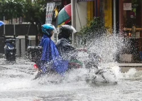
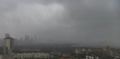
China's Ministry of Water Resources on Sunday, 12 July upgraded its national flood warning to yellow — the third tier in the country's four-level colour-coded alert system — as Typhoon Bavi is forecast to deliver heavy rainfall across eastern, central, and southern China from Sunday through Tuesday. The move signals a significant escalation in preparedness as the storm's reach extends deep inland.
What the Yellow Alert Means
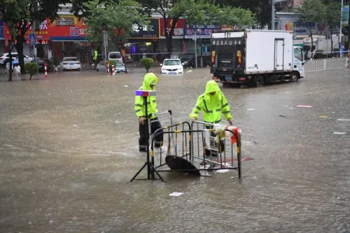
China's flood warning hierarchy runs from blue (least severe) through yellow, orange, and red (most severe). A yellow alert mandates heightened preparedness, precautionary evacuations from vulnerable zones, and active monitoring of river levels. Authorities have urged citizens to avoid low-lying areas, underground passages, and mountain valleys during downpours.
Rainfall Forecast and Affected Regions
Cumulative precipitation of 40 mm to 90 mm is expected across large parts of the country, with some localised zones potentially recording rainfall exceeding 260 mm, according to forecasts. The worst-affected areas are projected to include the Yangtze-Huaihe region, the Yellow River basin, and northeastern China. In parts of eastern and southern Zhejiang Province and northern Fujian, maximum accumulated rainfall could reach 250 to 500 mm, while central and northern Taiwan Island may see 250 to 800 mm, according to the National Observatory's forecast.
Rivers Already Flooding, More at Risk
Several rivers in the Haihe River basin have already recorded their first floods of 2026. The incoming rainfall could trigger new numbered floods in major waterways including Taihu Lake, the Liaohe River, and the Songhua River. Authorities have specifically warned of elevated risks of flash floods, mountain torrents, and urban waterlogging across the affected belt. This comes amid a broader pattern of increasingly intense typhoon seasons affecting China's eastern seaboard in recent years.
Typhoon Bavi's Track and Prior Alerts
Typhoon Bavi, the ninth typhoon of the year, made successive landfalls along the coast of Zhejiang Province late Saturday before moving inland. It is expected to track northwest while gradually weakening. Ahead of the storm's arrival, China's National Meteorological Centre had already issued a red alert for rainstorms — the highest level in its system — alongside an orange alert for the typhoon itself on Saturday.
Disruptions on the Ground
More than 50 major tourist attractions in Shanghai had been temporarily closed or had adjusted operating hours as of 4 pm on Saturday. The closures reflect the scale of precautionary measures being implemented across the country's most densely populated eastern corridor. Authorities continue to monitor the storm's inland progression as it weakens.
Point of View
Liaohe, Songhua, and Taihu systems are all simultaneously at risk, the cumulative infrastructure and agricultural exposure dwarfs any single river event. The 250–800 mm forecast band for Taiwan Island also adds a cross-strait dimension that bears watching beyond the meteorological. China's flood response machinery is well-drilled, but back-to-back typhoon seasons of rising intensity are stress-testing even its most prepared eastern provinces.
NationPress
11 Oct 2026
Frequently Asked Questions
What is China's yellow flood alert and what does it mean?
China uses a four-tier colour-coded flood warning system — blue, yellow, orange, and red, with red being the most severe. A yellow alert, issued on 12 July 2026, calls for heightened preparedness, precautionary measures, and active monitoring of at-risk areas such as low-lying zones and river banks.
Where has Typhoon Bavi made landfall in China?
Typhoon Bavi, the ninth typhoon of the 2026 season, made successive landfalls along the coast of Zhejiang Province in eastern China late Saturday. It is expected to move northwest while gradually weakening as it travels inland.
Which regions of China face the highest flood risk from Typhoon Bavi?
The most exposed areas include the Yangtze-Huaihe region, the Yellow River basin, northeastern China, and parts of eastern and southern Zhejiang and northern Fujian. Some zones in these areas could see accumulated rainfall of 250–500 mm, while central and northern Taiwan Island may receive 250–800 mm.
Are any rivers already flooding due to Typhoon Bavi?
Yes. Several rivers in the Haihe River basin have already recorded their first floods of 2026. Authorities have warned that the incoming rainfall could trigger new numbered floods in Taihu Lake, the Liaohe River, and the Songhua River.
What precautions have Chinese authorities announced?
Authorities have urged the public to avoid low-lying areas, underground passages, and mountain valleys during downpours. More than 50 major tourist attractions in Shanghai were temporarily closed or operating on adjusted hours as of Saturday afternoon, ahead of the storm's peak impact.