BRO Project VARTAK marks 66th Raising Day, maintains 2,066 km of border roads in Northeast
Synopsis
India's first BRO project, Project VARTAK, turns 66 — and it's still building. Maintaining over 2,066 km of roads through snow-bound passes like Bumla and Yangtse, and running 119 active construction works, this Tezpur-based operation is the quiet backbone of India's northeastern border security.
Key Takeaways
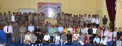
Project VARTAK celebrated its 66th Raising Day on 7 May 2025 at Tezpur, Assam .
Originally raised as Project Tusker on 7 May 1960 , it was renamed in 1963 and is the first BRO project to build roads in India.
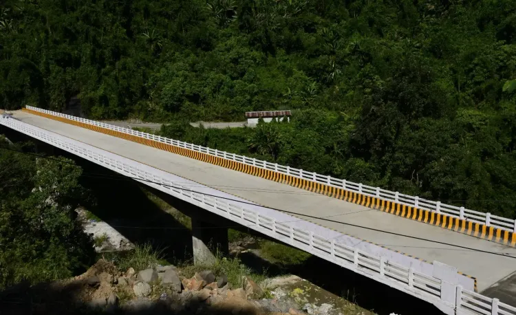
The project currently maintains 2,066.90 km of road network across Sonitpur (Assam) , and West Kameng and Tawang (Arunachal Pradesh) .
67 roads with 119 ongoing works are currently under progress; snow clearance covers 550.83 km .
Strategically critical posts including Bumla , Yangtse , and Monkey Pass fall within its operational area.
The project also plays a key role in disaster response during floods and landslides across the Northeast.
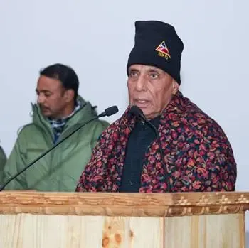
The Border Roads Organisation's (BRO) Project VARTAK celebrated its 66th Raising Day on 7 May 2025 at Tezpur, Assam, reaffirming its commitment to strengthening strategic border infrastructure and improving connectivity across the Northeastern region, according to officials. The milestone underscores over six decades of continuous road-building in some of India's most challenging terrain.
Origins and Historical Significance
Originally raised as Project Tusker on 7 May 1960, the project was rechristened Project VARTAK in 1963 following the Indianisation of BRO project names. It holds the distinction of being the first BRO project to undertake road construction activities in the country — a legacy that has shaped India's strategic infrastructure doctrine in the Northeast for more than half a century.
According to a statement issued by the Defence Public Relations Officer, one of the project's earliest and most consequential missions was improving the Bhalukpong-Tenga-Tawang axis during 1964–65. This included formation cutting works connecting Bomdila with Sela, and surfacing works from Bhalukpong to Rupa — all executed under extremely adverse terrain and weather conditions in the immediate aftermath of the 1962 Sino-Indian War.
Current Operations and Road Network
At present, Project VARTAK operates through task forces located at Tenga, Sapper Camp, and Khirmu. It is responsible for the construction, development, and maintenance of roads across Sonitpur district of Assam, and West Kameng and Tawang districts of Arunachal Pradesh — all areas of significant strategic sensitivity given their proximity to the International Border.
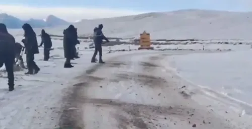
The project currently maintains approximately 2,066.90 km of road network, including stretches through high-altitude and snow-bound regions. Strategically critical locations such as Bumla, Yangtse, Nagula, Womingla, Lungro GG, Monkey Pass, and Assam Hill fall within its area of responsibility.
Ongoing Works and Snow Clearance
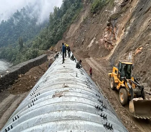
Officials noted that 67 roads with 119 ongoing works are currently under progress under the project. In addition, Project VARTAK is actively maintaining 1,309.22 km of roads and conducting snow clearance operations over 550.83 km, despite challenging climatic and geographical conditions. Regular snow clearance and restoration works are carried out to ensure uninterrupted connectivity for both civilians and defence forces.
Disaster Response and Strategic Role
Beyond routine road construction, Project VARTAK has played a significant role in disaster response — restoring connectivity during floods, landslides, and other natural calamities that frequently disrupt the Northeast. This dual mandate of strategic infrastructure and humanitarian response makes the project a critical pillar of India's security and civilian framework in the region.
This comes amid heightened national focus on border infrastructure development, particularly along the Line of Actual Control (LAC), as India accelerates investment in frontier connectivity. As Project VARTAK enters its 67th year, its operational tempo and expanding road network signal an enduring commitment to securing India's northeastern frontier.
Point of View
The project's operational scale is rarely appreciated in mainstream coverage. What deserves closer scrutiny is the pace: with China accelerating village and road construction on its side of the LAC, the question is not whether India is building, but whether it is building fast enough. Project VARTAK's legacy is impressive; the urgency of its present mandate is even greater.
NationPress
25 Jun 2026
Frequently Asked Questions
What is BRO's Project VARTAK?
Project VARTAK is a Border Roads Organisation project responsible for constructing and maintaining strategic road networks in Assam and Arunachal Pradesh. Originally raised as Project Tusker on 7 May 1960, it was renamed in 1963 and is the first BRO project to have undertaken road construction in India.
Where does Project VARTAK operate?
Project VARTAK operates through task forces at Tenga, Sapper Camp, and Khirmu, covering Sonitpur district in Assam and West Kameng and Tawang districts in Arunachal Pradesh — areas close to the International Border with China.
How much road network does Project VARTAK maintain?
Project VARTAK currently maintains approximately 2,066.90 km of road network, including 1,309.22 km under active maintenance and snow clearance operations across 550.83 km of high-altitude terrain.
What are the strategically important locations under Project VARTAK?
Key strategic locations within Project VARTAK's area of responsibility include Bumla, Yangtse, Nagula, Womingla, Lungro GG, Monkey Pass, and Assam Hill — all situated near India's border with China in Arunachal Pradesh.
What is the significance of the Bhalukpong-Tenga-Tawang axis?
The Bhalukpong-Tenga-Tawang axis is one of the most strategically vital road corridors in Northeast India, connecting the plains to the high-altitude Tawang region. Project VARTAK undertook the challenging task of improving this axis during 1964–65, shortly after the 1962 Sino-Indian War.