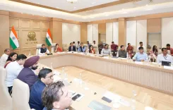
CM Dhami installs GLOF early warning system at Vasundhara Tal
Synopsis
Uttarakhand has installed its first glacial lake early warning system at Vasundhara Tal in Chamoli — deploying weather, water-level, and seismic sensors linked via Iridium satellite to CBRI Roorkee and USDMA dashboards, under CM Pushkar Singh Dhami's directive.
Key Takeaways
Uttarakhand has installed its first-ever GLOF early warning system on a glacial lake, at Vasundhara Tal in Chamoli district.
The lake is 900m long, 600m wide , and 38.50m deep ; sensors cover weather, water level, vibration, tilt, and ground movement.
Iridium satellite communication is used to transmit data, overcoming the absence of mobile networks at high altitude.
Sensors transmit every two hours under normal conditions and instantly in emergencies to dashboards at CBRI Roorkee and USDMA .
The expedition was flagged off by Chief Secretary Anand Bardhan on 29 September and supported by SDRF, NDRF, and ITBP .
CM Pushkar Singh Dhami called Phase 1 a critical step; further expansion to other glacial lakes is expected.
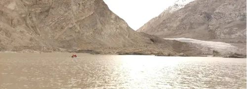
In the high Himalayas of Chamoli district, where glacial lakes can rupture without warning and send walls of water down narrow mountain valleys, Uttarakhand has just completed a milestone it has been working toward since a series of catastrophic floods reshaped the state's approach to disaster preparedness. The Chief Minister's Office of Uttarakhand announced on Tuesday, 13 October 2026, that a scientific and technical team has successfully returned after installing the state's first-ever Glacial Lake Outburst Flood (GLOF) early warning system at Vasundhara Tal — a glacial lake sitting at high altitude in Chamoli.
What the sensors at Vasundhara Tal will now watch
The lake they chose is no small body of water. Vasundhara Tal stretches 900 metres in length, 600 metres in width, and plunges to a depth of approximately 38.50 metres. At those dimensions, an uncontrolled outburst would carry enormous destructive force downstream. The installed system now deploys an all-in-one weather sensor measuring wind speed and direction, rainfall, solar radiation, air temperature, and atmospheric pressure. Floating and submerged water-level sensors track the lake's fill at all times. Two accelerometers and tilt sensors monitor sudden vibrations, inclinations, and ground movements that could signal an imminent breach.
In normal conditions, all sensors transmit data every two hours to twin dashboards — one at CBRI Roorkee and one at the Uttarakhand State Disaster Management Authority (USDMA) headquarters. In an emergency, the two-hour interval is bypassed entirely: sensors fire data instantly, giving authorities the earliest possible alert window to act.
Iridium satellites bridge the communications gap
There is no mobile network at Vasundhara Tal's altitude — a challenge the team solved by embedding Iridium satellite communication technology into the system. Every reading from every sensor travels up to low-earth orbit and back down to the dashboards, regardless of terrain. The expedition confirmed full data-transmission functionality before returning. Dr. D.P. Kanungo, scientist at the Central Building Research Institute (CBRI), Roorkee and expedition lead, reported that current lake dimensions show no significant change from previous surveys, and that sensor placement was deliberately chosen at sites with minimal landslide and avalanche risk to protect long-term equipment integrity.
The expedition that made it happen
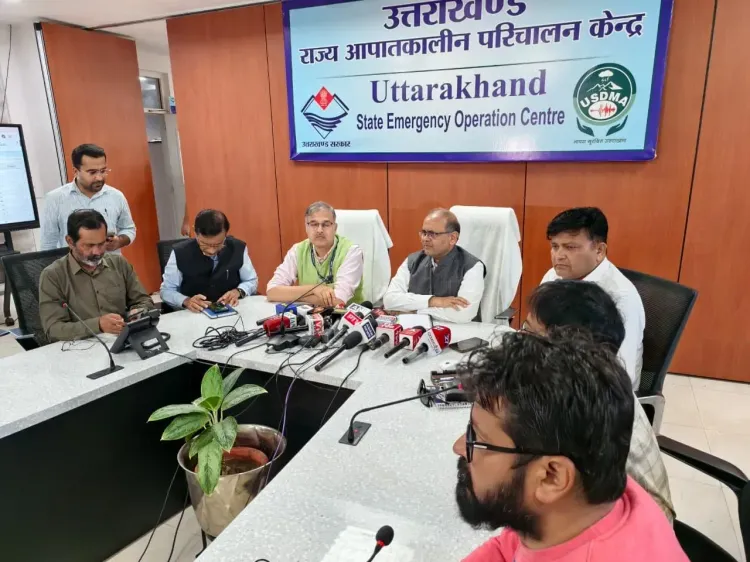
Chief Secretary Anand Bardhan flagged off the team on 29 September, launching what became a technically demanding mission through the unforgiving geography of the upper Himalayas. On its return, the team was welcomed at USDMA by Secretary Disaster Management and Rehabilitation Vinod Kumar Suman. The expedition drew on the combined support of the State Disaster Response Force (SDRF), the National Disaster Response Force (NDRF), and the Indo-Tibetan Border Police (ITBP). Scientists present at the welcome included Prof. R. Pradeep Kumar, Director of CBRI Roorkee, Dr. Shantanu Sarkar of ULMMC, Dr. S.K. Panigrahi, Dr. Kaushik Pandit, and several other technical and administrative officers.
Dhami's push — and the post-Kedarnath imperative
Chief Minister Pushkar Singh Dhami called the Phase 1 installation a critical step in safeguarding communities in vulnerable mountain zones. 'Pahadi rajya mein glacial jheelon se utpann sambhavit khatron ki samay rahte pehchaan karna atyant mahatvapurn hai' ('In a mountain state like Uttarakhand, identifying threats from glacial lakes in time is extremely important'), he said. He stressed that modern technology, scientific research, and institutional coordination are together making the state's disaster management apparatus more effective. The urgency is real: the 2013 Kedarnath floods and the 2021 Chamoli glacial event both exposed the deadly speed at which high-Himalayan water events can overwhelm downstream communities. Uttarakhand now becomes the first state in the country to have deployed such a system on a glacial lake — and the architecture it has built at Vasundhara Tal is the template for more.
Similar early-warning efforts are taking shape in Sikkim and Himachal Pradesh, and India's national disaster framework is moving steadily toward real-time sensor-based monitoring across high-risk Himalayan catchments. Whether Uttarakhand's Vasundhara Tal system can be replicated across the dozens of other at-risk lakes in the state will define how far this first milestone actually travels.
Point of View
USDMA, and security forces, the state is building durable monitoring infrastructure rather than one-off interventions. The choice of Iridium satellite comms signals an awareness that Himalayan disaster tech must be connectivity-independent to be credible. If the Vasundhara Tal model is replicated at even a fraction of Uttarakhand's dozens of at-risk glacial lakes, it would represent one of India's most substantive climate-adaptation investments in mountain resilience.
NationPress
13 Oct 2026
Frequently Asked Questions
What is a GLOF and why is it dangerous in Uttarakhand?
A Glacial Lake Outburst Flood (GLOF) occurs when a glacial lake suddenly releases a large volume of water, often due to a dam breach caused by ice melt, landslide, or seismic activity. Uttarakhand's steep Himalayan valleys amplify the destructive force — the 2013 Kedarnath and 2021 Chamoli events showed how quickly such floods can overwhelm communities downstream.
Where is Vasundhara Tal and what is its size?
Vasundhara Tal is a high-altitude glacial lake in Chamoli district, Uttarakhand. It is approximately 900 metres long, 600 metres wide, and 38.50 metres deep, making it a significant water body with considerable outburst potential.
How does the early warning system at Vasundhara Tal work?
The system uses an all-in-one weather sensor, floating and submerged water-level sensors, and accelerometer-tilt sensors. Data is transmitted every two hours — or instantly in an emergency — via Iridium satellite to dashboards at CBRI Roorkee and USDMA, where analysts monitor for anomalies.
Why is Iridium satellite used instead of mobile networks?
Vasundhara Tal sits at such high altitude that conventional mobile network coverage is unavailable. Iridium low-earth-orbit satellite communication provides reliable, terrain-independent data transmission, ensuring sensor readings reach the monitoring dashboards regardless of local connectivity.
Which agencies were involved in the Vasundhara Tal expedition?
The expedition involved scientists from CBRI Roorkee (led by Dr. D.P. Kanungo), the Uttarakhand State Disaster Management Authority (USDMA), and field support from the State Disaster Response Force (SDRF), National Disaster Response Force (NDRF), and Indo-Tibetan Border Police (ITBP). It was flagged off by Chief Secretary Anand Bardhan on 29 September 2026.