CM Fadnavis Releases MMR Southern Extended Area Land Use Report
Synopsis
Chief Minister Devendra Fadnavis and Deputy CM Sunetra Ajit Pawar released the Existing Land Use Report for the Southern Extended Approved Area of the Mumbai Metropolitan Region on October 2, 2026 — a foundational planning document shaping MMR's next development phase.
Key Takeaways
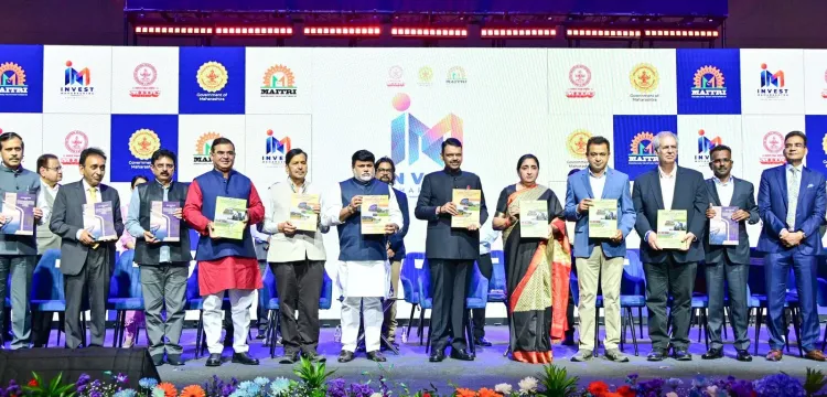
Chief Minister Devendra Fadnavis and Deputy Chief Minister Sunetra Ajit Pawar jointly released the Existing Land Use Report for the Southern Extended Approved Area of the Mumbai Metropolitan Region (MMR) on October 2, 2026 in Mumbai.
An Existing Land Use (ELU) report is the foundational survey mapping current land use across a planning zone — a prerequisite for any formal Development Plan or Regional Plan.
The southern extended approved area covers newly delineated zones on MMR's southern perimeter, a belt of high planning significance due to coastal regulations and infrastructure pressures.
Senior ministers including Urban Development Minister Uday Samant and MP Mangal Prabhat Lodha were tagged in the official announcement, underscoring an inter-departmental push.
The release aligns with Maharashtra's Invest Maharashtra agenda, providing investors and infrastructure agencies with authoritative land-use data for the extended MMR zone.
The ELU publication triggers a planning sequence that could determine land use for thousands of hectares, directly affecting housing supply, industrial corridors, and green buffers across a region of over 21 million people .
Mumbai's next chapter of planned urban growth got a formal foundation on Friday, October 2, 2026, as the Chief Minister's Office of Maharashtra announced the release of a landmark document — the 'Existing Land Use Report of the Southern Extended Approved Area of MMR' — charting the current land-use patterns across a critical expansion zone of the Mumbai Metropolitan Region.
What was released — and why it matters for MMR's growth corridor
Chief Minister Devendra Fadnavis and Deputy Chief Minister Sunetra Ajit Pawar jointly presided over the publication event in Mumbai, signalling the state government's intent to bring structured planning data into the public domain for the southern extended approved area of the MMR. An 'Existing Land Use' (ELU) report is the foundational survey that maps how every parcel of land in a designated planning zone is currently being used — residential, commercial, agricultural, vacant, or otherwise. Without it, no credible development plan, regional master plan, or infrastructure overlay can be drawn.
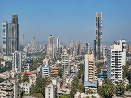
The Mumbai Metropolitan Region is one of India's most densely contested urban geographies, stretching across Mumbai City, Mumbai Suburban, Thane, Raigad, Raigad, Palghar, and adjoining areas. The 'southern extended approved area' refers to newly incorporated or newly delineated zones on the MMR's southern perimeter — precisely the belt where population pressure, coastal development regulations, and infrastructure ambitions converge most sharply.
The political weight behind a planning document
The presence of both the Chief Minister and Deputy Chief Minister at what might appear a technical release is itself a signal. The Mahayuti alliance government — anchored by the BJP, NCP (Ajit Pawar faction), and Shiv Sena (Shinde faction) — has positioned large-scale infrastructure and urban development, including the 'Invest Maharashtra' push visible in the post's hashtag, as a centrepiece of its governance agenda. Formalising land-use data for MMR's extended zones feeds directly into investor confidence: developers, infrastructure agencies, and central-government project proponents all require an authoritative ELU before committing capital.
The official tagging of @MPLodha (MP Mangal Prabhat Lodha, Mumbai's minister with urban affairs oversight), @JaykumarRawal, and @Sawkaresanjay11 along with Urban Development Minister @samant_uday underscores that this was a coordinated institutional act — not a ceremonial photo-op.
What the ELU report unlocks next
An ELU publication typically triggers a defined planning sequence: stakeholder consultations, draft Development Plan preparation, and eventually a notified Regional Plan that carries legal force. For the southern extended zone of MMR, that sequence could determine the fate of thousands of hectares currently in planning limbo — land whose ultimate use will shape housing supply, industrial corridors, and green buffers for a metropolitan region home to over 21 million people. The #InvestMaharashtra framing in the official post leaves little ambiguity about the direction the state intends to nudge that land-use mix.
Maharashtra's urban planning machinery has long been criticised for the gap between approved regional plans and on-ground reality — informal settlements, piecemeal permissions, and outdated survey data routinely undermining master-plan ambitions. An officially published ELU for the southern MMR belt is, in that context, a concrete step toward closing that gap.
The document is now in the public domain; whether the planning decisions it enables match its ambition will be the real test of this government's urban vision.
Point of View
Rather than delegating it to a technical agency, elevates the document's political significance and signals urgency. It also sets a benchmark: future deviations from the ELU's baseline will now be publicly measurable, raising accountability stakes for whatever Development Plan follows. For the 'Invest Maharashtra' brand, credible planning data is as important as incentive packages — and this release serves both.
NationPress
2 Oct 2026
Frequently Asked Questions
What is the Existing Land Use Report for MMR's Southern Extended Approved Area?
It is a foundational planning survey that maps how every parcel of land in the newly designated southern extension zone of the Mumbai Metropolitan Region is currently being used — residential, commercial, agricultural, or vacant — providing the data baseline needed to prepare a formal Development Plan for the area.
Who released the MMR Existing Land Use Report in 2026?
Chief Minister Devendra Fadnavis and Deputy Chief Minister Sunetra Ajit Pawar jointly released the report in Mumbai on October 2, 2026, in an event attended by several senior Maharashtra ministers.
Why does the MMR southern extended approved area need a land use report?
The southern extended approved area is a newly delineated planning zone where population pressure, infrastructure ambitions, and coastal regulations intersect. Without a formal Existing Land Use record, no legally enforceable Development Plan or Regional Plan can be prepared for the zone.
What happens after the Existing Land Use Report is published?
Publication typically triggers a formal planning sequence: stakeholder consultations, preparation of a draft Development Plan, and eventually a notified Regional Plan with legal force — determining land use for housing, industry, and green buffers across the zone.
How is the MMR land use report linked to Invest Maharashtra?
The 'Invest Maharashtra' agenda requires authoritative land-use data so developers, infrastructure agencies, and industrial investors can assess and commit capital to the MMR's extended zones with regulatory clarity. The ELU report directly supports that confidence-building goal.