CM Himanta flags 400% excess rain, flood trail in Upper Assam
Synopsis
Assam Chief Minister Himanta Biswa Sarma has flagged catastrophic flooding in Upper Assam driven by 400% excess upstream rainfall, inundating districts that rarely flood. Three ministers are on the ground as the CM monitors the crisis centrally.
Key Takeaways
400% excess rainfall upstream caused a sudden and severe flood in Upper Assam , according to CM Himanta Biswa Sarma.
The affected districts are ones that 'usually don't flood' , making this an atypical disaster that strains standard preparedness frameworks.
Three ministers from the Assam government have been physically present in the disaster zone since the flooding began.
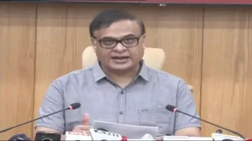
CM Sarma stated he is 'constantly monitoring' the situation, signalling active central coordination from the state government.
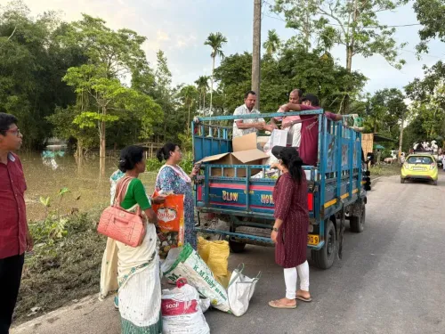
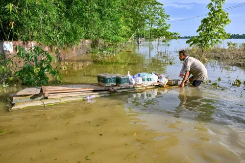
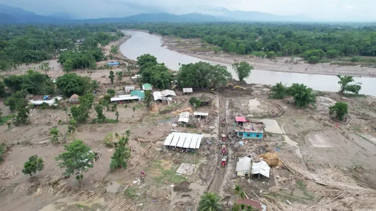
Four images shared with the post document the scale of ground-level inundation and destruction across the region.
A 400% excess in upstream rainfall has sent floodwaters surging into districts of Upper Assam that rarely face inundation — and Assam Chief Minister Himanta Biswa Sarma says the scale of devastation is unlike anything those communities typically brace for. Posting on Monday, 3 August 2026, the Chief Minister described the disaster as a 'trail of devastation' and confirmed that three of his ministerial colleagues have been deployed on the ground since the disaster broke out.
Districts hit that rarely flood
The critical detail in Sarma's account is not just the volume of rain, but where it fell and what it overwhelmed. Upper Assam's geography means that extreme rainfall upstream can translate almost instantly into flash flooding downstream — but the districts now submerged are ones that have historically sat outside Assam's chronic flood belt. That makes emergency response harder: local infrastructure, evacuation protocols, and community preparedness are all calibrated for a different risk profile. A 400% rainfall anomaly — four times the expected measure — is the kind of figure that signals a meteorological outlier, not a seasonal spike.
Three ministers on ground as CM monitors from command
Sarma said he has been 'constantly monitoring the situation' while three colleagues are physically present in the affected areas. The split — political leadership at the coordination level, field ministers embedded in the disaster zone — is a standard crisis-management posture, but the Chief Minister's decision to communicate it publicly signals both accountability and an attempt to reassure residents that the state government is treating this as an emergency, not a routine monsoon event. Assam's State Disaster Management Authority and the National Disaster Response Force (NDRF) are the institutional arms typically activated in such scenarios, though the post does not specify operational details.
Why Upper Assam's flood crisis demands attention
Assam is no stranger to annual flooding — the Brahmaputra river basin makes it one of India's most flood-prone states, with losses to agriculture, livestock, and lives recorded almost every monsoon. But when the disaster strikes districts outside the usual flood corridor, it exposes gaps in preparedness and tests the state's capacity to respond simultaneously across a wider geography. The combination of abnormal upstream rainfall, sudden inundation, and non-flood-zone communities makes this episode particularly consequential for relief logistics and recovery timelines.
The images shared alongside the Chief Minister's post capture the scale of the inundation — submerged roads, waterlogged settlements, and the kind of ground-level destruction that numbers alone cannot fully convey. For the families in Upper Assam who have never had to evacuate before, this flood is not a familiar crisis. It is a first — and that makes it harder to endure.
Point of View
Projecting urgency ahead of what could become a prolonged relief and rehabilitation challenge. For a Chief Minister who has built his identity around assertive governance, managing a disaster in non-traditional flood zones tests exactly the kind of administrative reach that defines his political brand. If recovery is slow or relief gaps emerge in these unfamiliar districts, the very specificity of his public communication today sets a benchmark against which his government will be measured.
NationPress
18 Sept 2026
Frequently Asked Questions
Which districts in Upper Assam are affected by the 2026 floods?
Chief Minister Himanta Biswa Sarma has not named specific districts in his post, but described the affected areas as districts that 'usually don't flood,' indicating the inundation has hit areas outside Assam's traditional flood belt in the Upper Assam region.
What caused the sudden flooding in Upper Assam in August 2026?
According to CM Sarma, a 400% excess in rainfall upstream triggered the sudden deluge, sending far greater volumes of water than normal into downstream districts of Upper Assam.
What is the Assam government doing about the Upper Assam floods?
CM Sarma confirmed he is constantly monitoring the situation, and three of his ministerial colleagues have been deployed on the ground in the affected areas since the disaster began.
Is Upper Assam normally prone to flooding?
While Assam as a whole is one of India's most flood-prone states due to the Brahmaputra river basin, the Chief Minister specifically noted that the districts now affected are ones that 'usually don't flood,' making this an atypical and particularly challenging disaster.
When did CM Himanta post about the Upper Assam floods?
CM Himanta Biswa Sarma posted about the Upper Assam flood situation on Monday, 3 August 2026, sharing four images of the devastation alongside his statement.