Delhi-NCR red alert: IMD warns of heavy rain, 60 km/h winds across all 11 districts
Synopsis
The IMD has thrown a red alert across all 11 districts of Delhi on 12 October, warning of thunderstorms, lightning, and winds up to 60 km/h — one of the widest single-day weather alerts of the season. While Monday's storm brings temporary cool relief, the seven-day outlook returns to dry, partly cloudy conditions, meaning this intense spell is likely a brief but disruptive finale to Delhi's active rain period.
Key Takeaways
The IMD issued a red alert for all 11 districts of Delhi on 12 October 2026 .
Thunderstorms and heavy rain with winds up to 60 km per hour and rainfall intensity exceeding 15 mm per hour were forecast.
All districts — including Central Delhi, North Delhi, South Delhi, Shahdara and others — were placed under the alert.
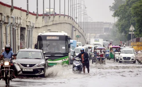
Waterlogging, traffic disruption, and increased road accident risk were flagged as primary concerns.
The seven-day forecast shows partly cloudy, dry conditions returning from 13 October , with maximum temperatures between 32 and 35 degrees Celsius .
Maximum temperatures had already dipped by 1–2 degrees Celsius in the 24 hours preceding the storm.
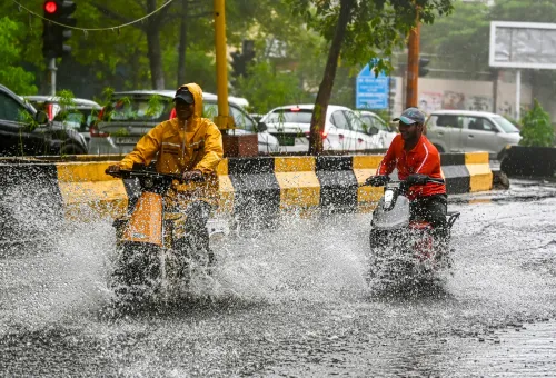
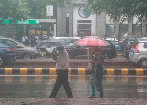
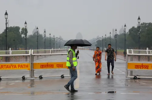
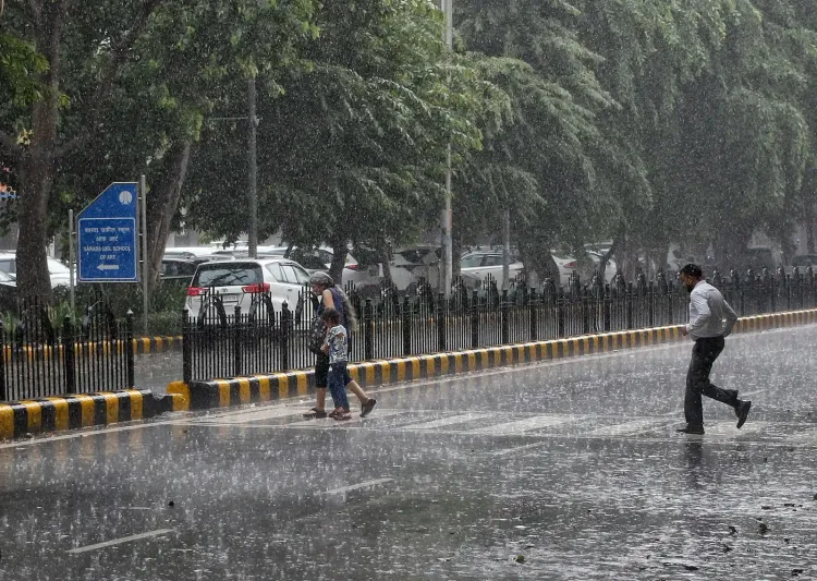
The India Meteorological Department (IMD) issued a red alert for all 11 districts of Delhi on Monday, 12 October, as heavy rainfall and thunderstorms swept across the national capital through the morning hours, triggering waterlogging in several areas and bringing a sharp dip in temperatures. The alert covers every district of Delhi, making it one of the broadest single-day weather warnings issued for the city this season.
Districts Under Red Alert
According to the IMD, the red alert encompasses Central Delhi, East Delhi, New Delhi, North Delhi, North East Delhi, North West Delhi, Shahdara, South Delhi, South East Delhi, South West Delhi, and West Delhi. The weather agency has warned of thunderstorms and intense showers accompanied by winds reaching up to 60 km per hour, as well as lightning and rainfall intensity exceeding 15 mm per hour.
Morning Disruption and Safety Risks
The early morning downpour blanketed the city in thick cloud cover and temporarily broke the prevailing warmth, but also raised immediate safety concerns. The IMD had cautioned ahead of the event that heavy showers could disrupt traffic, cause water accumulation in low-lying zones, and increase the risk of road accidents. Residents and commuters were advised to verify traffic conditions before setting out, adhere to official safety advisories, and steer clear of waterlogging-prone routes during the morning peak.
Notably, maximum temperatures across Delhi had already fallen by approximately one to two degrees Celsius in the preceding 24 hours, with minimums recorded between 21 and 24 degrees Celsius and maximums between 30 and 32 degrees Celsius before Monday's storm.
Seven-Day Forecast: Rain to Ease
Despite Monday's intense spell, the IMD's seven-day outlook suggests the rainfall will not sustain. Partly cloudy skies are expected to dominate from Tuesday onwards, with no significant precipitation forecast for most of the coming week.
On 13 October, temperatures are expected to range between a maximum of 32–34 degrees Celsius and a minimum of 23–25 degrees Celsius. By 14 October, the maximum could nudge up to 33–35 degrees Celsius, with minimums again in the 23–25 degrees band. Temperatures on 15 October are forecast at 31–33 degrees Celsius (maximum) and 23–25 degrees Celsius (minimum). For 16 and 17 October, readings are expected to stabilise at 32–34 degrees Celsius (maximum) and 22–24 degrees Celsius (minimum), with partly cloudy but dry conditions prevailing.
Context and What Residents Should Know
This spell follows a broader pattern of late-monsoon or post-monsoon weather activity that periodically affects Delhi-NCR well into October, often catching urban commuters off guard after a prolonged dry phase. The city's drainage infrastructure in low-lying localities remains vulnerable to even moderate rainfall intensities, making the IMD's early-warning red alert particularly relevant for residents in susceptible areas. Authorities have urged people to remain alert during thunderstorms, especially while travelling, as the combination of strong winds, lightning, and waterlogged roads poses compounding safety risks. The situation is expected to normalise over the course of the week as the weather system moves away.
Point of View
Not sudden high-intensity post-monsoon bursts, which tend to cause disproportionate disruption relative to total rainfall. The broader pattern of late-season weather events intensifying over Delhi-NCR is consistent with documented urban heat island effects accelerating convective activity. Authorities routinely issue advisories, but the gap between warning issuance and on-ground preparedness — particularly in low-lying colonies — remains the city's most persistent weather-governance failure.
NationPress
12 Oct 2026
Frequently Asked Questions
Why did the IMD issue a red alert for Delhi on 12 October 2026?
The IMD issued a red alert because heavy thunderstorms, lightning, and strong winds of up to 60 km per hour were forecast across all 11 districts of Delhi on 12 October 2026. The alert was the highest-level warning, signalling a high probability of intense rainfall exceeding 15 mm per hour and associated safety risks including waterlogging and road accidents.
Which areas of Delhi are under the red alert?
All 11 districts are covered: Central Delhi, East Delhi, New Delhi, North Delhi, North East Delhi, North West Delhi, Shahdara, South Delhi, South East Delhi, South West Delhi, and West Delhi. The blanket alert is one of the broadest single-day weather warnings issued for the capital this season.
What are the safety advisories for Delhi residents during this weather event?
Residents have been advised to check traffic updates before leaving home, follow official IMD and civic authority advisories, and avoid routes prone to waterlogging. People should remain indoors or take extra precautions during thunderstorms, as strong winds, lightning, and waterlogged roads pose significant safety risks.
How long will the heavy rain last in Delhi?
According to the IMD's seven-day forecast, the intense rainfall is not expected to persist beyond Monday. Partly cloudy and largely dry conditions are forecast from 13 October through at least 17 October, with no significant rain anticipated during that period.
What are the temperature forecasts for Delhi this week?
Maximum temperatures are forecast to range between 32 and 35 degrees Celsius from 13 to 17 October, while minimum temperatures will likely stay between 22 and 25 degrees Celsius. The weather is expected to remain partly cloudy but dry for most of the week following Monday's storm.