CM Himanta unveils Mission Basundhara 4, Assam's biggest land overhaul
Synopsis
Assam Chief Minister Himanta Biswa Sarma announced Mission Basundhara 4 on 31 July 2026, anchored by three projects — JORIP, ASOM, and MATI — promising the state's first systematic land resurvey since the 1960s, covering 18,000 villages with GNSS technology and 100% digitization of land records.
Key Takeaways
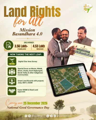
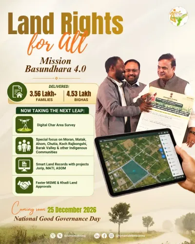
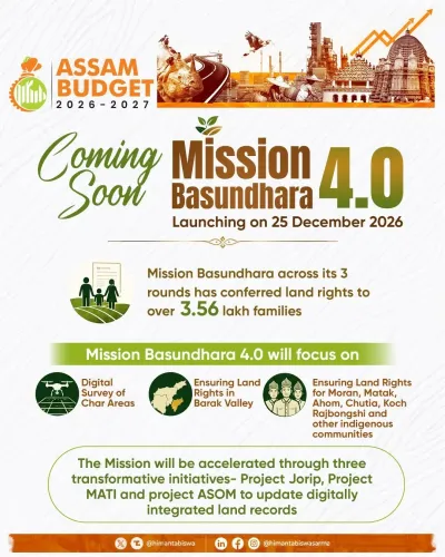
Mission Basundhara 4 is scheduled for launch on 25 December 2026 , announced by Assam CM Himanta Biswa Sarma on 31 July 2026.
The mission rests on three projects: Project JORIP , Project ASOM , and Project MATI .
Assam will conduct its first systematic land resurvey since the 1960s , covering 18,000 villages over four years using GNSS technology .
The plan includes 100% digitization of land records and a GIS-based scientific valuation system .
The reform is framed around the state government's Jati, Mati, Bheti (identity, land, homeland) agenda, linking land security to indigenous community rights.
Mission Basundhara was first launched in 2021-22 ; this fourth phase is the most expansive in scope.
Sixty years of outdated land surveys, millions of families whose official records don't match the ground beneath their feet — Assam Chief Minister Himanta Biswa Sarma says he has a plan to fix all of it. On 31 July 2026, the Chief Minister announced Mission Basundhara 4, slated for launch on 25 December 2026, framing it as the most ambitious land administration overhaul the state has seen since independence.
Three projects, one backbone: JORIP, ASOM and MATI
Sarma revealed that Mission Basundhara 4 will be built on three distinct missions — Project JORIP, Project ASOM, and Project MATI — following a detailed review with senior officials. Together, they are designed to address what the Chief Minister described as a systemic gap between official land records and ground realities that has persisted for decades. The announcement ties the reform explicitly to the state government's cultural-political framework of protecting 'Jati, Mati aur Bheti' — identity, land, and homeland — a phrase that carries deep resonance in Assam's public discourse around land rights and indigenous community security.
Assam's first land resurvey since the 1960s
The centrepiece of the mission is a systematic land resurvey — the state's first since the 1960s — covering 18,000 villages over four years using modern GNSS (Global Navigation Satellite System) technology. The scale is significant: Assam's land records have long been plagued by discrepancies between what revenue documents say and what exists on the ground, fuelling disputes that disproportionately affect rural families with no resources to navigate bureaucratic labyrinths. GNSS-based surveys, increasingly adopted in states facing similar record-reality mismatches, offer centimetre-level precision that manual surveys from six decades ago simply could not deliver.
Alongside the resurvey, the mission promises 100% digitization of land records, a GIS-based scientific valuation system to replace the patchwork of circle rates that currently govern property transactions, and simplified, citizen-first registration services. The goal, as Sarma stated, is to make land transactions 'transparent, fast and trustworthy for every family in Assam.'
Mission Basundhara's evolution from 2021 to 4.0
Mission Basundhara was first launched in 2021-22 under Sarma's government to clear a backlog of land mutations and begin the digitization of records — a process that had stalled under successive administrations. Each subsequent phase has built on that foundation, situating Assam within the broader national Digital India Land Records Modernization Programme framework. The fourth edition, however, is notably more ambitious in scope: the resurvey alone would touch nearly every revenue village in the state, a logistical undertaking that will require sustained legislative and budgetary commitment from the Assam Assembly.
The Northeast's land politics carry stakes that go well beyond administrative efficiency. In a region where land ownership is intertwined with questions of citizenship, demographic change, and tribal identity, a credible, technology-backed land record system has the potential to reduce litigation, curb encroachment disputes, and provide indigenous communities with legally defensible documentation of their holdings.
Whether the 25 December launch date holds — and whether the four-year village coverage target is matched by the resources to execute it — will be the real test. The architecture is ambitious. The clock is now running.
Point of View
Moving from mutation clearance and partial digitization to a full-state resurvey — a politically loaded undertaking in a region where land records intersect directly with citizenship and identity disputes. By anchoring the reform in the 'Jati, Mati, Bheti' framework, Sarma is simultaneously pursuing administrative modernization and consolidating a political narrative around indigenous land protection that has defined his tenure. The GNSS and GIS components align Assam with a broader national push for technology-driven land governance, but the Northeast's unique demographic sensitivities mean the stakes here are higher than in most other states. Execution — particularly the four-year village coverage target and the legislative backing it requires — will determine whether this becomes a landmark reform or a well-announced aspiration.
NationPress
15 Sept 2026
Frequently Asked Questions
What is Mission Basundhara 4 in Assam?
Mission Basundhara 4 is the fourth phase of Assam's land records modernization programme, announced by Chief Minister Himanta Biswa Sarma and scheduled for launch on 25 December 2026. It includes Assam's first systematic land resurvey since the 1960s, covering 18,000 villages using GNSS technology, 100% digitization of land records, and a GIS-based valuation system.
What are Project JORIP, Project ASOM and Project MATI?
JORIP, ASOM, and MATI are three sub-missions announced by CM Himanta Biswa Sarma as the backbone of Mission Basundhara 4. Specific operational details of each project have not yet been made fully public.
When was Mission Basundhara first launched in Assam?
Mission Basundhara was first launched in 2021-22 under Chief Minister Himanta Biswa Sarma's government to clear a backlog of land mutations and begin digitization of land records in Assam.
Why is Assam conducting a new land survey after the 1960s?
Assam's last comprehensive land survey was conducted in the 1960s. Decades of population growth, encroachment, and administrative gaps have created widespread discrepancies between official records and ground realities, fuelling land disputes across the state.
What is GNSS technology and how will it be used in Assam's land survey?
GNSS, or Global Navigation Satellite System, is a satellite-based positioning technology that enables highly precise geographic measurements. Assam plans to use it to resurvey 18,000 villages over four years, ensuring land boundaries in official records accurately match physical ground conditions.