IMD warns of heavy rain, storms in Odisha for 3 days from July 21

Synopsis
Odisha is bracing for three days of heavy rain, lightning, and gusty winds after IMD Bhubaneswar issued a yellow warning for Sundargarh, Kendujhar, and Mayurbhanj. With Dhenkanal already recording 119.6 mm in 24 hours and roads washed out across coastal districts, the active low-pressure system shows no sign of easing — and farmers are already counting crop losses.
Key Takeaways
IMD Bhubaneswar on 20 July forecast widespread rain, thunderstorms, and gusty winds across Odisha for the next three days .
Dhenkanal district recorded the highest rainfall of 119.6 mm in the preceding 24 hours .
A yellow warning has been issued for Sundargarh , Kendujhar , and Mayurbhanj on 21 July .
Gusty winds of 30–40 kmph are expected alongside isolated heavy spells over the next 48 hours .
Waterlogging, road washouts, and crop damage have already been reported in Dhenkanal , Cuttack , and coastal districts.
Fishermen have been advised to track weather updates before going to sea; residents in low-lying areas urged to stay alert.
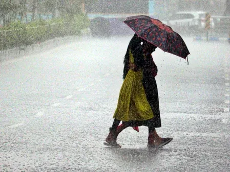
The India Meteorological Department (IMD), Bhubaneswar, on Monday, 20 July forecast widespread rainfall, thunderstorms, lightning, and gusty winds across Odisha over the next three days, with isolated heavy spells expected in multiple districts. The warning comes as the state already grapples with waterlogging, crop damage, and severed road connectivity following continuous rainfall over the past 24 hours.
Current Rainfall Situation
Scattered to fairly widespread rainfall was recorded across Odisha in the 24 hours preceding the forecast, with Dhenkanal district logging the highest single-station rainfall of 119.6 mm. Low-lying areas in Dhenkanal, Cuttack, and other coastal districts are already experiencing waterlogging, according to reports. River breaches have washed away roads in several central and coastal districts, cutting off connectivity to multiple villages.
IMD Alert and Yellow Warning
IMD Bhubaneswar Director Manorama Mohanty said light to moderate rain or thundershowers are very likely at many places across several districts during the next 24 hours. Isolated locations may also experience heavy rainfall accompanied by thunderstorms, lightning, and gusty surface winds reaching 30–40 kmph.
The weather agency has issued a yellow warning for Sundargarh, Kendujhar, and Mayurbhanj districts on 21 July, predicting heavy rainfall at one or two places in each. Heavy rainfall is expected to continue across coastal as well as interior districts over the subsequent 48 hours, with thunderstorms and gusty winds persisting through the period.
Impact on Agriculture and Connectivity
The relentless rainfall, driven by a low-pressure system, has caused severe distress to farmers across the state. Vegetable crops and other standing crops have been damaged in many parts of Odisha, compounding agrarian stress at a critical stage of the kharif season. Road connectivity to several villages in central and coastal districts remains disrupted after roads were washed away following river breaches.
Notably, Dhenkanal — which recorded the highest rainfall — is among the districts facing the worst waterlogging, with low-lying residential and agricultural areas submerged.
Advisories for Residents and Fishermen
The IMD has advised residents, particularly those in vulnerable and low-lying areas, to remain alert and take necessary precautions during thunderstorms and heavy rainfall episodes. Fishermen have been specifically cautioned to monitor the latest weather updates before venturing into the sea. The weather office stated it is closely tracking the evolving weather system and will issue further updates as conditions develop.
With the low-pressure system still active, authorities across Odisha are expected to remain on heightened alert through the coming days.
Point of View
Kendujhar, and Mayurbhanj is the floor, not the ceiling — if the low-pressure system intensifies, those districts could escalate quickly. What is missing from official communication is any concrete district-level evacuation or relief pre-positioning signal, which is precisely what vulnerable coastal communities need before the next 48-hour window closes.
NationPress
20 Oct 2026
Frequently Asked Questions
What has IMD forecast for Odisha from 21 July?
IMD Bhubaneswar has forecast widespread rainfall, thunderstorms, lightning, and gusty winds across Odisha for three days starting 21 July. Isolated heavy spells and surface winds of 30–40 kmph are expected in multiple districts.
Which districts are under yellow warning in Odisha?
IMD has issued a yellow warning for Sundargarh, Kendujhar, and Mayurbhanj districts on 21 July, predicting heavy rainfall at one or two places in each of these districts.
Which district recorded the highest rainfall in Odisha recently?
Dhenkanal district recorded the highest rainfall of 119.6 mm in the 24 hours preceding the 20 July forecast. The district is also experiencing waterlogging in low-lying areas as a result.
What is causing the heavy rainfall in Odisha?
Continuous rainfall in Odisha is occurring under the influence of an active low-pressure system. The system has led to waterlogging, river breaches, road washouts, and crop damage across central and coastal districts.
What precautions has IMD advised for Odisha residents?
IMD has advised people in vulnerable and low-lying areas to remain alert and take precautions during thunderstorms and heavy rain. Fishermen have been specifically cautioned to monitor the latest weather updates before venturing into the sea.