IMD red alert: Bay of Bengal depression to cross Odisha coast by July 27

Synopsis
A Bay of Bengal depression is barrelling toward the Odisha–West Bengal coast, with the IMD warning of extremely heavy rainfall in at least nine districts and a likely landfall near Paradip by the forenoon of 27 July 2026. Families are already stranded and crops damaged — and the system is still intensifying.
Key Takeaways
The IMD issued a red alert for several Odisha districts on Sunday, 26 July 2026 as a Bay of Bengal low-pressure area intensified into a depression .
The system was centred 170 km east of Chandbali and 180 km east-southeast of Balasore at 8:30 am IST .
Landfall is forecast between Paradip and Sagar Island around the forenoon/noon of 27 July 2026 .
Districts including Jajpur , Kendrapada , Jagatsinghapur , Kataka , Anugola , and Dhenkanal face extremely heavy rainfall warnings.
Families in low-lying areas have reportedly been stranded; crops have been damaged across the state.
The Indian Meteorological Department (IMD) on Sunday, 27 July 2026, issued a red alert for several districts of Odisha after a well-marked low-pressure area over the northwest Bay of Bengal intensified into a depression, triggering heavy to extremely heavy rainfall across the state. The system is forecast to cross the north Odisha and West Bengal coasts between Paradip and Sagar Island around the forenoon or noon of 27 July 2026.
Where the System Stands
As of 8:30 am IST on Sunday, the depression was centred over the northwest Bay of Bengal, approximately 170 km east of Chandbali and 180 km east-southeast of Balasore in Odisha. The IMD said the system is very likely to move northwestwards and intensify further into a deep depression within the next 24 hours before making landfall.
Districts Under Red Alert
The IMD has flagged Jajpur, Kendrapada, Jagatsinghapur, Kataka, Anugola, and Dhenkanal as likely to experience extremely heavy rainfall at one or two places until Monday morning. Districts of Sundargarh, Kendujhar, and Mayurbhanj have been warned of very heavy to extremely heavy rainfall over the next 48 hours. Several other districts face very heavy rainfall warnings for the next five to seven days.
Flooding, Waterlogging and Crop Damage
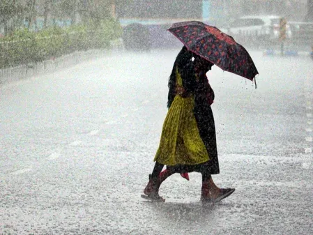
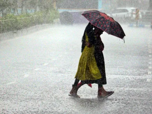
The IMD cautioned that heavy rainfall is likely to cause localised road flooding, waterlogging in low-lying areas, and temporary closure of underpasses, particularly in urban zones. Multiple families residing in low-lying parts of the state have reportedly been stranded due to the incessant rain triggered by the system over the past couple of days. The continuous downpour has also damaged crops, causing considerable distress to farmers across Odisha.
What Comes Next
The system's expected landfall near the Paradip–Sagar Island stretch places densely populated coastal belts of both Odisha and West Bengal in the direct path of the intensifying weather. Authorities are expected to remain on high alert as the depression strengthens. This comes amid the peak of the 2026 southwest monsoon season, when Bay of Bengal systems have historically caused the most severe flooding in eastern India. Residents in low-lying and riverine areas have been urged to stay vigilant and heed official advisories.
Point of View
And the coastal infrastructure remains vulnerable. The crop damage already reported before landfall suggests the human cost will extend well beyond the storm's passage. What matters now is whether evacuation and relief pre-positioning moves faster than the system does.
NationPress
25 Oct 2026
Frequently Asked Questions
What is the current status of the Bay of Bengal depression affecting Odisha?
As of Sunday, 26 July 2026, the low-pressure area over the northwest Bay of Bengal has intensified into a depression, centred about 170 km east of Chandbali and 180 km east-southeast of Balasore. It is expected to deepen into a deep depression within 24 hours and make landfall near Paradip by the forenoon of 27 July 2026.
Which Odisha districts are under red alert?
The IMD has placed Jajpur, Kendrapada, Jagatsinghapur, Kataka, Anugola, and Dhenkanal under red alert for extremely heavy rainfall until Monday morning. Sundargarh, Kendujhar, and Mayurbhanj face very heavy to extremely heavy rain warnings for the next 48 hours.
Where is the depression expected to make landfall?
The IMD predicts the system will cross the north Odisha and West Bengal coasts between Paradip and Sagar Island around the forenoon or noon of 27 July 2026, after intensifying into a deep depression.
What impact has the rainfall already caused in Odisha?
Several families in low-lying areas of Odisha have reportedly been stranded due to continuous rain over the past couple of days. Crops have also been damaged, causing significant distress to farmers across the state.
What hazards has the IMD warned about?
The IMD has warned of localised road flooding, waterlogging in low-lying areas, and temporary closure of underpasses — especially in urban areas — as well as potential flooding in some river basins across Odisha.