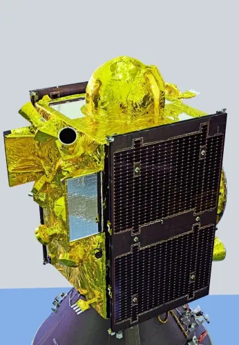
ISRO's NVS-03 launch strengthens NavIC navigation system, third satellite up
Synopsis
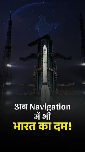
ISRO's NVS-03 launch is not just another satellite milestone — it is the third piece of a five-part strategic puzzle. When complete, the NVS series will give India a fully indigenous next-generation navigation system capable of covering the subcontinent and 1,500 km beyond its borders, reducing critical dependence on foreign GPS networks for both civilian and defence applications.
Key Takeaways
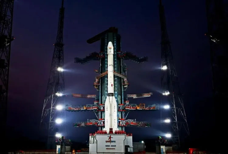
ISRO launched NVS-03 aboard GSLV-F18 from Sriharikota , placing it into a Geosynchronous Transfer Orbit (GTO) .
The satellite will be manoeuvred to a geosynchronous slot at 111.75 degrees East following orbit-raising manoeuvres.
NVS-03 is the third of five next-generation NavIC satellites ; NVS-04 and NVS-05 are yet to be launched.
NavIC covers India's landmass and approximately 1,500 km beyond its borders, serving both civilian and strategic users.
NavIC signals are interoperable with GPS , Glonass , Galileo , and BeiDou , broadening device compatibility.
The NVS series supports India's Atmanirbhar Bharat goal of reducing dependence on foreign satellite navigation systems.
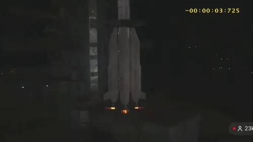
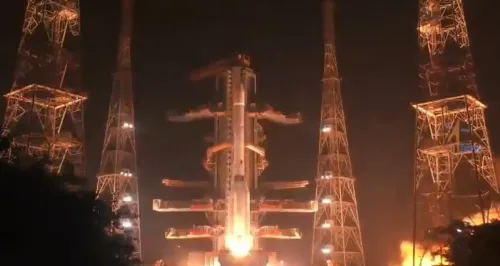
The Indian Space Research Organisation (ISRO) has successfully launched NVS-03, the third next-generation navigation satellite, aboard the GSLV-F18 rocket from the Satish Dhawan Space Centre (SDSC) in Sriharikota, marking a significant advance in India's indigenous satellite-based navigation capabilities under the Navigation with Indian Constellation (NavIC) programme.
The launch vehicle placed NVS-03 into a precise Geosynchronous Transfer Orbit (GTO). Following a first orbit manoeuvre completed on 31 October, further manoeuvres are planned to position the satellite in its designated geosynchronous orbital slot at 111.75 degrees East.
Where NVS-03 Fits in the NavIC Constellation
NVS-03 is the third satellite in a series of five next-generation NavIC satellites, designed to strengthen the coverage, accuracy, and reliability of India's regional navigation system. NVS-01 and NVS-02 have already been launched, while NVS-04 and NVS-05 remain in the pipeline. ISRO is progressively augmenting the NavIC constellation to ensure uninterrupted indigenous navigation services.
What NavIC Offers and Who It Serves
NavIC covers the entire Indian landmass and a region extending approximately 1,500 km beyond India's geopolitical boundary. It provides two distinct navigation services: an open service accessible to civilian users and an encrypted service available exclusively to authorised strategic users.
NavIC's Standard Positioning Service (SPS) signals are designed to be interoperable with other global navigation satellite systems, including GPS (United States), Glonass (Russia), Galileo (European Union), and BeiDou (China). This interoperability expands NavIC's practical utility across consumer devices, aircraft, and maritime platforms.
Applications Driving the Push for Better Navigation
Satellite navigation systems support a wide range of critical applications — from route navigation and aircraft tracking to precision agriculture, disaster management, and telecommunications infrastructure. As India's digital economy and defence requirements expand, a robust indigenous navigation system reduces exposure to potential denial or degradation of foreign-controlled signals.
Notably, this constellation upgrade directly supports India's Atmanirbhar Bharat ambitions in advanced space technology. Historically, India's dependence on US-operated GPS for everything from agriculture advisory apps to missile guidance has been a strategic vulnerability — one that ISRO is methodically addressing through successive NVS launches.
Strategic Significance and What Comes Next
The successful deployment of three NVS satellites in quick succession underscores ISRO's growing capability to design, develop, and operate strategic space infrastructure at scale. With NVS-04 and NVS-05 yet to launch, the full next-generation NavIC constellation will only be complete once all five are operational.
Once the complete NVS series is in place, India will have a fully indigenous, next-generation positioning, navigation, and timing (PNT) infrastructure — a milestone with both civilian and strategic consequences. ISRO's upcoming launch schedule will be closely watched for the timelines of the remaining two satellites.
Point of View
As India's 1999 Kargil experience starkly demonstrated. The speed of the NVS rollout — three satellites in relatively quick succession — signals that ISRO has resolved earlier propulsion and payload reliability issues that delayed the original NavIC constellation. The real test will be whether device manufacturers, particularly in the agriculture and logistics sectors, are incentivised to integrate NavIC receivers at scale, which is where policy intervention, not just orbital success, is required.
NationPress
1 Nov 2026
Frequently Asked Questions
What is the NVS-03 satellite and what is its purpose?
NVS-03 is the third next-generation navigation satellite in ISRO's NVS series, launched to strengthen India's NavIC satellite navigation system. It is designed to improve the coverage, accuracy, and reliability of India's indigenous regional navigation services for both civilian and strategic users.
What is NavIC and how does it compare to GPS?
NavIC, or Navigation with Indian Constellation, is India's own satellite navigation system, covering the Indian landmass and a region extending approximately 1,500 km beyond India's borders. Unlike GPS, which is operated by the United States, NavIC is indigenously controlled; its civilian signals are interoperable with GPS, Glonass, Galileo, and BeiDou.
How many NVS satellites have been launched so far?
Three NVS satellites — NVS-01, NVS-02, and NVS-03 — have been launched to date. Two more, NVS-04 and NVS-05, are still in the pipeline, and the full five-satellite next-generation constellation will only be complete once all are operational.
Where will NVS-03 be positioned in orbit?
NVS-03 was first placed into a Geosynchronous Transfer Orbit (GTO) by GSLV-F18. Following a first orbit manoeuvre completed on 31 October, further manoeuvres are planned to place it in its designated geosynchronous orbital slot at 111.75 degrees East.
Why does India need its own navigation satellite system?
India's dependence on foreign-operated navigation systems like GPS creates strategic vulnerability, particularly for defence and critical infrastructure applications. An indigenous NavIC system ensures India can independently provide positioning, navigation, and timing services and reduces exposure to potential denial or degradation of foreign-controlled signals.