Khattar meets Google Maps team on urban mobility, last-mile connect
Synopsis
Union Minister Manohar Lal Khattar met Google Maps team at Sankalp Bhawan on 26 June 2026 to deliberate on digital mapping, urban traffic management, and last-mile connectivity solutions. The talks align with India's Smart Cities Mission and AMRUT 2.0, signalling deeper integration of private tech platforms into urban governance.
Key Takeaways
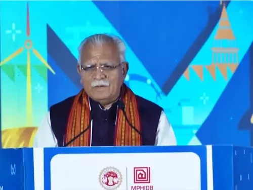
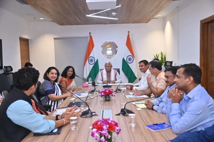
Manohar Lal Khattar , Union Minister of Housing and Urban Affairs, met the Google Maps (Google India) team at Sankalp Bhawan on 26 June 2026 .
Discussions centred on urban traffic management, last-mile connectivity, and data-driven urban planning.
The engagement aligns with the Smart Cities Mission (2015), which targets 100 cities for technology-enabled urban solutions.
AMRUT 2.0 (2021) provides additional policy backing for technology integration in urban mobility and last-mile infrastructure.
Key stakeholders include urban commuters and municipal bodies who could benefit from improved real-time mapping and traffic data.
A formal MoU or pilot roll-out in selected Smart Cities would be the next concrete step to watch.
Union Minister of Housing and Urban Affairs Manohar Lal Khattar held a detailed discussion with a team from Google Maps (Google India) at Sankalp Bhawan, New Delhi, on Friday, 26 June 2026, focusing on leveraging digital mapping and data-driven solutions to strengthen urban traffic management and last-mile connectivity.
Khattar posted on X, tagging @GoogleIndia, that the meeting involved 'विस्तृत एवं सार्थक विचार विमर्श' ('detailed and meaningful deliberations') on making urban planning more effective through technology and innovation. He added that such collaborations would play an important role in developing a safer, smoother, and more accessible urban transport system for citizens.
Context
The meeting at Sankalp Bhawan — the headquarters of the Ministry of Housing and Urban Affairs — brought together ministry officials and the Google Maps team to explore how digital mapping and real-time data can be integrated into India's urban governance framework. The discussion covered three broad areas: urban traffic management, last-mile connectivity, and data-based urban planning.
Last-mile connectivity — the final leg of a commuter's journey from a transit hub to their destination — remains a persistent challenge in Indian cities, particularly in tier-2 and tier-3 urban centres where formal public transport networks are thin.
Policy Backdrop
The engagement sits squarely within the policy architecture the Government of India has built since 2015. The Smart Cities Mission, launched that year, earmarked 100 cities for technology-enabled solutions spanning intelligent traffic management, e-governance, and spatial planning. The mission has consistently identified digital mapping as a core enabler.
Alongside it, the AMRUT Mission — upgraded to AMRUT 2.0 in 2021 — explicitly supports technology integration for urban mobility and last-mile infrastructure. Both schemes provide the institutional scaffolding within which a Google Maps partnership would operate. The broader Digital India programme has further normalised the integration of private technology platforms into public urban governance.
Since 2014, successive policy documents have emphasised real-time data and digital mapping for traffic, transit, and spatial planning across Indian cities, making this meeting a continuation of a well-established government thrust rather than a new departure.
Stakeholders and Impact
Urban commuters across India's cities stand to be the primary beneficiaries if the discussions translate into on-ground deployments. Improved traffic management systems informed by Google Maps data could reduce congestion, cut commute times, and improve road safety.
Municipal bodies and urban local bodies would gain access to granular, real-time spatial data that can inform infrastructure investment decisions — from signal timing to bus-route planning. For Google India, deeper integration with government urban platforms would expand its data footprint and strengthen its position in the public-sector technology market.
What's Next
Observers will watch for any formal Memorandum of Understanding (MoU) or data-sharing framework announced by the Ministry of Housing and Urban Affairs following this discussion. Pilot roll-outs of Google Maps-based traffic modules in selected Smart Cities would be the clearest indicator that the meeting has moved beyond intent to implementation.
As India's urban population continues to grow, the pressure on city administrations to deliver efficient, technology-backed transport solutions will only intensify — making the ministry's engagement with platforms like Google Maps a space worth watching in the months ahead.
Point of View
Such visible tech-sector engagements also carry political value, projecting a modernising, innovation-friendly image ahead of continued urban expansion. The real test will be whether these deliberations produce binding data-sharing agreements and measurable on-ground pilots, or remain at the level of high-profile optics.
NationPress
26 Jun 2026
Frequently Asked Questions
What did Manohar Lal Khattar discuss with Google Maps?
Khattar met the Google Maps team at Sankalp Bhawan on 26 June 2026 to discuss urban traffic management, last-mile connectivity, and using digital mapping and data-driven solutions to make urban planning more effective.
Where is Sankalp Bhawan located?
Sankalp Bhawan is the headquarters of the Ministry of Housing and Urban Affairs, located in New Delhi.
How does this meeting relate to the Smart Cities Mission?
The Smart Cities Mission, launched in 2015 to develop 100 cities with technology-enabled solutions, specifically identifies intelligent traffic management and digital mapping as core priorities — the same areas discussed in the Khattar-Google Maps meeting.
What is last-mile connectivity in urban transport?
Last-mile connectivity refers to the final leg of a commuter's journey from a transit hub such as a metro station or bus terminal to their home or destination, which remains a significant gap in many Indian cities.
Will there be a formal agreement between Google India and the Housing Ministry?
No formal MoU or data-sharing agreement has been announced yet. Observers are watching for any pilot roll-outs of Google Maps-based traffic modules in selected Smart Cities as a follow-up to the 26 June discussions.