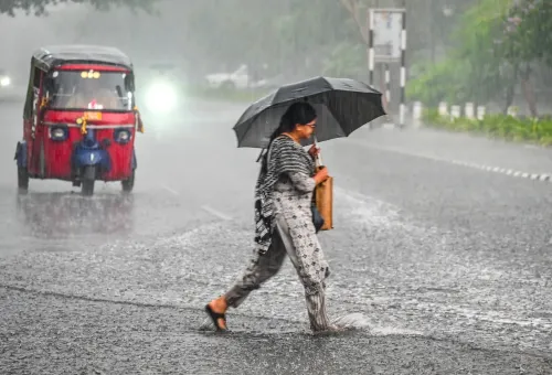
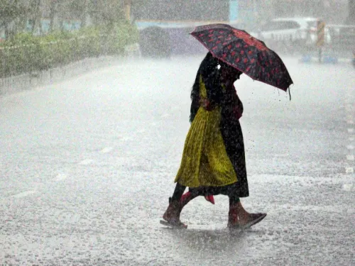
Odisha rules out cyclone threat, heavy rain from Sep 23 as Bay depression deepens

Synopsis
Odisha has dodged a cyclone — but not the rain. A deepening Bay of Bengal depression is on course to hit the north Andhra Pradesh–south Odisha coast by 23 September, with southern districts like Ganjam and Gajapati bracing for extremely heavy rainfall. Eleven district collectors are on high alert, ODRAF teams are deployed, and the state has even mapped out expectant mothers needing pre-emptive evacuation.
Key Takeaways
Odisha Chief Secretary Anu Garg confirmed on 21 September 2026 that the state faces no cyclone threat, but heavy to very heavy rainfall is expected from Tuesday, 22 September .
The Bay of Bengal system is forecast to intensify into a deep depression on 22 September and reach the north Andhra Pradesh–south Odisha coast by the morning of 23 September .
Peak impact is expected on 23 and 24 September ; districts including Ganjam , Gajapati , and Kandhamal face warnings of extremely heavy rainfall .
Collectors of 11 districts have been placed on high alert with instructions to activate control rooms, stock relief centres, and deploy nodal officers.
ODRAF teams are on standby; fishermen advised not to venture into the sea from 22 to 24 September .
The Health Department has been asked to ensure availability of anti-snake venom and other medical supplies at the district level.
Odisha Chief Secretary Anu Garg on Monday, 21 September 2026, ruled out any cyclone threat to the state, clarifying that the India Meteorological Department (IMD) has forecast heavy to very heavy rainfall under the influence of a deepening depression in the Bay of Bengal. The system is expected to reach the north Andhra Pradesh–south Odisha coast by the morning of 23 September, with peak impact on 23 and 24 September.
What the IMD Has Forecast
IMD Bhubaneswar Director Manorama Mohanty said the current Bay of Bengal system is likely to intensify into a deep depression on Tuesday, 22 September, and track toward the north Andhra Pradesh–south Odisha coast. The heaviest impact is expected over two days — 23 and 24 September — after which rainfall activity is forecast to reduce substantially.
Southern Odisha districts, particularly Ganjam, Gajapati, and Kandhamal, have received warnings for extremely heavy rainfall in the coming days — a tier above the general heavy-to-very-heavy alerts issued for several other districts across the state. Fishermen have been advised to return to shore by the evening of 21 September and to avoid venturing into the sea from 22 to 24 September.
Government Preparedness Measures
Chief Secretary Garg chaired a virtual review meeting with collectors of 11 districts identified as likely to be affected. Collectors have been directed to remain on high alert, stay at their headquarters, and keep flood and relief centres operational with adequate stocks of essential materials. Control rooms are to be activated and nodal officers deployed across vulnerable locations.
The Odisha Disaster Rapid Action Force (ODRAF) has been put on standby, with teams instructed to identify vulnerable zones — including waterlogging-prone areas and bridges at risk of submersion. In a notable precautionary step, collectors have also been asked to identify expectant mothers with delivery dates falling within the impact window and make advance arrangements to shift them to safer locations.
Health and Medical Readiness
The state Health Department has been directed to coordinate with Chief District Medical and Public Health Officers (CDMOs) to ensure full medical preparedness. This includes ensuring adequate availability of anti-snake venom and other essential supplies — a standard but critical measure during Odisha's monsoon flooding, when snakebite incidence spikes in inundated rural areas.
Context and What to Watch
Odisha has historically been one of India's most cyclone- and flood-exposed states, and its disaster management framework — often cited as a national model — is now being stress-tested ahead of a potentially intense weather event. This comes amid an active late-monsoon period over the Bay of Bengal, which has seen multiple low-pressure systems in quick succession this season.
The Chief Secretary's clarification distinguishing a deep depression from a cyclone carries practical significance: while a deep depression can cause severe flooding and disruption, it does not carry the destructive wind speeds of a cyclonic storm, allowing authorities to calibrate evacuation and shelter protocols accordingly. All eyes will now be on how the system tracks over the next 48 hours as it approaches the coast.
Point of View
But the operational risk is that the public and lower administrative tiers may underestimate a system that can still deliver catastrophic flooding. Odisha's southern coastal belt — Ganjam, Gajapati, Kandhamal — has seen deadly inundation from non-cyclonic systems before, and the 'extremely heavy' tag on those districts deserves as much public attention as a cyclone warning would get. The real test of Odisha's celebrated disaster management machinery is not just pre-positioning ODRAF teams but ensuring last-mile communication reaches fishermen, pregnant women in remote villages, and communities near flood-prone bridges — groups where the gap between state preparedness and ground reality has historically been widest.
NationPress
21 Sept 2026
Frequently Asked Questions
Is there a cyclone threat to Odisha from the Bay of Bengal system?
No. Odisha Chief Secretary Anu Garg confirmed on 21 September that the IMD has forecast a deep depression, not a cyclone. The system will bring heavy to extremely heavy rainfall but is not expected to develop into a full cyclonic storm.
When will the Bay of Bengal depression reach the Odisha coast?
IMD Bhubaneswar Director Manorama Mohanty said the system is expected to reach near the north Andhra Pradesh–south Odisha coast by the morning of 23 September. Peak impact is forecast on 23 and 24 September, after which rainfall will reduce substantially.
Which Odisha districts face the highest rainfall risk?
Southern Odisha districts — Ganjam, Gajapati, and Kandhamal — have received warnings for extremely heavy rainfall, a higher category than the heavy-to-very-heavy alerts issued for other districts. A total of 11 districts have been flagged for heightened preparedness.
What precautionary steps has the Odisha government taken?
Collectors of 11 at-risk districts have been directed to stay at their headquarters, activate control rooms, stock flood and relief centres, and deploy ODRAF teams at vulnerable locations. The Health Department is ensuring medical supplies including anti-snake venom are available, and arrangements are being made to shift expectant mothers to safer locations before the system makes landfall.
Are fishermen in Odisha safe to go to sea?
No. Fishermen have been advised to return to the coast by the evening of 21 September and to avoid venturing into the sea from 22 to 24 September, covering the period of the system's expected approach and peak impact.