Rain alert in Bengal: Red warning for north, orange for 6 south districts

Synopsis
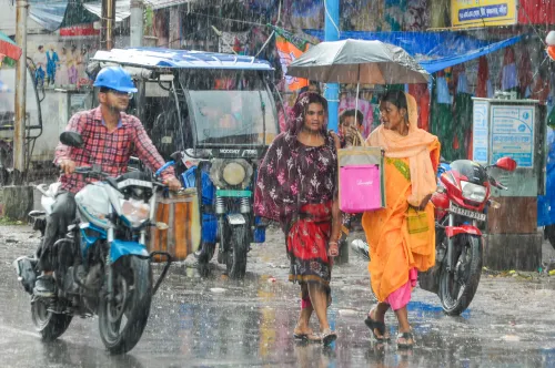
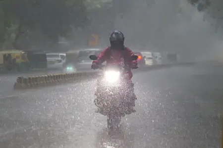
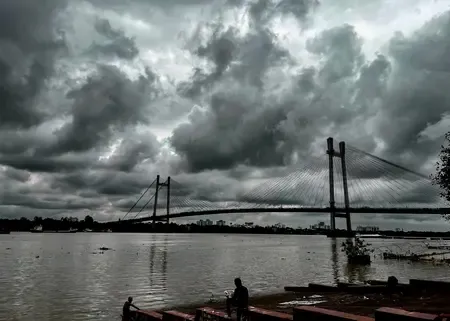
Bengal is bracing for a double-barrelled monsoon assault: a red alert for the north Bengal hills — where rainfall could hit 200 mm and trigger landslides — runs until Monday, while six south Bengal districts face an orange alert from Tuesday. A monsoon axis stretching from Rajasthan to Bihar is funnelling Bay of Bengal moisture into the state, making this one of the more intense multi-district alert events of the 2025 monsoon season.
Key Takeaways
RMC Kolkata issued a red alert for north Bengal valid until Monday, 30 June .
An orange alert is in force for Purulia, Bankura, West Midnapore, West Burdwan, Birbhum , and Murshidabad from Tuesday to Friday .
Darjeeling, Kalimpong, Cooch Behar, Jalpaiguri , and Alipurduar may receive up to 200 mm of rain.
Landslide risk flagged for Darjeeling and Kalimpong hill areas; low-lying zones face flooding .
Hill river water levels may rise above danger marks , according to the MET office.
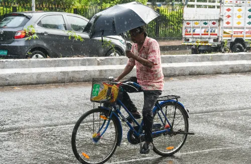
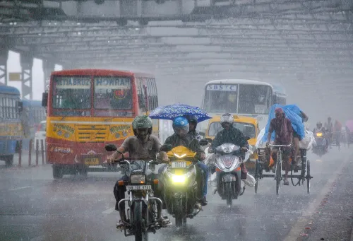
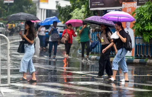
Kolkata faces heavy rain on Tuesday and Wednesday , with light to moderate showers on Sunday and Monday.
The Regional Meteorological Centre (RMC) in Kolkata's Alipore on Sunday, 28 June issued an orange alert for heavy rain across six south Bengal districts from Tuesday to Friday, while a red alert remains in force for north Bengal until Monday. The warnings follow a surge in moisture from the Bay of Bengal driven by an active monsoon system stretching across northern India.
Alert Levels and Affected Districts
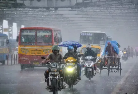
An orange alert covering rain with thunderstorms and wind gusts of 40 to 50 km per hour is in place for Purulia, Bankura, West Midnapore, West Burdwan, Birbhum, and Murshidabad districts from Tuesday through Friday. A separate orange alert covers North Dinajpur, South Dinajpur, and Malda in the north.
The red alert — the highest weather warning tier — applies to the hill and foothills districts of Darjeeling, Kalimpong, Cooch Behar, Jalpaiguri, and Alipurduar, where rainfall accumulation may reach up to 200 mm. The remaining districts of the state are also expected to see rain with thunderstorms.
What Is Driving the Rains
An RMC official explained the meteorological trigger: 'There is a monsoon axis from Rajasthan to Bihar. It extends over Haryana and Uttar Pradesh. Due to the influence of this system, a large amount of water vapour is entering the state from the Bay of Bengal. Due to this, heavy rain is forecast in the south and very heavy rain in the north.'
This confluence of a cross-country monsoon axis and Bay of Bengal moisture is a pattern that typically intensifies rainfall over Bengal during the peak monsoon weeks of late June and early July.
Landslide and Flood Risk
The weather department has warned that heavy rain may trigger landslides in the hill areas of Darjeeling and Kalimpong, both of which are geologically vulnerable during intense monsoon spells. Low-lying areas across the state face a risk of flooding, and river levels in hill catchments may rise above danger marks, according to the MET office.
Notably, the Teesta and Torsa river systems — which drain the north Bengal hills — have historically breached danger levels during red-alert events, affecting thousands of households in Jalpaiguri and Cooch Behar.
Kolkata Weather Outlook
The sky over Kolkata is expected to remain partly cloudy over the coming days. Light to moderate rain with thunderstorms is likely in the city on Sunday and Monday, with heavy rain predicted on Tuesday and Wednesday. Residents in low-lying neighbourhoods and areas prone to waterlogging have been advised to remain alert.
What to Watch
District administrations in north Bengal are expected to remain on standby for evacuation and relief operations. The RMC will issue updated bulletins as the monsoon system evolves. Conditions in the hill districts bear close monitoring through Monday, when the red alert is currently scheduled to lapse.
Point of View
But the meteorological setup this time — a monsoon axis anchored from Rajasthan to Bihar pulling in Bay of Bengal moisture — has the makings of a sustained multi-day event rather than a passing squall. The hill districts of Darjeeling and Kalimpong are perennially under-prepared for rapid-onset landslides, and the 200 mm rainfall projection for those areas demands proactive evacuation readiness, not reactive response. The broader pattern also raises a question that recurs every monsoon season: whether district-level disaster machinery is activated before alerts escalate, or only after the damage is done.
NationPress
28 Jun 2026
Frequently Asked Questions
What does the red alert for north Bengal mean?
A red alert is the highest weather warning level, indicating extremely heavy rainfall that poses serious risks of flooding and landslides. The RMC has issued this alert for north Bengal districts including Darjeeling, Kalimpong, Cooch Behar, Jalpaiguri, and Alipurduar, valid until Monday, 30 June, with rainfall accumulation potentially reaching 200 mm.
Which south Bengal districts are under orange alert?
Six south Bengal districts — Purulia, Bankura, West Midnapore, West Burdwan, Birbhum, and Murshidabad — are under an orange alert for heavy rain with thunderstorms from Tuesday to Friday. Wind gusts of 40 to 50 km per hour are also possible in these areas.
Why is Bengal receiving such heavy rainfall?
According to the RMC, a monsoon axis extending from Rajasthan to Bihar — passing over Haryana and Uttar Pradesh — is drawing large amounts of moisture from the Bay of Bengal into West Bengal. This system is responsible for the forecast of heavy rain in the south and very heavy rain in the north of the state.
Is there a landslide or flood risk?
Yes. The weather department has warned of landslide risk in the hill areas of Darjeeling and Kalimpong due to heavy rainfall. Low-lying areas across the state may also face flooding, and hill river levels could rise above danger marks, the MET office has cautioned.
What is the weather forecast for Kolkata?
Kolkata will remain partly cloudy over the next few days, with light to moderate rain and thunderstorms expected on Sunday and Monday. Heavier rainfall is forecast for Tuesday and Wednesday as the monsoon system intensifies over south Bengal.