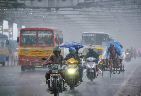
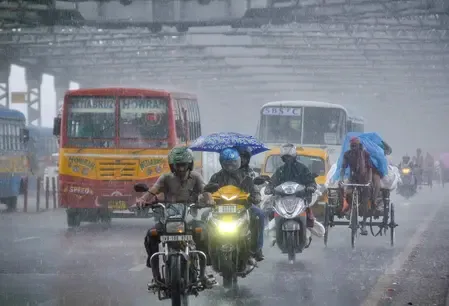
South Bengal rain alert: Kolkata faces thunderstorms for 3-4 days, cyclone watch on

Synopsis
South Bengal is under a yellow alert for three to four days of rain and thunderstorms, with winds up to 40 km/h and a lightning risk across seven named districts including Kolkata. More critically, the IMD is quietly watching the Bay of Bengal for a potential cyclone later this month — the kind of late-September development that can rapidly escalate.
Key Takeaways
Yellow alert issued for all districts of south Bengal on 19 September 2026 for light to moderate rain with thunderstorms.
Squally winds of 30 to 40 km per hour and lightning risk flagged for North 24 Parganas , South 24 Parganas , East Midnapore , West Midnapore , Jhargram , Bankura , and Purulia .
Kolkata can expect intensified rainfall from Monday through 24 September .
The city recorded 32.6 mm of rain in the 24 hours through Saturday morning; max temperature was 31.9°C .
The IMD is monitoring the Bay of Bengal for a possible cyclone later this month, though no official formation has been declared.
Rainfall activity is expected to ease in north Bengal from Saturday.
South Bengal, including Kolkata, is bracing for three to four days of light to moderate rain accompanied by thunderstorms, according to a forecast issued by the India Meteorological Department (IMD) on Saturday, 19 September 2026. A yellow alert has been sounded for all districts in the region, with squally winds of 30 to 40 km per hour and a risk of lightning flagged alongside the showers.
Districts on Alert
The weather department has specifically named North 24 Parganas, South 24 Parganas, East Midnapore, West Midnapore, Jhargram, Bankura, and Purulia as areas likely to receive rain and thunderstorms. A separate yellow alert covering six districts — including the western districts of the state — has been extended for the next two days, with lightning and strong wind warnings in force.
'There is a yellow alert for light to moderate rain with thunderstorms in all districts of south Bengal today. Squally winds may blow at 30 to 40 km per hour along with the rain. There will also be a risk of lightning,' a Met department official said.
Kolkata Weather Outlook
In Kolkata, skies are expected to remain overcast, with thunderstorms possible by evening. On Friday, 18 September, the city recorded a maximum temperature of 31.9 degrees Celsius — 0.9 degrees below normal — and a minimum of 25.8 degrees Celsius, 0.5 degrees below normal. Relative humidity hovered between 77 and 96 per cent, and the city received 32.6 mm of rain in the 24 hours through Saturday morning.
Should rain fail to materialise on Saturday, high humidity is expected to push discomfort levels higher. Rainfall activity is forecast to intensify from Monday and persist through 24 September, with gusty winds of 30 to 40 km per hour likely during this period.
Bay of Bengal Cyclone Watch
The IMD is currently monitoring weather developments in the Bay of Bengal over the possibility of a cyclone forming later this month. No official announcement regarding cyclone formation has been made, and the department says it is keeping a close watch on evolving conditions. This comes amid an already active monsoon pattern across eastern India — the Bay of Bengal routinely generates cyclonic systems during the September–October window, and the timing warrants close attention.
North Bengal Sees a Let-Up
Contrasting with the south, rainfall activity is expected to ease across north Bengal from Saturday. Light to moderate rain with thunderstorms may still occur at isolated locations across the northern districts, but conditions are broadly expected to improve compared to recent days.
What Residents Should Know
Authorities have urged residents in alert districts to remain indoors during thunderstorms, avoid open fields and elevated structures given the lightning risk, and stay updated on IMD bulletins. The combination of gusty winds, heavy humidity, and potential lightning makes the forecast period one that warrants caution across coastal and inland south Bengal alike. Conditions will be closely tracked as the Bay of Bengal system develops over the coming days.
Point of View
But the Bay of Bengal monitoring note buried at the end of the IMD bulletin deserves closer attention. Late September is prime cyclone season for the eastern coast, and a system developing now could amplify the already wet forecast for a region that includes dense urban settlements and flood-prone coastal districts. The IMD's cautious 'keeping a close watch' language is standard pre-formation hedging — but it also means the situation can change rapidly. Local administrations in coastal South 24 Parganas and East Midnapore should be treating this as an early-warning window, not a routine weather update.
NationPress
19 Sept 2026
Frequently Asked Questions
Which districts of south Bengal are under a rain and thunderstorm alert today?
All districts of south Bengal are under a yellow alert on 19 September 2026, with North 24 Parganas, South 24 Parganas, East Midnapore, West Midnapore, Jhargram, Bankura, and Purulia specifically named for rain and gusty winds of 30 to 40 km per hour. Six districts, including western Bengal, face an extended yellow alert for the next two days.
How long will the rain and thunderstorms last in Kolkata?
The IMD forecast indicates light to moderate rain with thunderstorms for three to four days from Saturday. Rainfall is expected to intensify from Monday and continue through 24 September, accompanied by gusty winds of 30 to 40 km per hour.
Is a cyclone forming in the Bay of Bengal?
No official cyclone formation has been announced. The IMD says it is monitoring weather developments in the Bay of Bengal over the possibility of a cyclone forming later in September, and is keeping a close watch on evolving conditions.
What was Kolkata's temperature and rainfall on Friday?
On Friday, 18 September, Kolkata recorded a maximum temperature of 31.9 degrees Celsius — 0.9 degrees below normal — and a minimum of 25.8 degrees Celsius, 0.5 degrees below normal. The city received 32.6 mm of rain in the 24 hours through Saturday morning, with relative humidity between 77 and 96 per cent.
What is the weather outlook for north Bengal?
Rainfall activity is expected to ease in north Bengal from Saturday. Light to moderate rain with thunderstorms may still occur at isolated locations across the northern districts, but conditions are broadly forecast to improve.