What Should Farmers in MP Do Amid Ongoing Inclement Weather?
Synopsis
As inclement weather continues to affect Madhya Pradesh, farmers are urged to take precautions. With the combination of a western disturbance and south-easterly winds, many districts are experiencing rainfall and potential hailstorms. Stay informed for effective agricultural practices during this unpredictable weather.
Key Takeaways
Stay updated on weather forecasts.
Implement adequate drainage in fields.
Monitor crops closely for signs of disease.
Postpone irrigation until the weather stabilizes.
Use recommended pesticides promptly.
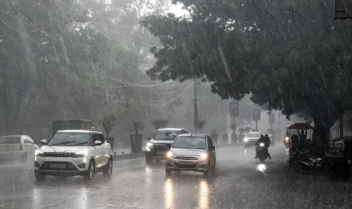
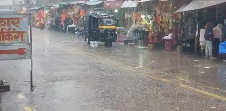
Bhopal, Jan 31 (NationPress) The onset of a western disturbance in conjunction with south-easterly winds has once again transformed the weather landscape across Madhya Pradesh. Many districts are experiencing cloudy skies and sporadic rainfall.
The latest update from the Meteorological Centre in Bhopal indicates that no significant decrease in temperatures is anticipated over the next 24 to 48 hours. However, light to moderate rain, strong winds, and even hailstorms are forecasted in several areas, as stated by the Bhopal weather office.
Regions including Ujjain, Indore, Bhopal, Narmadapuram, Jabalpur, and Shahdol are likely to experience thunderstorms with rain and gusty winds. Light rainfall is also expected in Panna, Damoh, Chhatarpur, Sagar, Tikamgarh, Niwari, Vidisha, Raisen, Sehore, Dewas, Shajapur, Mandsaur, and Neemuch.
Amid these changing weather patterns in Madhya Pradesh, agricultural science centers, alongside the meteorological department, have released an advisory urging farmers to exercise caution.
Experts have highlighted the necessity of adequate drainage in fields to avert crop damage from short-term rainfall. Crops like wheat and gram are especially susceptible to diseases caused by strong winds and increased humidity, making regular monitoring and timely application of recommended pesticides crucial.
The department has also cautioned of potential hailstorms in northern and western districts such as Morena, Sheopur, and Bhind, where wind speeds may reach between 25 to 35 km per hour. This poses significant challenges for farmers, particularly for gram, mustard, and wheat crops.
In Bhopal, the highest temperature recorded in the last 24 hours was 29 degrees Celsius, while the minimum was noted at 11 degrees, slightly above the norm. Minimum temperatures across most districts ranged from 8 to 14 degrees Celsius.
Meteorologists have clarified that no major changes in cold conditions are expected immediately, though there may be a slight dip in night temperatures after the rain ceases. The rainfall activity is attributed to the influence of an active western disturbance over North India, which has enhanced the flow of moist air into Madhya Pradesh, leading to widespread cloud cover and rain in several districts.
On January 29, Satna recorded the highest rainfall at 20.4 mm, followed by Tikamgarh at 10.8 mm, Sagar at 9.8 mm, and Bhopal at 8.8 mm. Looking forward, the forecast indicates partly cloudy skies with intermittent rain persisting for the next two days. Farmers are advised to postpone irrigation until the weather clears, avoid leaving harvested crops exposed, and provide support to horticultural plants to prevent fruit drop.
Point of View
I believe it is imperative for farmers to stay vigilant amidst these weather fluctuations in Madhya Pradesh. The combination of a western disturbance and changing winds presents both challenges and opportunities. Adhering to agricultural advisories and preparing for potential adverse conditions will be key to safeguarding crops and ensuring food security.
NationPress
3 Jul 2026
Frequently Asked Questions
What is a western disturbance?
A western disturbance is a weather system that brings moisture from the Mediterranean region, leading to cloudiness and precipitation in the affected areas.
How can farmers protect their crops during hailstorms?
Farmers should ensure proper drainage, monitor humidity levels, and apply pesticides as needed to protect crops like wheat and gram from damage.
What precautions should be taken during this weather?
Farmers should delay irrigation, avoid leaving harvested crops exposed, and support horticultural plants to prevent fruit drop.