Environmental Degradation on the Rise: A GIS Analysis of Kohima District
Synopsis
A groundbreaking study utilizing GIS technology unveils alarming environmental changes in Nagaland’s Kohima district, highlighting significant degradation of natural landscapes and rising temperatures. The research emphasizes urgent action to mitigate these impacts and offers a comprehensive framework for sustainable development.
Key Takeaways
Kohima district is experiencing rapid environmental transformation.
Natural landscapes have decreased significantly over the past two decades.
Average temperatures are rising at an alarming rate.
Urgent measures are needed to address environmental degradation.
A comprehensive framework for sustainable development is essential.
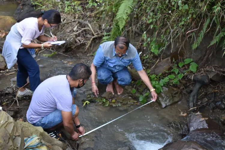
Kohima, April 1 (NationPress) A collaborative research effort by scholars from Nagaland University and a university in Nainital has implemented cutting-edge Geographic Information System (GIS) modeling and remote sensing techniques to assess the environmental shifts in the Kohima district of Nagaland. Their findings provide essential scientific insights regarding the delicate geo-ecological landscape of the Northeast's hilly terrain, raising alarms about rising environmental degradation.
The research paper, co-authored by Dr. Khrieketouno Belho and Prof. M.S. Rawat from the Department of Geography at the School of Sciences, Nagaland University, alongside Dr. Pradeep Kumar Rawat from the Uttarakhand Open University Study Centre, was published in a peer-reviewed journal focusing on environmental quality monitoring and management, released by the esteemed Springer Nature.
This study was made possible through the support of Nagaland University, which provided a Non-NET Fellowship to Dr. Belho, as well as funding from the Union Ministry of Tribal Affairs.
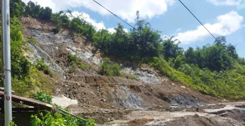
Discussing the importance of the research, Prof. M.S. Rawat highlighted the region’s extreme vulnerability due to ongoing seismotectonic activities, frequent landslides, slope failures, fragmented geology, complex geomorphology, and steep terrain. He noted that these factors, coupled with a high incidence of natural hazards, have led to alarming conditions marked by escalating land use degradation, which in turn exacerbates global environmental issues, including climate change and its detrimental effects.
"Immediate measures are critical to counteract the existing environmental changes and degradation. Failure to act promptly could lead to severe future consequences," he warned. This study underscores a comprehensive strategy for addressing such environmental challenges.
He further emphasized the necessity for the adoption of reliable geospatial technology and action-oriented management strategies to mitigate the risks associated with environmental degradation.
Utilizing an integrated GIS database modeling system, the researchers explored environmental changes through three key modules: Geodiversity Informatics, Land Use Informatics, and Climate Informatics.
This methodology enabled the team to analyze various interconnected environmental factors, including geological structures, land-use trends, vegetation cover, precipitation patterns, temperature fluctuations, and ecological habitats.
According to Prof. Pradeep Kumar Rawat, "Our findings indicate that Kohima district is experiencing rapid environmental shifts. The area’s natural landscapes, including forests, scrublands, and water bodies, have diminished from 93.93% to 81.86% over the last twenty years, while built-up spaces, agricultural lands, and wastelands have steadily increased due to human expansion. Additionally, we observed an average temperature rise of approximately 0.13 degrees Celsius annually, alongside a decline in rainfall and fewer rainy days."
Moreover, Dr. Belho mentioned, "Geoenvironmentally, the Northeast hill region is particularly susceptible to monsoon-related hazards. The socio-economic and demographic fabric is equally vulnerable to the impacts of climate change. This study represents a significant international contribution to understanding the ecological challenges posed by geoecological, anthropogenic, and climate change pressures in the region."
The research also underscored the geological fragility of the area. An analysis of seismic records from 1982 to 2022 showed that over 1,100 seismic events occurred in the Kohima district, averaging around 27 micro earthquakes each year, typically with magnitudes between 2 and 4. Most of these events were associated with tectonic faults and geological lineaments that contribute to landscape instability, erosion, and landslides.
The study advocates for evidence-based planning and sustainable land management strategies within this environmentally sensitive Himalayan region. By fusing geospatial technologies with environmental data, this research provides a thorough framework that policymakers and planners can utilize to better comprehend environmental risks and formulate strategies for climate adaptation, university officials stated.
Officials expressed hope that the study's insights will enhance environmental monitoring, climate resilience planning, and sustainable development in the northeastern hilly region and the larger Indian Himalayan landscape.
This research addresses escalating concerns over environmental degradation in the Himalayan and Northeast Hill regions, driven by both natural processes and human activities. Factors such as rapid urbanization, deforestation, shifting cultivation practices, and climate change collectively heighten the risks of landslides, floods, droughts, and extreme weather events.
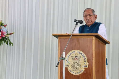
Vice Chancellor Prof. Jagadish K. Patnaik highlighted the university’s ongoing commitment to addressing critical issues affecting the Northeast region, stating, "Nagaland University has initiated a significant research project utilizing GIS technology to map environmental degradation in Kohima."
"The study offers a detailed geospatial analysis that reveals rapid land-use changes, emerging climate trends, and the seismic vulnerabilities of the region. These revelations provide valuable insights for policymakers, planners, and stakeholders, facilitating informed decision-making for sustainable development and effective environmental management in the Northeast Hill Region," he concluded.
Point of View
The combination of natural processes and human activities has led to significant ecological changes, necessitating immediate attention from policymakers. The data presented calls for evidence-based strategies to combat environmental degradation, which is crucial for sustainable development in the region.
NationPress
2 Jul 2026
Frequently Asked Questions
What is the primary focus of the GIS study?
The study primarily focuses on examining environmental changes and degradation in Kohima district using advanced GIS modeling and remote sensing techniques.
Who conducted the research on Kohima district?
The research was conducted by scholars from Nagaland University and a university in Nainital, specifically Dr. Khrieketouno Belho, Prof. M.S. Rawat, and Dr. Pradeep Kumar Rawat.
What are the key findings of the study?
Key findings indicate significant declines in natural landscapes, rising average temperatures, and an increase in human activity, leading to environmental degradation in Kohima district.
Why is the study significant?
The study is significant as it highlights the fragile geo-ecological conditions of the Northeast and provides essential insights for sustainable land management and climate resilience strategies.
What recommendations were made by the researchers?
Researchers recommend adopting reliable geospatial technology and action-oriented management strategies to mitigate the risks of environmental degradation.