Delhi CM reviews SVAMITVA rollout; property cards for Lal Dora areas soon

Synopsis
Thousands of Delhi residents living in Lal Dora areas — long trapped outside formal property records due to a colonial-era land classification — are about to receive digital PVC ownership cards under the SVAMITVA scheme. With 8,423 dispute-free properties across 30 villages cleared for issuance, this is the most concrete step yet toward formalising land rights in the capital's informal village belts.
Key Takeaways
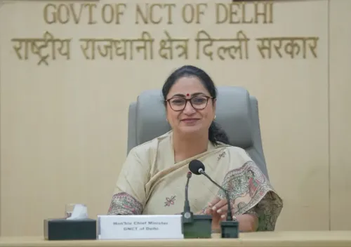
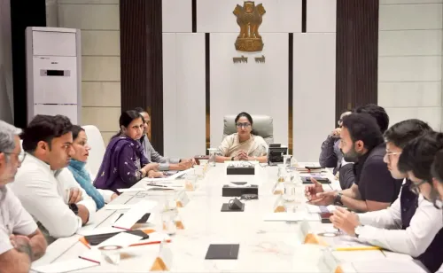
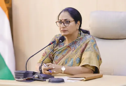
Delhi CM Rekha Gupta chaired a SVAMITVA review meeting on Tuesday , confirming imminent rollout of digital property cards for Lal Dora residents.
Of 48 villages surveyed, digital property cards have been prepared for 30 villages .
12,232 properties were surveyed; 8,423 (about 69% ) were found dispute-free and are eligible for card issuance.
Cards will be high-quality PVC with QR codes , compliant with UIDAI standards, and will carry a Bhu-Aadhar number .
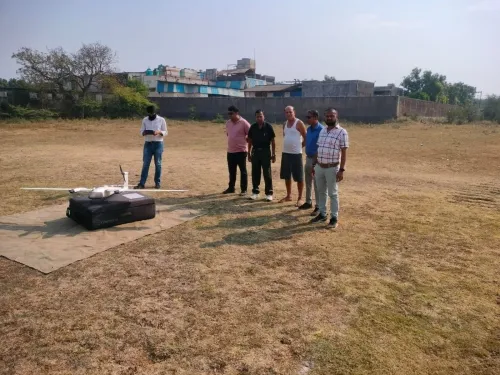
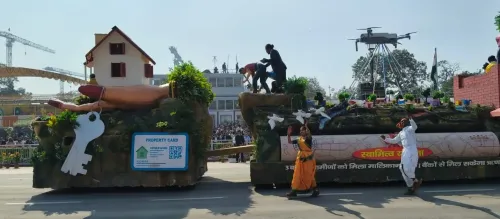
The SVAMITVA scheme was launched in 2020 by the Ministry of Panchayati Raj using drone-based surveys to formalise rural residential land.
A large-scale distribution event is reportedly being planned for the formal card handover.
Delhi Chief Minister Rekha Gupta on Tuesday chaired a review meeting of the SVAMITVA (Survey of Villages and Mapping with Improvised Technology in Village Areas) scheme, signalling that residents of Lal Dora areas across the capital will soon receive digital property cards for their residential holdings. The move is expected to bring formal ownership records to thousands of households that have historically lacked legally recognised documentation.
Where the Scheme Stands
According to government records, 48 villages were surveyed under the SVAMITVA framework, of which digital property cards have already been prepared for 30 villages. Surveys covering 12,232 properties have been completed, and 8,423 of those — roughly 69 percent — have been found dispute-free. The process of issuing smart property cards for this dispute-free cohort is now being initiated.
Chief Minister Gupta confirmed that the final property cards are ready for the 30 villages falling under Lal Dora limits, and a large-scale distribution event is reportedly being planned for the formal rollout.
What the Cards Will Contain
The Delhi government will issue high-quality PVC cards compliant with UIDAI standards. Each card will carry the Property Identification Number (PID), date of issue, village, sub-division, district, occupant's name, father's or husband's name, share or stake details, total area, built-up and open area, Bhu-Aadhar number, co-occupant details, and a contact number. The cards will also feature a QR code for instant digital verification.
Why Lal Dora Areas Have Lacked Property Records
Lal Dora — literally 'red thread' — is a colonial-era demarcation that historically excluded village abadi (residential) land from standard urban property laws and revenue records. Residents in these zones have long been unable to access formal bank loans, sell property through registered deeds, or resolve boundary disputes through official channels. Chief Minister Gupta noted that these difficulties were set to become 'a thing of the past' with the creation of authenticated digital records.
How the Survey Process Works
Under the SVAMITVA scheme, steered by the Ministry of Panchayati Raj and launched in 2020, Lal Dora boundaries are demarcated first. Drones then conduct an aerial survey of the entire village. Revenue Department officials subsequently visit the site to cross-verify drone maps against ground realities. Discrepancies, if any, are flagged to the Survey of India for rectification before final records are sealed.
What Comes Next
With cards ready for 30 of the 48 surveyed villages, the remaining 18 villages are still in the pipeline. A grand distribution event is likely to be organised once the issuance process is formally launched. The scheme's expansion across Delhi's Lal Dora belt could set a template for integrating informal urban-village land into the city's formal property ecosystem.
Point of View
But the real test lies in the 31 percent of surveyed properties — nearly 3,800 homes — that remain entangled in disputes. Issuing cards to the uncontested majority is the easy part; the harder governance challenge is building a credible, time-bound dispute resolution mechanism for the rest. Without that, Lal Dora's most vulnerable residents — often those with the weakest documentation — risk being left out of the very scheme designed to help them. Delhi's Lal Dora belt also sits at the intersection of urban expansion and village land rights, making this a political as much as an administrative exercise.
NationPress
20 Oct 2026
Frequently Asked Questions
What is the SVAMITVA scheme and how does it apply to Delhi?
SVAMITVA (Survey of Villages and Mapping with Improvised Technology in Village Areas) is a central scheme launched in 2020 by the Ministry of Panchayati Raj to provide legal ownership documents for rural residential land using drone surveys. In Delhi, it is being applied to Lal Dora areas — village abadi zones historically excluded from formal property records — to issue digital PVC property cards to eligible residents.
What is a Lal Dora area and why have residents there lacked property records?
Lal Dora is a colonial-era classification that demarcated village residential land from agricultural and urban land, effectively placing it outside standard revenue and property laws. Residents in these zones could not access formal bank loans, execute registered sale deeds, or resolve boundary disputes through official channels due to the absence of authenticated ownership records.
How many properties in Delhi are getting property cards under SVAMITVA?
A total of 12,232 properties were surveyed across 48 villages. Of these, 8,423 properties — approximately 69 percent — were found dispute-free and are being processed for smart property card issuance. Digital cards have already been prepared for 30 of the 48 surveyed villages.
What information will the new Delhi property cards contain?
Each PVC card will carry the Property Identification Number (PID), date of issue, village, sub-division, district, occupant's name, father's or husband's name, share details, total and built-up area, Bhu-Aadhar number, co-occupant details, contact number, and a QR code. The cards will be compliant with UIDAI standards.
When will the Delhi Lal Dora property cards be distributed?
Chief Minister Rekha Gupta confirmed on Tuesday that final cards are ready for residents of 30 Lal Dora villages, and a large-scale distribution event is reportedly being planned. No specific date has been announced yet for the formal rollout.