Southwest monsoon stalls over Maharashtra; IMD flags weak winds

Synopsis
The Southwest Monsoon has hit a wall over Maharashtra — stalled since its 8 June entry into South Konkan, with weakened Arabian Sea winds, a disrupted MJO, and no triggering weather systems in sight. Most of the state faces sparse rain for another 4-5 days, with the next realistic window for revival pegged at 24-25 June along the Konkan coast.
Key Takeaways
The Southwest Monsoon entered South Konkan on 8 June 2025 but has since stalled, with no meaningful northward advance.
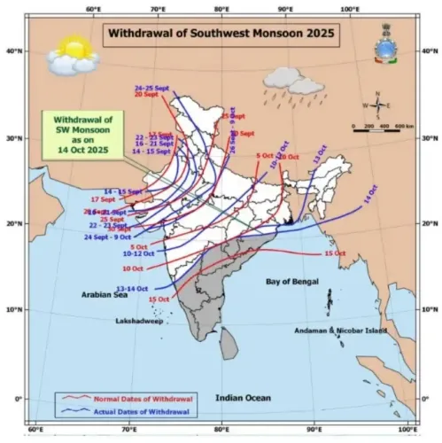
The Northern Limit of Monsoon (NLM) currently passes through Harnai, Solapur, Hyderabad, Bhadrachalam, Koraput, Phulbani, Ranchi, Jamui , and Muzaffarpur .
IMD attributes the stall to weakened low-level southwesterly winds, reduced cross-equatorial flow, and an unfavourable Madden-Julian Oscillation (MJO) phase.
Rainfall is expected to remain isolated across most of Maharashtra for the next 4-5 days .
A revival over the Konkan belt is projected around 24-25 June , according to numerical weather models.
Farmers and water resource managers in Maharashtra have been advised to plan around the delayed onset.
The India Meteorological Department (IMD) has confirmed a significant stall in the Southwest Monsoon's advance across Maharashtra, with large-scale atmospheric conditions turning unfavourable after the system's initial entry into the state on 8 June 2025. Despite early rains along the southern coast, the monsoon's northward march has been effectively frozen for several days, leaving most of the state still waiting for full onset.
Where the Monsoon Stands
According to the Regional Meteorological Centre, Mumbai, the Northern Limit of Monsoon (NLM) currently runs through Harnai, Solapur, Hyderabad, Bhadrachalam, Koraput, Phulbani, Ranchi, Jamui, and Muzaffarpur. The system entered South Konkan and adjoining areas of South Madhya Maharashtra on 8 June but has made no meaningful progress northward since.
What Is Causing the Slowdown
IMD officials have cited several compounding meteorological factors. Low-level southwesterly winds over the Arabian Sea — the primary moisture highway for the Southwest Monsoon — have weakened considerably, cutting off the moisture supply to Maharashtra's coast and interior. The cross-equatorial flow over the western Indian Ocean and Arabian Sea, another critical moisture source, has also diminished in recent days.
Notably, the absence of weather-system triggers — such as low-pressure areas, cyclonic circulations over the Arabian Sea or Bay of Bengal, or an active offshore trough along the west coast — has further blocked the system's advance. The Madden-Julian Oscillation (MJO), a planetary-scale atmospheric wave that often amplifies monsoon activity, is currently in an unfavourable phase over the region.
Rainfall Outlook for the Next Week
Rainfall is expected to remain isolated over most of Maharashtra during the next 4-5 days, according to IMD projections. However, numerical weather models indicate a likely uptick in activity over the Konkan belt around 24-25 June, as synoptic conditions are expected to become more supportive. The IMD said updated forecasts will be issued as conditions evolve.
Impact on Agriculture and Water Resources
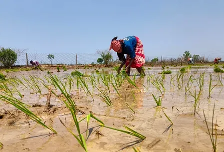
The delay arrives at a critical juncture for Maharashtra's farm sector, which is heavily dependent on the June-July monsoon window for sowing. Farmers and local authorities have been advised to plan operations around the revised timeline. Water reservoir levels in several districts remain below seasonal norms, adding urgency to the monsoon's revival. The IMD has urged citizens and stakeholders to monitor official warnings closely.
Point of View
But the convergence of factors this year — weakened Arabian Sea surge, disrupted MJO, and absent cyclonic triggers — points to a structurally slow onset rather than a brief pause. What mainstream coverage underplays is the downstream pressure on reservoir storage: several Maharashtra districts enter this lull already below seasonal water levels, compressing the buffer for late-arriving rains. The IMD's 24-25 June Konkan revival window is model-guided, not confirmed — and if that window slips, the agricultural sowing calendar for kharif crops faces real disruption. The broader pattern of erratic onset timing across western India in recent years deserves more systematic attention than seasonal reassurance.
NationPress
19 Sept 2026
Frequently Asked Questions
Why has the Southwest Monsoon stalled over Maharashtra?
The monsoon has stalled due to weakened low-level southwesterly winds over the Arabian Sea, reduced cross-equatorial moisture flow, and an unfavourable Madden-Julian Oscillation (MJO) phase, according to the IMD. The absence of triggering weather systems such as low-pressure areas or cyclonic circulations has compounded the slowdown.
When did the monsoon enter Maharashtra and where has it reached?
The Southwest Monsoon entered South Konkan and adjoining areas of South Madhya Maharashtra on 8 June 2025. The Northern Limit of Monsoon currently passes through Harnai, Solapur, Hyderabad, Bhadrachalam, Koraput, Phulbani, Ranchi, Jamui, and Muzaffarpur, with no further advance reported since.
When will normal rainfall resume in Maharashtra?
IMD projects rainfall to remain isolated across most of Maharashtra for the next 4-5 days. Numerical weather models indicate a likely increase in activity over the Konkan belt around 24-25 June, though the department said it will issue updated forecasts as conditions evolve.
How does the monsoon delay affect Maharashtra's farmers?
The delay is critical for the kharif sowing season, which depends on June-July rains. Farmers and local authorities have been advised by the IMD to plan operations around the revised timeline, while water reservoir levels in several districts remain below seasonal norms.
What is the Madden-Julian Oscillation and why does it matter for the monsoon?
The Madden-Julian Oscillation (MJO) is a large-scale atmospheric wave that travels eastward around the globe and can significantly amplify or suppress monsoon rainfall. The IMD has noted that the MJO is currently in an unfavourable phase, meaning it is not providing the additional push needed for the monsoon to advance over Maharashtra.