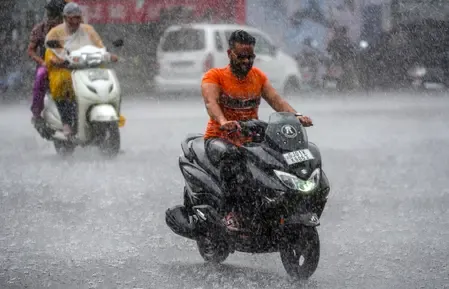
MP rains Day 3: Bhopal logs 7 inches, 10 rescued in Sehore as IMD warns of more
Synopsis
Three straight days of heavy rain have pushed Bhopal to seven inches in 24 hours, stranded families, and submerged bridges across Madhya Pradesh — yet the state still sits 15% below its seasonal rainfall normal. With a fresh low-pressure system forming by 12 August, the next four days could swing the monsoon from deficit to disaster.
Key Takeaways
Bhopal received approximately 7 inches of rain in 24 hours as of 11 August , marking the third consecutive day of heavy rainfall.
10 family members were rescued from near the Bhilakhedi River in Sehore on Monday evening after rising waters stranded them.
The IMD issued a heavy rainfall alert for 10 districts including Neemuch, Mandsaur, Ratlam, Guna, and Morena for Tuesday.
Madhya Pradesh received 483 mm of rain between 1 June and 10 August — 15% below the seasonal normal of 571 mm .
A fresh low-pressure area is likely to form over the Bay of Bengal around 12 August , extending heavy rain risk through the week.
All schools in Bhopal from nursery to Class 12 were shut on Tuesday; disaster control rooms have been kept operational statewide.
Heavy rainfall lashed Bhopal and large swathes of Madhya Pradesh for the third consecutive day on Tuesday, 11 August, waterlogging roads and residential colonies, swelling rivers, and forcing authorities to shut schools across the state capital. The India Meteorological Department (IMD) has warned that the deluge is far from over, with several districts on high alert through the week.
Ground Situation in Bhopal and Nearby Districts
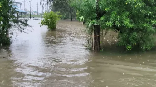
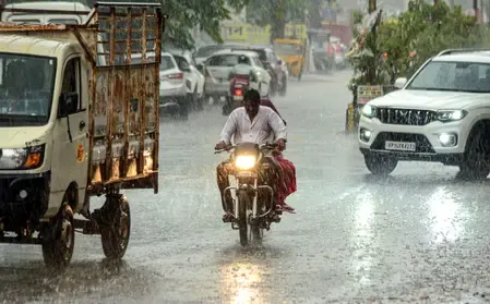
Bhopal recorded approximately seven inches of rainfall in the 24 hours preceding Tuesday, according to the IMD. Low-lying colonies were inundated, rainwater entered homes, and traffic movement was severely disrupted. The district administration issued an advisory urging residents to avoid waterlogged areas and limit unnecessary travel.
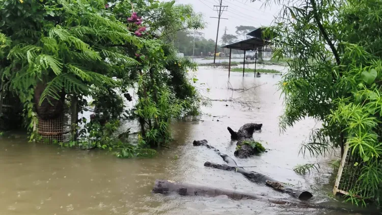
All schools in Bhopal — from nursery to Class 12 — were ordered shut on Tuesday as a precautionary measure. In neighbouring Sehore, 10 members of a single family were stranded in their home near the Bhilakhedi River after water levels surged on Monday. Police, assisted by local villagers, rescued all of them by Monday evening.
In Raisen, rivers and streams overflowed their banks. Rising waters in the Jakha-Betwa River on Bhopal Road and at Pagneshwar on Sanchi Road submerged small bridges, while agricultural fields across several areas were flooded.
IMD Alerts and Districts on Watch
The IMD Meteorological Centre issued a heavy rainfall alert for Neemuch, Mandsaur, Ratlam, Alirajpur, Agar-Malwa, Rajgarh, Guna, Shivpuri, Sheopur and Morena districts for Tuesday. Light to heavy rain is also forecast over the next 24 hours across more than 45 districts, spanning Bhopal, Indore, Ujjain, Jabalpur, Gwalior, Rewa, Shahdol, Sagar and their surrounding regions.
What Is Driving the Rainfall
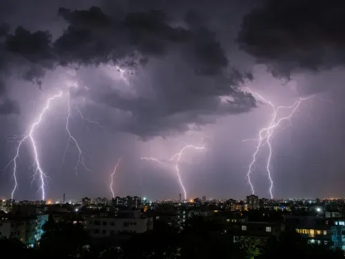
Weather expert Shailendra Kumar Nayak explained that a low-pressure area formed over northern Madhya Pradesh and adjoining areas on 10 August, with an associated cyclonic circulation extending up to 5.8 km in altitude. The monsoon trough is passing through the centre of this system, intensifying rainfall across the state.
Nayak added that a separate cyclonic circulation has developed over the northwestern Bay of Bengal and is likely to trigger the formation of a fresh low-pressure area around 12 August. 'The next four days will be crucial for Madhya Pradesh as rainfall activity is likely to continue under the influence of these systems,' he said.
Seasonal Deficit and Government Response
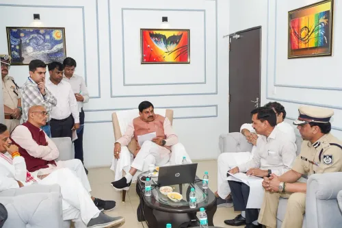
Despite the current spell, Madhya Pradesh remains in a rainfall deficit. According to state government data presented at a review meeting chaired by Chief Minister Mohan Yadav on Monday, the state received 483 mm of rain between 1 June and 10 August against a seasonal normal of 571 mm — a shortfall of 15 per cent. Eastern Madhya Pradesh logged 513.20 mm during the period, while western Madhya Pradesh recorded 459.80 mm.
Around half the state's districts have received normal rainfall so far, while others remain deficient. The government has directed officials to closely monitor rainfall, reservoir, and river levels and keep disaster control rooms operational. With a fresh low-pressure system potentially forming by 12 August, the coming days will determine whether the deficit closes — or whether relief turns into crisis.
Point of View
Yet Madhya Pradesh remains 15% below its seasonal rainfall normal. This is the paradox of India's increasingly erratic monsoon — prolonged dry spells punctuated by concentrated deluges that flood fields without replenishing groundwater sustainably. The formation of back-to-back low-pressure systems in quick succession points to a pattern that disaster managers and agricultural planners in central India must reckon with more systematically. Chief Minister Yadav's review meeting is a procedural response; what the state needs is a standing early-warning and evacuation protocol that does not wait for the third day of flooding to mobilise.
NationPress
25 Sept 2026
Frequently Asked Questions
How much rain has Bhopal received in the current spell?
Bhopal recorded approximately seven inches of rainfall in the 24 hours leading up to Tuesday, 11 August, according to the IMD. It is the third consecutive day of heavy rain in the city, causing widespread waterlogging and school closures.
Which districts in Madhya Pradesh are on IMD heavy rain alert?
The IMD has issued a heavy rainfall alert for Neemuch, Mandsaur, Ratlam, Alirajpur, Agar-Malwa, Rajgarh, Guna, Shivpuri, Sheopur, and Morena for Tuesday, 11 August. Light to heavy rain is also forecast across more than 45 districts over the next 24 hours.
What caused the rescue operation in Sehore?
Ten members of a family were stranded in their home near the Bhilakhedi River in Sehore after torrential rain caused the water level to rise sharply. Police, aided by local villagers, rescued all 10 on Monday evening.
Is Madhya Pradesh facing a monsoon deficit despite the heavy rain?
Yes. State government data shows Madhya Pradesh received 483 mm of rain between 1 June and 10 August, against a seasonal normal of 571 mm — a deficit of 15%. Around half the state's districts have received normal rainfall, while others remain below par.
How long is heavy rainfall expected to continue in Madhya Pradesh?
Weather expert Shailendra Kumar Nayak has said the next four days will be crucial, as a low-pressure area over northern Madhya Pradesh is sustaining heavy rain. A fresh low-pressure system is also likely to form over the northwestern Bay of Bengal around 12 August, potentially extending the wet spell further.