Is Heavy Rain Hammering MP? Weather Alerts Sounded for Multiple Districts
Synopsis
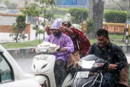
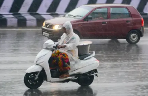
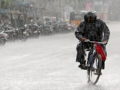
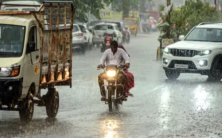
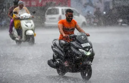
Heavy rainfall is sweeping through Madhya Pradesh as the monsoon intensifies. Alerts have been issued for multiple districts, warning of severe weather conditions and potential flooding. Residents are urged to remain cautious and follow local advisories as the situation develops.
Key Takeaways
Madhya Pradesh is experiencing a powerful monsoon surge.
Heavy rainfall alerts have been issued for multiple districts.
Significant waterlogging and disruptions reported in affected areas.
Residents are urged to remain cautious and follow advisories.
Emergency services are on high alert due to potential flooding.
Bhopal, July 2 (NationPress) - The central part of India is currently experiencing a powerful monsoon surge, leading to extensive rainfall and disruptions in Madhya Pradesh.
The India Meteorological Department (IMD) has issued several alerts for the area, cautioning residents about ongoing heavy to very heavy rainfall, especially in the western and eastern regions from July 2 to July 4.
Intense rain has affected Neemuch, Mandsaur, Ratlam, Sidhi, Singrauli, Mandla, Dindori, and Balaghat, with certain locations measuring up to 8 inches of rain within just 24 hours.
Both Bhopal and Narmadapuram have faced relentless downpours since the morning, resulting in significant waterlogging.
The IMD has linked the extensive rainfall to an active monsoon trough and a low-pressure system positioned over the region.
The local Meteorological Department has reported widespread precipitation throughout Madhya Pradesh in the last 24 hours, with most divisions experiencing moderate to heavy rain.
This weather pattern has also caused a notable decrease in temperatures across various areas.
The Bhopal Meteorological Centre has recorded consistent rainfall in Narmadapuram, Chambal, Jabalpur, and Sagar divisions. Regions such as Bhopal, Indore, Ujjain, Gwalior, and Rewa witnessed rainfall at multiple locations, while Shahdol had sporadic showers. However, some divisions remained dry.
The rainfall has resulted in a marked decline in daytime temperatures, with maximum temperatures dropping by 2 to 2.5 degrees Celsius in parts of Shahdol and Sagar, although they increased slightly in Bhopal and Ujjain.
Across the board, temperatures were significantly below normal, by as much as 6.7 degrees Celsius in Narmadapuram, Jabalpur, Shahdol, and Sagar.
Nighttime temperatures remained stable but also fell below normal in districts like Indore, Bhopal, and Gwalior.
The local weather agency had warned on July 2 about heavy to extremely heavy rainfall, thunderstorms, and gusty winds (30-40 km/h) in isolated areas of the state.
Thunderstorms accompanied by lightning and strong winds are anticipated in Bhopal, Burhanpur, Khandwa, Khargone, Barwani, Alirajpur, Jhabua, Dhar, Ratlam, Shajapur, Agar, Mandsaur, and Neemuch. Additional lightning warnings were issued for Singrauli, Sidhi, Rewa, Mauganj, Satna, Narsinghpur, and Maihar.
Rainfall is expected to intensify further on July 3. Singrauli is under a very heavy rain alert, while districts like Gwalior, Bhind, Morena, Sheopur, Guna, Vidisha, Neemuch, and Jabalpur are flagged for heavy rain.
In Neemuch, rain persisted for a third consecutive day, inundating roads and isolating several villages. Reports indicate that the Neemuch-Singoli road was submerged, and traffic on key bridges was halted due to strong currents.
By July 4, the weather system is projected to shift slightly eastward, but rainfall may continue, according to the weather department.
An orange alert has been issued for Jabalpur, Damoh, Panna, Satna, Rewa, Mauganj, and Sidhi.
In Jabalpur and surrounding areas, heavy showers could potentially trigger flash floods in low-lying regions.
In Bhopal, numerous roads remained underwater due to the heavy rain observed on Tuesday and Wednesday, with over two feet of water on the roads exacerbated by a malfunctioning drainage system.
Over the past three days, more than 45 districts in Madhya Pradesh have recorded significant rainfall, with wind speeds reaching up to 40 km/h in certain areas. Daytime temperatures stabilized around 30 degrees Celsius, while nighttime lows fell below 25 degrees Celsius, providing some relief from the typical July heat, as noted by the weather office.
With the monsoon system anticipated to remain active, meteorologists have urged residents to remain vigilant, avoid unnecessary travel, and heed local advisories. Emergency services are on high alert as the state prepares for ongoing rainfall and possible flooding.
Point of View
It's essential for residents to stay informed and prepared as the monsoon continues to exert its influence. The alerts issued by the IMD signify the potential dangers and disruptions that can arise from such intense rainfall. Our responsibility is to ensure that communities are aware and equipped to handle these challenges, prioritizing safety and adherence to advisories.
NationPress
25 Jun 2026
Frequently Asked Questions
What areas in Madhya Pradesh are most affected by the rainfall?
The districts most impacted include Neemuch, Mandsaur, Ratlam, Sidhi, Singrauli, Mandla, Dindori, and Balaghat.
What alerts has the IMD issued?
The IMD has issued alerts for heavy to very heavy rainfall, thunderstorms, and gusty winds in several districts.
How much rainfall has been recorded in affected areas?
Some areas have experienced up to 8 inches of rainfall in just 24 hours.
What are the expected impacts of the rainfall?
The heavy rainfall is likely to cause waterlogging, flash floods in low-lying areas, and disruptions in daily life.
What safety measures should residents take?
Residents are advised to stay alert, avoid unnecessary travel, and follow local advisories to ensure their safety.