7.7-magnitude earthquake hits Flores Island, Indonesia; tsunami warning issued
Synopsis
A 7.7-magnitude quake off Flores Island — shallow, just 15 km deep — has triggered a tsunami warning across three Indonesian provinces. With no casualty reports yet but a 6.1-magnitude aftershock already recorded, this has the hallmarks of a high-impact disaster in one of the world's most seismically vulnerable nations.
Key Takeaways
A 7.7-magnitude earthquake struck 36 km northeast of Mbay , East Nusa Tenggara , Indonesia, on 15 August .
BMKG issued a tsunami warning for East Nusa Tenggara , South Sulawesi , and West Nusa Tenggara provinces.
A 6.1-magnitude aftershock followed the initial tremor; no casualties were immediately reported.
The quake struck at a shallow depth of 15 km , increasing its potential for surface damage and wave generation.
Indonesia's deadliest recent quakes include the 2004 Sumatra tsunami (220,000 deaths) and the 2018 Palu disaster (4,300+ dead or missing).
A powerful 7.7-magnitude earthquake struck off the coast of Flores Island in Indonesia in the early hours of Saturday, 15 August, prompting authorities to issue a tsunami warning for multiple provinces. The tremor's epicentre was recorded 36 km northeast of Mbay, East Nusa Tenggara province, at a shallow depth of 15 km, according to Indonesia's Meteorology, Climatology and Geophysics Agency (BMKG).
Key Developments
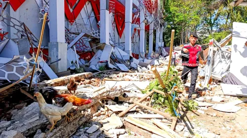
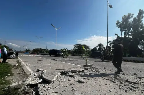
Strong tremors were felt across several areas, sending panicked residents rushing into the streets seeking open ground and safe shelter, according to local media reports. The initial quake was followed by significant aftershocks in the same region, including one registering a magnitude of 6.1. There were no immediate reports of casualties as of early Saturday.
Tsunami Warning and Affected Provinces
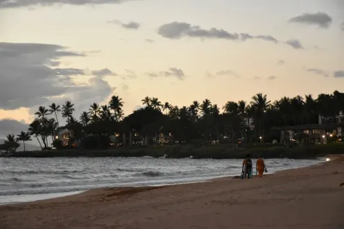
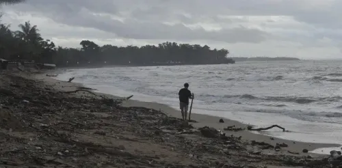
BMKG earthquake and tsunami director Wijayanto confirmed the threat, stating: 'Tsunami modelling results indicate that this earthquake has the potential to generate a tsunami in the provinces of East Nusa Tenggara, South Sulawesi, and West Nusa Tenggara.' Authorities urged coastal residents in those provinces to move to higher ground immediately.
Indonesia's Seismic History
Indonesia sits on the Pacific 'Ring of Fire' and hosts more than 120 active volcanoes, making it one of the world's most seismically and volcanically active nations. The country has endured a series of catastrophic earthquakes in recent decades. A 9.1-magnitude quake off Sumatra in 2004 triggered a tsunami that killed approximately 220,000 people across the region, with around 170,000 deaths in Indonesia alone.
In 2018, Lombok island was struck by a powerful quake followed by weeks of aftershocks, killing more than 550 people across Lombok and neighbouring Sumbawa. Later that same year, a 7.5-magnitude earthquake hit Sulawesi, triggering a devastating tsunami in Palu that left more than 4,300 people dead or missing.
What Happens Next
Emergency response teams were on alert as BMKG continued to monitor the situation for further aftershocks and wave activity. Coastal communities in the three warned provinces were advised to remain away from shorelines until authorities issued an all-clear. The scale of structural damage and the full human impact remained unclear in the immediate aftermath.
Point of View
Early-warning dissemination at the village level in eastern Indonesia remains patchy. The absence of immediate casualty reports is cautiously reassuring, but the 2018 Palu disaster — where the tsunami arrived within minutes — is a reminder that the window between warning and wave can be devastatingly short.
NationPress
29 Sept 2026
Frequently Asked Questions
Where did the 7.7-magnitude earthquake strike in Indonesia?
The earthquake struck off the coast of Flores Island, with its epicentre located 36 km northeast of Mbay in East Nusa Tenggara province. It occurred at a depth of 15 km, according to Indonesia's BMKG.
Has a tsunami warning been issued after the Indonesia earthquake?
Yes. BMKG issued a tsunami warning covering East Nusa Tenggara, South Sulawesi, and West Nusa Tenggara provinces. BMKG director Wijayanto confirmed that tsunami modelling indicated wave-generation potential from the quake.
Were there casualties in the Flores Island earthquake?
There were no immediate reports of casualties as of early Saturday, 15 August. However, strong tremors prompted residents to flee into the streets, and the full extent of damage was not yet known.
What aftershocks followed the 7.7-magnitude quake?
The initial tremor was followed by strong aftershocks in the same area, including one with a magnitude of 6.1. BMKG continued to monitor the region for further seismic activity.
Why is Indonesia so vulnerable to earthquakes and tsunamis?
Indonesia sits on the Pacific 'Ring of Fire' and has more than 120 active volcanoes, making it one of the world's most seismically active countries. Past disasters include the 2004 Sumatra tsunami that killed 220,000 people and the 2018 Palu earthquake-tsunami that left over 4,300 dead or missing.