7.8 magnitude quake hits Philippines, Japan issues tsunami advisory
Synopsis
A powerful 7.8 magnitude quake off Mindanao set off a chain of tsunami warnings stretching from nine Philippine coastal provinces to Japan's Pacific coastline and northeastern Indonesia — a stark reminder of how a single seismic event in the Ring of Fire can simultaneously threaten millions across three nations.
Key Takeaways
A 7.8 magnitude earthquake struck 32 km southwest of Maasim, Sarangani Province, Mindanao at 7:37 a.m. local time on 8 June .
The quake hit at a depth of 33 km , according to the Philippine Institute of Volcanology and Seismology .
PHIVOLCS issued a tsunami warning to nine coastal provinces , ordering immediate evacuation to higher ground.
Japan's weather agency issued tsunami advisories from Ibaraki Prefecture to Okinawa along the Pacific coast.
Indonesia's Meteorology, Climatology and Geophysics Agency activated an early tsunami warning for northeastern coastal areas.
No significant casualties were reported initially, though assessments near the epicentre were ongoing.
A 7.8 magnitude earthquake struck the southern Philippines on Monday, 8 June, prompting Japan's weather agency to issue tsunami advisories for coastal stretches from Ibaraki Prefecture on the eastern Pacific coast all the way south to the island prefecture of Okinawa. The tremor, one of the strongest to hit the region in recent years, also triggered early tsunami warnings across northeastern Indonesia.
What Happened and Where
According to the Philippine Institute of Volcanology and Seismology (PHIVOLCS), the tectonic earthquake struck at 7:37 a.m. local time at a depth of 33 km. The epicentre was located 32 km southwest of the coast of Maasim town in Sarangani Province on Mindanao Island, the second-largest island in the Philippines.
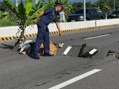
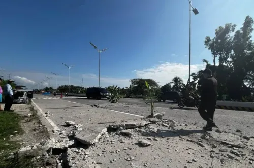
The quake was felt across neighbouring provinces, and local media reported damage to some buildings along with power outages in affected areas. Officials indicated that localities nearest the epicentre experienced the strongest ground shaking.
Tsunami Warnings Issued Across the Region
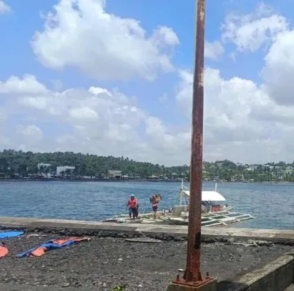
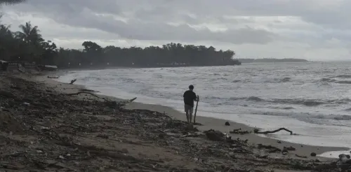
PHIVOLCS issued a tsunami warning to nine coastal provinces, strongly advising residents to immediately evacuate to higher ground or move farther inland. Authorities forecast that the first tsunami waves would arrive on Monday morning and continue for several hours.
In Japan, the meteorological agency's advisory covered a broad swathe of the Pacific-facing coastline. Separately, Indonesia's Meteorology, Climatology and Geophysics Agency activated an early tsunami warning for the coastal areas of northeastern Indonesia following the same seismic event.
No Major Casualties Reported Initially
As of early Monday, there were no initial reports of significant casualties or major structural damage in either the Philippines or Indonesia, according to officials. However, assessments were still under way, and the situation in areas closest to the epicentre remained fluid.
Why the Philippines Is So Vulnerable
The Philippines sits squarely within the Pacific 'Ring of Fire' — a belt of intense tectonic activity encircling the Pacific Ocean that accounts for roughly 90% of the world's earthquakes. Mindanao in particular lies near the convergence of several major tectonic plates, making it one of the most seismically active zones globally. This is not the first time a significant quake originating near Mindanao has triggered regional tsunami alerts; the island has a documented history of generating tsunamis that affect neighbouring nations.
What Comes Next
Regional disaster agencies are monitoring wave activity closely, with evacuation orders remaining in force until authorities can confirm the threat has passed. Japan and Indonesia are expected to lift or downgrade their advisories once tidal gauges confirm wave heights. Affected communities in Sarangani Province and surrounding areas face an extended period of aftershocks, which are common following a quake of this magnitude.
Point of View
But evacuation compliance in remote coastal communities remains inconsistent. The Philippines has absorbed several major quakes in recent years with relatively low fatalities — a credit to improved alert infrastructure — but building codes in Mindanao's rural provinces lag far behind. The real test of this event will not be the wave heights recorded, but whether the evacuation orders were followed in the nine provinces where they mattered most.
NationPress
19 Sept 2026
Frequently Asked Questions
Where did the 7.8 magnitude earthquake strike on 8 June?
The earthquake struck 32 km southwest of Maasim town in Sarangani Province on Mindanao Island in the southern Philippines. It occurred at a depth of 33 km at 7:37 a.m. local time, according to PHIVOLCS.
Which countries issued tsunami warnings after the Philippines earthquake?
The Philippines issued a tsunami warning to nine coastal provinces, Japan's weather agency issued advisories from Ibaraki Prefecture to Okinawa, and Indonesia's meteorological agency activated an early tsunami warning for northeastern coastal areas.
Were there casualties from the Philippines earthquake?
There were no initial reports of significant deaths or major damage in the Philippines or Indonesia as of early Monday. However, officials noted that areas nearest the epicentre experienced strong tremors and assessments were still ongoing.
Why does Mindanao experience so many earthquakes?
Mindanao lies within the Pacific Ring of Fire, a zone of intense tectonic plate activity that accounts for the majority of the world's earthquakes and volcanic eruptions. The island sits near the convergence of several major plates, making it one of the most seismically active locations on Earth.
How long will tsunami waves continue after the quake?
Authorities forecast that tsunami waves would arrive on Monday morning and continue for several hours following the 7.8 magnitude quake. Regional agencies were monitoring tidal gauges to determine when it would be safe to lift evacuation orders.