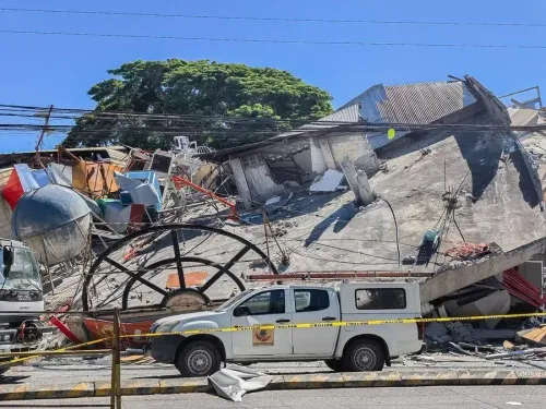
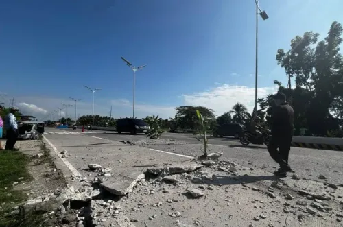
6.3-magnitude earthquake hits Southern Philippines, second tremor in 24 hours
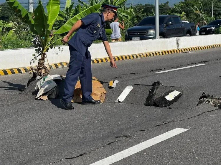
Synopsis
Two powerful offshore earthquakes — magnitude 6.4 on Wednesday and 6.3 on Thursday — struck Davao Occidental in the southern Philippines within 24 hours, raising alarm just weeks after a June 8 tremor killed at least 76 people on Mindanao and shifted the seabed by two metres. No tsunami warning has been issued, but seismologists are watching the fault systems closely.
Key Takeaways
A 6.3-magnitude offshore earthquake struck Davao Occidental , southern Philippines, at 5:41 a.m. on 6 August , at a depth of 10 km .
A 6.4-magnitude quake had already hit the same province the previous day, Wednesday , at 12:14 p.m. at a depth of 13 km .
PHIVOLCS confirmed no tsunami threat to the Philippines from either earthquake.
The epicentre of Thursday's quake was 99 km southwest of Balut Island .
A 8 June earthquake on Mindanao killed at least 76 people and raised the seabed by up to two metres .
The Philippines lies on the Pacific Ring of Fire , making it one of the most seismically active nations in the world.
A 6.3-magnitude offshore earthquake struck Davao Occidental province in the southern Philippines early on Thursday, 6 August, the Philippine Institute of Volcanology and Seismology (PHIVOLCS) confirmed. The tectonic quake hit at 5:41 a.m. local time at a depth of 10 km, with its epicentre located 99 km southwest of the coast of Balut Island.
Second Major Quake in Under 24 Hours
This is the second significant offshore earthquake to strike Davao Occidental within a single day. On Wednesday, a 6.4-magnitude tremor hit the same province at 12:14 p.m. local time, at a depth of 13 km. PHIVOLCS confirmed there was no tsunami threat to the Philippines from either event.
Separately, the GFZ German Research Centre for Geosciences recorded a 6.3-magnitude earthquake jolting Mindanao at 04:14 GMT on Wednesday, with an epicentre at a depth of 10 km, initially placed at 5.37 degrees north latitude and 125.45 degrees east longitude.
Why the Philippines Is Earthquake-Prone
The Philippines sits along the Pacific 'Ring of Fire' — a vast horseshoe-shaped belt of intense seismic and volcanic activity encircling the Pacific Ocean. As an archipelagic nation in Southeast Asia, it is routinely exposed to earthquakes, volcanic eruptions, and tsunamis, making it one of the world's most seismically active countries.
Shadow of the June 8 Catastrophe
These successive tremors come in the wake of a devastating earthquake on 8 June that caused building collapses and triggered landslides on the nearby island of Mindanao, killing at least 76 people. That quake shifted the Cotabato trench and raised the seabed by as much as two metres (6.6 feet), damaging coral reefs and causing widespread harm to marine ecosystems — a reminder of the long-term environmental toll of seismic events in the region.
What Authorities Are Monitoring
With two major offshore quakes registering above 6.0 magnitude in under 24 hours, seismologists will be closely watching for aftershocks and any shift in seismic activity along the Davao fault systems. Residents in coastal communities near Balut Island and southern Mindanao have been advised to remain alert, even as no immediate tsunami warning has been issued.
Point of View
And repeated high-magnitude tremors in the same zone raise the probability of a larger rupture, not just aftershocks. The absence of a tsunami warning is reassuring but not a full clearance — the 10 km shallow depth of Thursday's quake is precisely the profile that generates destructive ground shaking onshore. Philippine disaster authorities face a credibility test: the June 8 death toll of 76 exposed gaps in early warning reach in remote Mindanao communities, and those gaps have not visibly closed.
NationPress
20 Sept 2026
Frequently Asked Questions
What earthquake struck the southern Philippines on 6 August?
A 6.3-magnitude offshore earthquake struck Davao Occidental province in the southern Philippines at 5:41 a.m. local time on 6 August, at a depth of 10 km and with an epicentre 99 km southwest of Balut Island. The Philippine Institute of Volcanology and Seismology confirmed no tsunami threat.
Was there a second earthquake in the Philippines this week?
Yes. A 6.4-magnitude offshore earthquake had already hit Davao Occidental on Wednesday at 12:14 p.m. local time, at a depth of 13 km — making it the second major tremor to strike the province in under 24 hours. No tsunami threat was reported from that event either.
Why does the Philippines experience so many earthquakes?
The Philippines sits along the Pacific 'Ring of Fire,' a horseshoe-shaped zone of intense seismic and volcanic activity surrounding the Pacific Ocean. Its position as an archipelagic nation in Southeast Asia exposes it to frequent earthquakes, volcanic eruptions, and tsunamis.
How does this compare to the June 8 earthquake in the Philippines?
The June 8 earthquake on Mindanao was significantly more destructive — it caused building collapses and landslides, killed at least 76 people, shifted the Cotabato trench, and raised the seabed by up to two metres, damaging coral reefs. The August tremors have not yet been reported to cause casualties or structural damage.
Is there a tsunami risk from the latest Philippines earthquakes?
PHIVOLCS confirmed there is no tsunami threat to the Philippines from either the Wednesday 6.4-magnitude or the Thursday 6.3-magnitude offshore earthquakes. Authorities have not issued any coastal evacuation orders, though residents near Balut Island and southern Mindanao have been advised to stay alert.