7.8 earthquake strikes southern Philippines, tsunami warning for 9 provinces
Synopsis
A 7.8 magnitude offshore earthquake near Mindanao triggered tsunami warnings across nine Philippine coastal provinces and prompted a cross-border alert from Indonesia — a stark reminder that the Ring of Fire's most dangerous corridor runs right through Southeast Asia's most populated coastlines.
Key Takeaways
A 7.8 magnitude earthquake struck 32 km southwest of Maasim, Sarangani Province on Mindanao Island at 7:37 am local time on 8 June .
PHIVOLCS issued a tsunami warning for nine coastal provinces , ordering immediate evacuation to higher ground.
First tsunami waves were forecast to arrive Monday morning and continue for several hours.
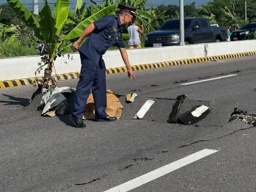
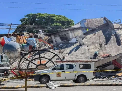
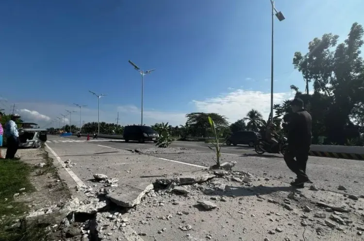
Local media reported building damage and power outages; no significant casualties confirmed in initial reports.
Indonesia's meteorological agency issued an early tsunami bulletin for northeastern coastal areas in response to the quake.
The Philippines lies on the Pacific Ring of Fire , one of the most seismically active zones in the world.
A 7.8 magnitude earthquake struck the waters off the southern Philippines on Monday, 8 June, triggering a tsunami warning for nine coastal provinces and prompting urgent evacuation orders for residents in low-lying areas. The Philippine Institute of Volcanology and Seismology (PHIVOLCS) confirmed the tremor, calling it a tectonic event with the potential for destructive waves along the Mindanao coastline.
What Happened
According to PHIVOLCS, the earthquake struck at 7:37 am local time at a depth of 33 km, with its epicentre located 32 km southwest of Maasim town in Sarangani Province on Mindanao Island. The agency issued a tsunami warning to nine coastal provinces, strongly advising residents to immediately evacuate to higher ground or move farther inland. Authorities warned that the first tsunami waves were forecast to arrive on Monday morning and could continue for several hours.
Damage and Tremors
Local media reported that the quake damaged some buildings and caused power outages in affected areas. Tremors were felt across neighbouring provinces on Mindanao, the second-largest island in the Philippines. There were no initial reports of significant casualties or deaths in either the Philippines or Indonesia, though officials noted that areas nearest the epicentre experienced strong shaking.
Indonesia Issues Early Warning
Indonesia's Meteorology, Climatology and Geophysics Agency also issued an early tsunami bulletin on Monday morning, covering the coastal areas of northeastern Indonesia in response to the strong earthquake in the southern Philippines. The cross-border alert underscores the regional scale of the seismic event and the interconnected risk across the archipelago zone.
Why the Philippines Is Earthquake-Prone
The Philippines sits along the Pacific 'Ring of Fire' — a zone of major tectonic plate boundaries that accounts for roughly 90% of the world's earthquakes and hosts the majority of active volcanoes. Mindanao in particular lies in one of the most seismically active corridors in the region, making it no stranger to high-magnitude events. This comes amid a broader pattern of elevated seismic activity across Southeast Asia in recent years. Authorities and disaster management agencies are continuing to monitor the situation as aftershocks remain possible.
Point of View
And the nine-province warning reflects that reality. What will matter in the hours ahead is the speed of evacuation compliance in Sarangani and neighbouring coastal districts, where informal settlements often sit at sea level. The cross-border alert to Indonesia is a reminder that the risk envelope here extends well beyond Philippine territorial waters. Historically, delayed or inconsistent public messaging during the critical first hour has cost lives in Pacific tsunami events; the real test of preparedness is not the warning system but last-mile communication.
NationPress
23 Oct 2026
Frequently Asked Questions
What was the magnitude and location of the Philippines earthquake on 8 June?
A 7.8 magnitude tectonic earthquake struck 32 km southwest of Maasim town in Sarangani Province on Mindanao Island at 7:37 am local time on 8 June. PHIVOLCS recorded the quake at a depth of 33 km.
Which areas received a tsunami warning after the Philippines earthquake?
PHIVOLCS issued a tsunami warning to nine coastal provinces in the southern Philippines, strongly advising residents to evacuate immediately to higher ground or move farther inland. The first tsunami waves were expected to arrive Monday morning.
Was Indonesia affected by the Philippines earthquake?
Indonesia's Meteorology, Climatology and Geophysics Agency issued an early tsunami warning bulletin for the coastal areas of northeastern Indonesia following the strong quake in the southern Philippines. There were no initial reports of significant damage in Indonesia.
Were there casualties reported after the 7.8 magnitude quake?
There were no initial reports of significant casualties or deaths in either the Philippines or Indonesia, according to officials. However, local media reported building damage and power outages, and officials noted strong tremors near the epicentre.
Why does the Philippines experience frequent earthquakes?
The Philippines is located along the Pacific Ring of Fire, a zone of major tectonic plate boundaries responsible for approximately 90% of the world's earthquakes. Mindanao in particular sits in one of the most seismically active corridors in Southeast Asia.