Philippines 7.8 quake triggers tsunami; Indonesia lifts warning after evacuations
Synopsis
A magnitude 7.8 quake off Mindanao sent tsunami waves as high as 1.4 metres crashing into Philippine coasts and triggered emergency evacuations in northeastern Indonesia — before BMKG lifted its warning hours later. With at least five confirmed dead and damage still being assessed, the event is a stark reminder of how quickly a single seismic event can cascade across two nations simultaneously.
Key Takeaways
A magnitude 7.8 earthquake struck offshore Mindanao , the southern Philippines, on Monday morning .
At least five people are reported dead, according to disaster management chief Agripino Dacera of General Santos City .
The highest tsunami wave recorded reached 1.4 metres , according to PHIVOLCS .
Nine coastal provinces in the Philippines received tsunami warnings; residents were ordered to evacuate to higher ground.
Indonesia's BMKG lifted its tsunami warning for northeastern coastal areas after sea levels returned to normal.
Philippine President Ferdinand Romualdez Marcos ordered disaster response operations and urged residents to evacuate.
A magnitude 7.8 earthquake struck offshore waters in the southern Philippines on Monday morning, triggering tsunami waves that prompted mass evacuations across coastal areas of both the Philippines and northeastern Indonesia. Indonesia's Meteorology, Climatology and Geophysics Agency (BMKG) subsequently lifted its tsunami warning after sea levels returned to normal, hours after the initial alert was issued.
Key Developments
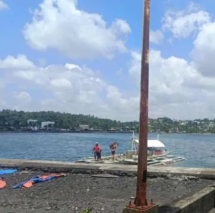
The Philippine Institute of Volcanology and Seismology (PHIVOLCS) confirmed the quake originated offshore near Mindanao, the country's second-largest island, located in one of the most seismically active zones on the planet. The institute recorded the highest tsunami wave at 1.4 metres at coastal monitoring stations. Minor tsunami waves were also detected at several monitoring stations along northern Indonesia's coastline before conditions stabilised.
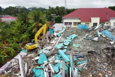
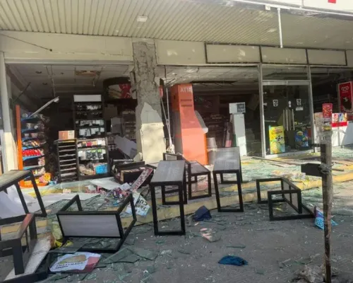
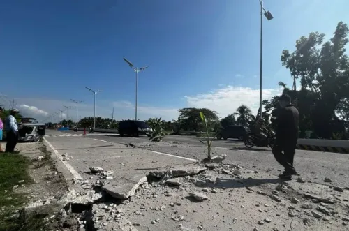
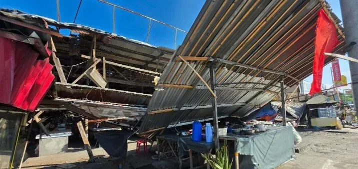
At least five people have been reported dead, according to Agripino Dacera, the disaster management chief in General Santos City, who said authorities are still verifying the full extent of fatalities and damage. Some buildings reportedly collapsed and power outages were recorded across affected areas, with tremors felt in neighbouring provinces.
Evacuation Orders and Government Response
PHIVOLCS issued tsunami warnings to nine coastal provinces, strongly advising residents to evacuate immediately to higher ground or move farther inland. Philippine President Ferdinand Romualdez Marcos ordered disaster response and monitoring operations across all affected areas, urging residents to comply with evacuation directives.
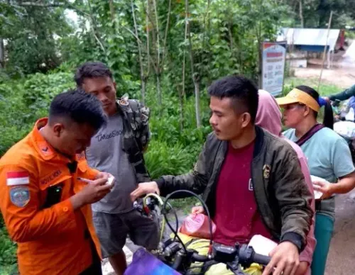
In Indonesia, BMKG ordered evacuations of northern coastal communities after minor waves were detected. The agency confirmed in a formal statement that the tsunami warning status was lifted once sea-level observations returned to normal. No casualties were immediately reported on the Indonesian side, though the tremors caused widespread panic in coastal areas of northeastern Indonesia, according to local media.
Why Mindanao Is Particularly Vulnerable
The Philippines sits squarely on the Pacific 'Ring of Fire' — a belt of major tectonic plate boundaries encircling the Pacific Ocean, responsible for roughly 90% of the world's earthquakes. Mindanao in particular has a history of destructive seismic events, making it one of the most hazard-exposed regions in Southeast Asia. This latest quake is among the strongest to hit the southern Philippines in recent years, compounding long-standing concerns about the region's disaster preparedness infrastructure.
What Happens Next
Authorities in both countries continue to assess structural damage and verify casualty figures. PHIVOLCS had forecast that tsunami waves would arrive in successive pulses through Monday morning, and residents in the nine warned provinces were advised to remain away from coastlines until an all-clear was formally issued. The disaster response effort is ongoing, with relief teams being mobilised across General Santos City and surrounding areas.
Point of View
But the window between detection and wave arrival is measured in minutes — not the hours it takes to evacuate densely populated coastlines. With the Ring of Fire showing no signs of quieting, the real question is whether the region's disaster infrastructure is scaling fast enough to match its seismic exposure.
NationPress
26 Oct 2026
Frequently Asked Questions
What caused the tsunami warning in Indonesia and the Philippines?
A magnitude 7.8 earthquake struck offshore waters near Mindanao in the southern Philippines on Monday morning, generating tsunami waves that prompted warnings across nine Philippine coastal provinces and northeastern Indonesia. Indonesia's BMKG subsequently lifted its warning after sea levels returned to normal.
How many people died in the Philippines earthquake?
At least five people have been reported dead, according to Agripino Dacera, the disaster management chief in General Santos City. Authorities said they are still verifying the full extent of fatalities and damage.
How high were the tsunami waves?
The Philippine Institute of Volcanology and Seismology recorded the highest wave at 1.4 metres at coastal monitoring stations. Minor tsunami waves were also detected at several monitoring stations along northern Indonesia's coast.
Why is Mindanao so prone to earthquakes?
Mindanao lies within the Pacific 'Ring of Fire', a belt of major tectonic plate boundaries responsible for the vast majority of the world's seismic and volcanic activity. The Philippines as a whole experiences frequent earthquakes and eruptions due to this geological positioning.
What did Philippine President Marcos do in response to the earthquake?
President Ferdinand Romualdez Marcos ordered disaster response and monitoring operations across all affected areas and urged residents in coastal zones to move to higher ground as a precautionary measure.