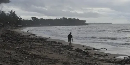
7.8-magnitude Philippines quake triggers tsunami warning, Indonesia orders evacuation

Synopsis
A 7.8-magnitude quake off Mindanao sent tsunami waves as high as 1.4 metres crashing toward Philippine coastlines and triggered evacuation orders in Indonesia's North Sulawesi and Gorontalo — a stark reminder that a single seismic event along the Ring of Fire can simultaneously threaten two of Southeast Asia's largest archipelago nations.
Key Takeaways
A magnitude 7.8 earthquake struck offshore southern Philippines on 8 June , near Mindanao .
At least 5 people have been reported dead; authorities are still verifying casualties and damage.
PHIVOLCS recorded the highest tsunami wave at 1.4 metres and issued warnings to 9 coastal provinces .
Indonesia's BNPB ordered evacuations in North Sulawesi and Gorontalo ; minor tsunami waves detected at northern Indonesian monitoring stations.
Philippine President Ferdinand Romualdez Marcos ordered nationwide disaster response and monitoring across affected areas.
Tsunami waves were forecast to continue arriving through Monday morning for several hours.
A powerful magnitude 7.8 earthquake struck offshore waters in the southern Philippines on Monday morning, 8 June, triggering tsunami warnings across nine coastal provinces in the Philippines and prompting Indonesia's National Disaster Management Agency (BNPB) to order evacuations along the northern coastal areas of the country. At least five people have been reported dead, according to a local disaster official, with authorities still assessing the full extent of casualties and damage.
Indonesia on High Alert
The BNPB confirmed that minor tsunami waves were detected at several coastal monitoring stations in northern Indonesia. The agency directed officials in affected provinces — including North Sulawesi and Gorontalo — to immediately instruct residents to remain vigilant, stay away from shorelines, and evacuate to higher ground in an orderly manner.
Indonesia's Meteorology, Climatology, and Geophysical Agency also issued a formal tsunami warning for the country's northeastern coastal areas. The tremors were felt across various cities and villages in northeastern Indonesia, sparking panic among coastal communities, according to local media reports. No immediate casualties were reported on the Indonesian side.
Scale of the Philippine Disaster
The Philippine Institute of Volcanology and Seismology (PHIVOLCS) confirmed the 7.8-magnitude offshore quake struck near Mindanao, the second-largest island in the Philippines, on Monday morning. The institute recorded the highest tsunami wave at 1.4 metres at coastal monitoring stations.
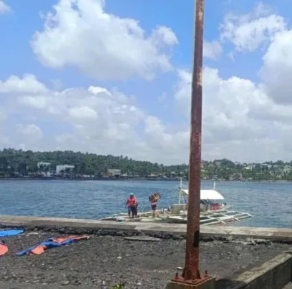
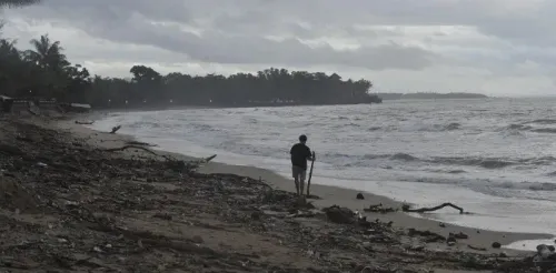
PHIVOLCS issued tsunami warnings to nine coastal provinces, strongly advising residents to evacuate immediately to higher ground or move farther inland. The agency warned that the first tsunami waves were forecast to arrive Monday morning and continue for several hours.
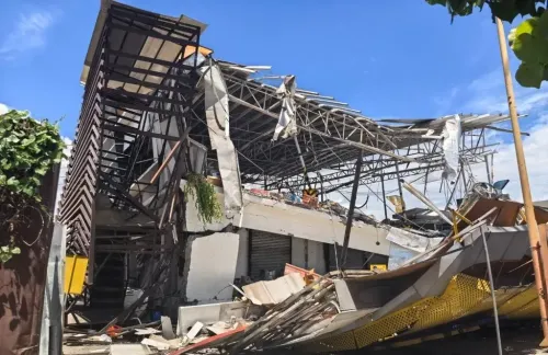
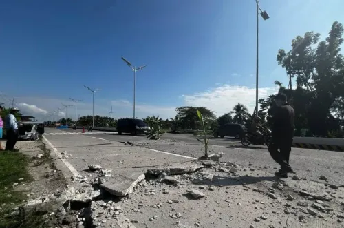
Local media reported that some buildings collapsed in affected areas, and power outages were recorded. Tremors were felt in neighbouring provinces as well.
Government Response
Philippine President Ferdinand Romualdez Marcos ordered disaster response and monitoring efforts across all affected areas, urging residents to move to higher ground without delay. Agripino Dacera, the disaster management chief in General Santos City, said authorities were still verifying the full extent of fatalities and structural damage.
Why the Philippines Is Especially Vulnerable
The Philippines sits along the Pacific 'Ring of Fire' — a zone of major tectonic plate boundaries encircling the Pacific Ocean, known for its high concentration of earthquakes and volcanic eruptions. The region around Mindanao is among the most seismically active in the world, making large-magnitude quakes and associated tsunamis a recurring threat to coastal populations.
This is not the first time a Philippine quake has triggered cross-border tsunami alerts in Indonesia; the geographic proximity of the two archipelago nations along the same tectonic corridor means seismic events in the southern Philippines routinely place northern Indonesian coastlines at risk. Authorities across both countries are expected to maintain heightened vigilance as aftershocks continue.
Point of View
The death toll is almost certainly provisional; past Ring of Fire events have shown that initial counts routinely understate the final figure as communications are restored in remote coastal areas. The real test for both governments is how quickly verified damage assessments reach affected communities — not just whether the evacuation order was issued, but whether it was heard in time.
NationPress
24 Oct 2026
Frequently Asked Questions
What caused the tsunami warning in Indonesia on 8 June 2025?
A magnitude 7.8 earthquake struck offshore waters in the southern Philippines near Mindanao on 8 June, generating tsunami waves that reached Indonesian coastal monitoring stations. Indonesia's BNPB and Meteorology, Climatology, and Geophysical Agency issued evacuation orders and tsunami warnings for northern coastal areas including North Sulawesi and Gorontalo.
How many people have died in the Philippines earthquake?
At least five people have been reported dead, according to a local disaster official in General Santos City. Authorities were still verifying the full extent of fatalities and structural damage as of Monday.
How high were the tsunami waves recorded after the Philippines quake?
The Philippine Institute of Volcanology and Seismology recorded the highest tsunami wave at 1.4 metres at coastal monitoring stations. Warnings were issued to nine coastal provinces, with waves forecast to continue arriving for several hours on Monday morning.
Which areas in Indonesia were ordered to evacuate?
The BNPB directed officials in North Sulawesi and Gorontalo to immediately order residents away from shorelines and to higher ground. Minor tsunami waves were detected at several coastal monitoring stations in northern Indonesia.
Why is the southern Philippines prone to major earthquakes?
The Philippines lies along the Pacific Ring of Fire, a zone of major tectonic plate boundaries known for frequent earthquakes and volcanic eruptions. The area around Mindanao is considered one of the most seismically active regions in the world.