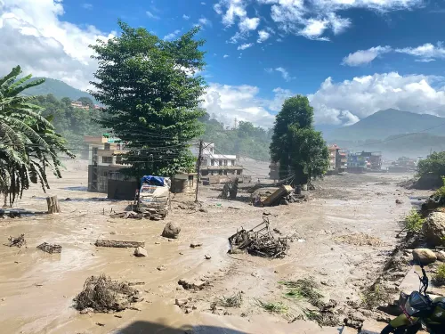
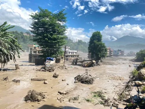
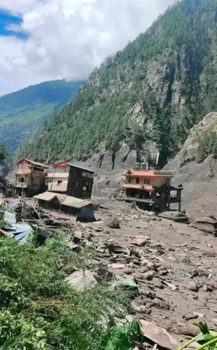
Chameliya River blockage risk eases as landslide debris clears in Nepal's Darchula
Synopsis
A landslide that partially blocked the Chameliya River in Nepal's Darchula district on Friday cleared naturally by evening, averting a potential dam-burst disaster. But the episode underscores a deepening Himalayan hazard: with 1,294 dead from last week's Nepal floods and climate change accelerating glacier retreat, the risk of cascading river blockages along the Nepal-India border is growing.
Key Takeaways
Landslides at Bhattar, Apihimal Rural Municipality in Darchula district partially blocked the Chameliya River from the morning of Friday, 4 September .
The river cleared naturally by 4–5 pm ; Mohan Singh Dhami , Assistant Chief District Officer, confirmed it was flowing freely by early evening.
The District Administration Office had issued a public alert warning of a possible complete blockage and downstream flood risk, including into India .
Mobile connectivity in the affected area remains completely disrupted , hampering real-time monitoring after sunset.
Nepal's broader flood crisis has claimed 1,294 lives , with 5,053 people still out of contact as of Friday, according to the National Disaster Risk Reduction and Management Authority .
Experts link rising Himalayan landslide and river-blockage risks to climate change -driven glacier retreat and permafrost degradation.
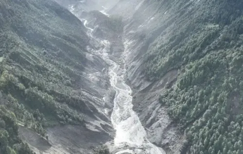
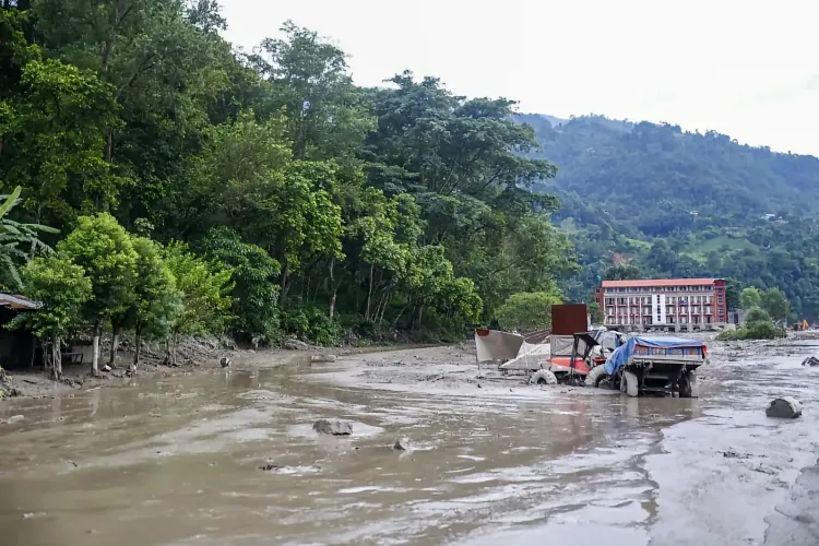
The risk of a major river blockage on the Chameliya River in western Nepal's Darchula district subsided on Friday, 4 September, after the river gradually flushed out landslide debris that had partially obstructed its flow since the morning. A senior district official confirmed the river was flowing freely by early evening, averting what could have been a catastrophic downstream disaster.
How the Blockage Developed
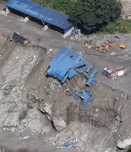
Continuous landslides at Bhattar in Apihimal Rural Municipality, Darchula, began at around 10–11 am on Friday, with the most significant earth movement occurring between 1 pm and 2 pm. The slides partially obstructed the Chameliya River — a tributary of the Mahakali River, which forms the international boundary between Nepal and India.
The District Administration Office, Darchula, promptly issued a public alert urging residents along the banks of the river — locally referred to as the Chaulani River — to remain on high alert. Authorities warned of the possibility of a complete blockage and instructed downstream communities and relevant government agencies to take immediate precautionary measures to protect lives and property.
Situation Verified, Risk Recedes
Mohan Singh Dhami, Assistant Chief District Officer of Darchula, confirmed that the natural blockage had cleared by early evening. 'The river has gradually washed away the landslide debris and sediment, and the river was flowing freely by early Friday evening when we verified the situation,' Dhami said.
The situation was assessed at around 4–5 pm, by which time the immediate danger had diminished. However, Dhami noted that his office was encountering difficulties in obtaining real-time updates from the affected area after sunset, as mobile connectivity in the region remains completely disrupted.
Cross-Border Risk Highlighted
Officials underlined the transboundary dimension of the threat. 'If a major blockage were to occur in the Chameliya River, the risk would be greater in the upstream areas of Nepal, while the impact could also extend to downstream areas and even into India,' Dhami said. The Chameliya's confluence with the Mahakali — a shared river — means any large-scale dam-burst event carries implications for border communities on both sides.
The episode drew comparisons to the natural disaster triggered by the Bhote Koshi River in Rasuwa district the previous week, which demonstrated how rapidly a cascading chain of landslide-to-flood events can develop in Nepal's high-mountain terrain.
Climate Change and Growing Himalayan Hazard
Experts have warned that Nepal faces a rising risk of rivers being temporarily blocked by landslides, glacier collapses, and debris avalanches as climate change continues to destabilise the Himalayan environment. Rising temperatures are accelerating glacier retreat and permafrost degradation, weakening mountain slopes and increasing the likelihood of cascading hazards. Such events can send vast volumes of ice, rock, and sediment into river valleys, forming natural dams that, when breached, unleash destructive flash floods downstream.
Nepal Flood Toll Mounts
The Chameliya incident comes against the backdrop of a broader national disaster. According to the National Disaster Risk Reduction and Management Authority, as many as 1,294 people have died in last week's floods across Nepal, while 5,053 people remained out of contact as of Friday evening. The scale of the ongoing crisis has placed Nepal's disaster response agencies under severe strain.
Authorities in Darchula say monitoring of the Chameliya River will continue, particularly given disrupted communications and the persistent risk of further landslides in the area during the ongoing monsoon season.
Point of View
Not disaster preparedness — and that distinction matters. The disruption of mobile connectivity in Darchula meant officials were essentially blind after sunset, a systemic gap that could prove fatal if a larger blockage forms overnight. The transboundary dimension is equally underreported: the Chameliya feeds the Mahakali, a shared river, meaning a dam-burst event here is not just Nepal's problem. With 1,294 dead from last week's floods and climate change accelerating Himalayan instability, the question is not whether another such blockage will occur, but whether Nepal and India have the early-warning infrastructure to respond before the river decides for them.
NationPress
20 Oct 2026
Frequently Asked Questions
What caused the Chameliya River blockage in Nepal's Darchula district?
Continuous landslides at Bhattar in Apihimal Rural Municipality, Darchula, partially obstructed the Chameliya River on Friday, 4 September, from approximately 10–11 am, with the heaviest movement between 1 pm and 2 pm. The river naturally flushed out the debris by early evening, clearing the blockage without a major flood event.
Was there a risk to India from the Chameliya River blockage?
Yes, officials flagged a cross-border risk. The Chameliya is a tributary of the Mahakali River, which forms the Nepal-India boundary. Assistant Chief District Officer Mohan Singh Dhami stated that a major blockage could have impacted downstream areas inside India, in addition to upstream communities in Nepal.
How does this compare to the Bhote Koshi River disaster in Rasuwa?
The Bhote Koshi River event in Rasuwa district the previous week showed how rapidly a landslide-triggered river blockage can escalate into a catastrophic flood. The Chameliya situation followed a similar pattern but resolved naturally before a complete dam formed, avoiding a comparable disaster.
What is Nepal's current flood death toll?
According to the National Disaster Risk Reduction and Management Authority, at least 1,294 people had died in Nepal's floods as of Friday evening, with 5,053 people still out of contact. The crisis has placed severe pressure on the country's disaster response agencies.
Why are Himalayan river blockages becoming more frequent?
Experts attribute the growing risk to climate change, which is accelerating glacier retreat and permafrost degradation across the Himalayas. Weakened mountain slopes are increasingly prone to landslides and debris avalanches that can temporarily dam rivers, creating natural lakes that may burst without warning.