

Cyclone Akvan to intensify into severe storm by Tuesday evening; Andhra CM reviews preparedness
Synopsis
Cyclone Akvan — the third to target Andhra Pradesh in quick succession — is tracking toward a Nellore-Tuni landfall on 20 November with winds potentially hitting 145 km/h. Chief Minister Naidu has taken personal charge, activating ground-level outreach through Swarna Grama and Swarna Ward networks. The unusually rapid series of cyclones is testing the state's disaster response infrastructure in real time.
Key Takeaways
Cyclonic Storm Akvan is expected to intensify into a severe cyclonic storm by Tuesday evening, 17 November .
The storm is forecast to become a very severe cyclonic storm by the morning of 19 November and make landfall between Nellore and Tuni on 20 November afternoon.
Landfall wind speeds are projected at 120–130 km/h , gusting up to 145 km/h .
The storm is currently 610 km from Chennai and moving at 3 km/h in a west-northwesterly direction.
Chandrababu Naidu held a teleconference with officials Tuesday morning; this is the third cyclone to approach the state in recent weeks.
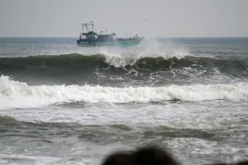
Authorities are deploying Swarna Grama and Swarna Ward staff for direct coastal community outreach; fishermen have been warned to stay off the sea.
Cyclonic Storm Akvan, currently positioned over the Southeast and adjoining Southwest Bay of Bengal, is likely to intensify into a severe cyclonic storm by Tuesday evening (17 November), according to the Andhra Pradesh State Disaster Management Authority (SDMA). The storm is tracking west-northwesterly and is expected to make landfall between Nellore and Tuni by Friday afternoon, 20 November.
Current Position and Projected Track
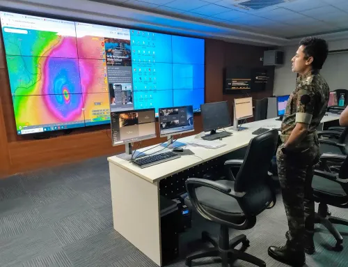
As of Tuesday, the storm is centred 610 km from Chennai, 660 km from Machilipatnam, 670 km from Visakhapatnam, and 790 km from Gopalpur in Odisha, according to Prakhar Jain, Managing Director of the SDMA and CEO of the Real Time Governance Society (RTGS). The cyclone has been moving at a relatively slow speed of 3 km/h over the last six hours.
Akvan is forecast to further strengthen into a very severe cyclonic storm by the morning of Thursday, 19 November. At the time of landfall, wind speeds are expected to range between 120 and 130 km/h, with gusts potentially peaking at 145 km/h. Heavy rainfall is anticipated across the region on 19 and 20 November.
Chief Minister Naidu Reviews Preparedness
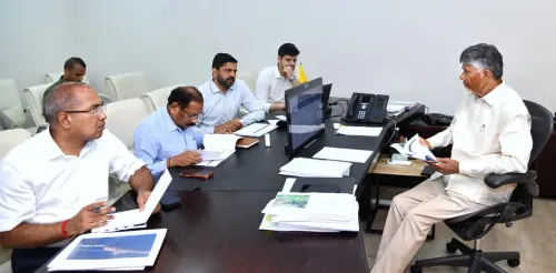
Chief Minister N. Chandrababu Naidu on Tuesday morning held a teleconference with senior officials to assess the cyclone's trajectory and the state's readiness. He was briefed that greater clarity on the storm's intensity would emerge by Tuesday evening.
Naidu noted that Akvan is the third cyclone to approach the state in recent weeks — an unusually high frequency that has stretched disaster response machinery. He urged officials not to allow public panic, stressing instead that proactive steps must eliminate avoidable harm. 'There is no need to panic due to these disasters; instead, measures must be taken to ensure the public is not adversely affected,' he said.
Key Directives to Officials
The Chief Minister issued a series of operational instructions. Weather warnings must be continuously relayed to coastal communities, with field-level outreach through 'Swarna Grama' and 'Swarna Ward' staff tasked with direct communication to residents in affected areas. Fishermen must be firmly prevented from venturing out to sea, he emphasised.
Naidu also directed officials to guard against breaches in tanks and canals, ensure downed trees and electricity poles are cleared without delay, and conduct real-time assessments to support rescue and rehabilitation operations. The public must be reassured that government support will be available regardless of the disaster's scale, he added.
Coastal Communities on Alert
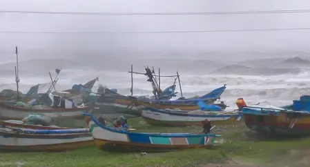
Coastal districts between Nellore and Visakhapatnam face the highest risk as the storm approaches landfall. This comes amid a broader pattern of increasing cyclonic activity over the Bay of Bengal in the post-monsoon season, with meteorologists noting that warmer sea-surface temperatures have contributed to more frequent and rapidly intensifying systems in recent years.
Authorities are expected to issue formal evacuation advisories for the most vulnerable coastal belts as the storm's track firms up over the next 48 hours.
Point of View
But the real test will be evacuation compliance in communities still fatigued from the previous two storms. The 3 km/h forward speed is also notable: a slow-moving storm dumps far more rain per square kilometre, raising flood and inundation risk well beyond the wind corridor. Mainstream coverage will focus on the landfall window; the deeper risk is freshwater flooding inland.
NationPress
17 Nov 2026
Frequently Asked Questions
When and where will Cyclone Akvan make landfall?
Cyclone Akvan is expected to make landfall between Nellore and Tuni in Andhra Pradesh by Friday afternoon, 20 November. Wind speeds at landfall are forecast at 120–130 km/h, with gusts up to 145 km/h.
How strong will Cyclone Akvan be at landfall?
The storm is likely to reach 'very severe cyclonic storm' intensity by the morning of 19 November, before making landfall on 20 November. Sustained winds of 120–130 km/h and gusts peaking at 145 km/h are anticipated at the time of landfall.
What is the current position of Cyclone Akvan?
As of 17 November, the storm is centred 610 km from Chennai, 660 km from Machilipatnam, 670 km from Visakhapatnam, and 790 km from Gopalpur in Odisha. It is moving in a west-northwesterly direction at 3 km/h.
What steps has the Andhra Pradesh government taken?
Chief Minister N. Chandrababu Naidu held a teleconference with officials on Tuesday morning to review preparedness. He directed that coastal communities be warned via Swarna Grama and Swarna Ward staff, that fishermen be kept off the sea, and that rescue and rehabilitation machinery be on standby.
Is Cyclone Akvan the first cyclone to hit Andhra Pradesh this season?
No. Chief Minister Naidu stated that Akvan is the third cyclone to approach the state in recent weeks, making this an unusually active post-monsoon season for Andhra Pradesh's coastline.