Andhra Pradesh AI flood warning system gives 48-hour alerts for Vijayawada
Synopsis
Andhra Pradesh has built what could be a template for urban flood preparedness in India — an AI system trained on 30 years of Budameru flood data that can warn Vijayawada ward by ward, six hours before a flash flood hits. If the statewide rollout delivers, it marks a genuine shift from reactive disaster response to predictive governance.
Key Takeaways
RTGS , APSDMA , and IIT Gandhinagar jointly developed the City Flood Alert platform for Andhra Pradesh .
The system provides 48-hour rainfall forecasts and six-hour flash flood warnings at ward level.
The predictive model is trained on nearly three decades of historical Budameru stream flood data.
Automated alerts are sent to Municipal Commissioners , District Collectors , and field agencies without manual intervention.
The platform launches first in Vijayawada and will expand to all Urban Local Bodies across Andhra Pradesh .
The initiative was launched under the vision of Chief Minister N.
Chandrababu Naidu as part of a climate-resilience push.
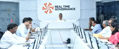
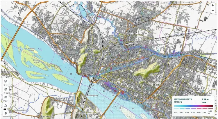
The Real Time Governance Society (RTGS) of the Andhra Pradesh government, in collaboration with the Andhra Pradesh State Disaster Management Authority (APSDMA) and IIT Gandhinagar, has developed an AI-powered urban flood forecasting platform capable of delivering 48-hour rainfall outlooks and six-hour flash flood warnings. The system, called City Flood Alert, is being operationalised first in Vijayawada — a city with a long history of severe inundation — before a planned rollout across all Urban Local Bodies in the state.
What the System Does
The City Flood Alert platform integrates artificial intelligence, satellite-based terrain mapping, predictive analytics, and hydrological modelling to generate highly accurate, location-specific flood forecasts. At its core is a high-resolution Digital Elevation Model (DEM) built from satellite imagery, with Vijayawada mapped ward by ward to capture terrain elevations, drainage networks, and flood-prone zones.
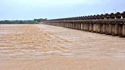
The predictive model draws on nearly three decades of historical flood data from the Budameru stream — the primary source of recurring inundation in the city — enabling it to simulate flood behaviour across varying rainfall scenarios with what officials describe as 'remarkable precision.' The platform also identifies drainage channels where silt accumulation could trigger waterlogging and backflow, allowing preventive maintenance ahead of heavy rain.
How Warnings Reach the Ground
Once a potential flood threat is detected, the platform automatically generates alerts and shares actionable intelligence with APSDMA, which then issues timely advisories to Municipal Commissioners, District Collectors, ward-level municipal officials, and field agencies. This automated chain enables authorities to clear drainage channels, deploy emergency response teams, and evacuate residents from vulnerable locations — all before flooding begins.
The system's five core functions include: rainfall forecasts up to 48 hours in advance; flash flood predictions up to six hours before occurrence; ward-level flood hotspot identification; automated early warning alerts to government officials; and real-time decision support for emergency response teams.
Why Vijayawada Was Chosen First
Vijayawada, one of Andhra Pradesh's fastest-growing cities, has historically battled recurring floods — particularly from the Budameru stream, which frequently inundates low-lying wards during the monsoon season. The city's vulnerability, combined with its dense urban footprint, made it the natural starting point for the platform's deployment. This comes amid a broader national push to shift disaster management from reactive crisis response to predictive, technology-driven governance.
Statewide Expansion Plan
The initiative, launched under the vision of Chief Minister N. Chandrababu Naidu, is designed to scale across all Urban Local Bodies (ULBs) in Andhra Pradesh. Each city and town will undergo digital terrain mapping and flood-risk assessment, creating a statewide network of intelligent urban flood monitoring systems capable of providing location-specific forecasts. The government has described the project as a significant step towards building climate-resilient cities, according to an official release dated 26 July.
Point of View
However, is last-mile execution: whether ward-level officials act on automated alerts in the critical hours before inundation, and whether the system's accuracy holds during extreme rainfall events that fall outside its training data. The statewide rollout ambition is the right goal, but Vijayawada's performance this monsoon season will be the proof of concept that determines how seriously other Indian states take this model.
NationPress
26 Oct 2026
Frequently Asked Questions
What is Andhra Pradesh's City Flood Alert system?
City Flood Alert is an AI-powered urban flood forecasting platform developed by RTGS, APSDMA, and IIT Gandhinagar. It uses satellite terrain mapping, hydrological modelling, and predictive analytics to deliver 48-hour rainfall forecasts and six-hour flash flood warnings at the ward level, starting with Vijayawada.
How does the Andhra Pradesh flood warning system work?
The platform uses a high-resolution Digital Elevation Model built from satellite imagery and a predictive flood model trained on nearly 30 years of Budameru stream data. When a flood threat is detected, it automatically alerts Municipal Commissioners, District Collectors, and field agencies to enable pre-emptive action such as drainage clearing and resident evacuation.
Why is Vijayawada the first city to get this flood alert system?
Vijayawada has a long history of recurring floods, particularly from the Budameru stream, which frequently inundates low-lying wards during heavy monsoon rainfall. Its vulnerability and dense urban footprint made it the priority deployment site for the City Flood Alert platform.
Will the flood warning system expand beyond Vijayawada?
Yes. The platform is designed to scale across all Urban Local Bodies in Andhra Pradesh. Each city and town will undergo digital terrain mapping and flood-risk assessment to create a statewide network of intelligent urban flood monitoring systems.
Who developed the Andhra Pradesh AI flood forecasting platform?
The platform was developed jointly by the RTGS AWARE Division of the Andhra Pradesh government, the Andhra Pradesh State Disaster Management Authority (APSDMA), and experts from IIT Gandhinagar, under the vision of Chief Minister N. Chandrababu Naidu.