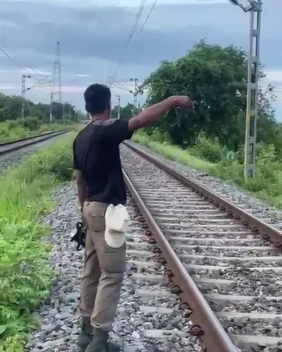
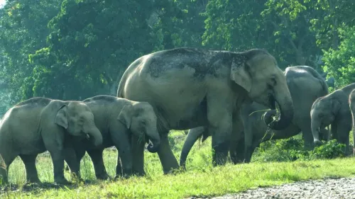
CM Himanta's AI-GPS System Has Saved 151 Elephants in Assam
Synopsis
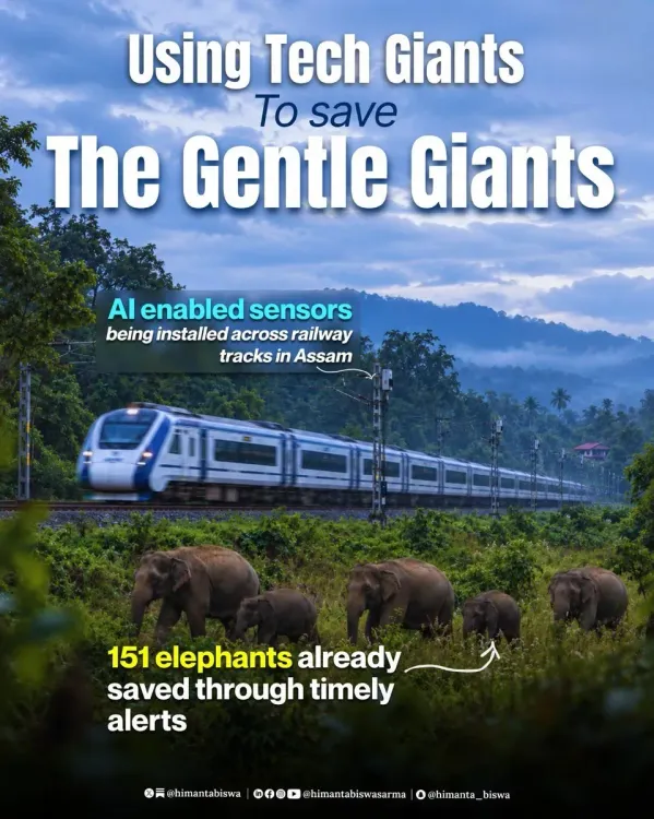
Assam CM Himanta Biswa Sarma reveals that combining five years of elephant GPS data with AI-powered rail alerts has saved 151 elephants from train collisions, positioning the state as a model for tech-driven wildlife conservation across India.
Key Takeaways
151 elephants have been saved so far through Assam's AI-enabled rail alert system.
The system draws on five years of GPS tracking data to identify elephant movement patterns and predict rail crossings.
Timely alerts to railway operators give train crews a critical window to slow or stop before a collision occurs.
Assam CM Himanta Biswa Sarma shared the initiative on October 9, 2026 , highlighting it as tech-enabled conservation in action.
The model has potential replication value for other high-risk elephant-rail corridors across Odisha, Jharkhand, West Bengal, Tamil Nadu, and Kerala .
India holds roughly 60 percent of Asia's wild elephant population, making scalable collision-prevention systems a national conservation priority.
Five years of elephant footprints, millions of GPS coordinates, and one urgent question — where is the herd headed next? Assam Chief Minister Himanta Biswa Sarma announced on Friday, October 9, 2026, that the state has turned that question into a working answer, deploying an AI-enabled alert system that cross-references half a decade of GPS tracking data to predict elephant movement — and flag it to railway operators before a collision can happen.
151 elephants pulled back from the tracks
The headline number is stark: 151 elephants saved so far. The system works by layering five years of GPS movement data onto real-time AI models that identify patterns in how elephant herds traverse Assam's forests and corridors. When the model anticipates an imminent rail crossing, timely alerts go out — giving train drivers and station masters a critical window to slow down or stop. That window, measured in minutes, is the difference between a statistic and a tragedy.
Assam sits at one of the most fraught intersections of wildlife and infrastructure in the country. The state's rail network cuts through dense forest corridors that are home to significant wild elephant populations. Train-elephant collisions have been a persistent and deadly problem across northeast India, claiming dozens of animal lives annually across the region for years.
Why AI and GPS together change the equation
GPS collars on individual elephants have been used in Indian wildlife management for years, but their data was largely reactive — useful for post-incident analysis, not prevention. Feeding five years of that accumulated movement data into an AI model flips the equation. Patterns emerge: preferred corridors, seasonal migration routes, time-of-day crossings. The AI does not just track; it anticipates.
That anticipatory layer is what makes the Assam model notable. Rail alerts generated by a predictive system carry far more operational weight than a forest ranger's radio call — they can be integrated into the signalling chain and acted upon at speed. The combination of deep historical data and machine-learning inference is the architecture that makes the 151-elephant figure credible rather than aspirational.
A template for India's other high-risk corridors
India holds roughly 60 percent of Asia's wild elephant population, and the conflict between expanding rail infrastructure and elephant habitat is not unique to Assam. Corridors in Odisha, Jharkhand, West Bengal, and parts of Tamil Nadu and Kerala face the same deadly geometry. A system that demonstrably works in Assam's complex terrain — forested, hilly, seasonally flooded — has a strong case for replication.
Conservation technology is at its most powerful when it is boring to operate: an alert fires, a driver brakes, a herd crosses safely, and no headline is written. The 151 elephants CM Sarma cited represent exactly those unwritten headlines — the collisions that did not happen because a machine saw the pattern before the locomotive did.
The next test for Assam's model is whether the alert system can scale across more rail divisions and whether the GPS collar coverage is dense enough to catch every herd, not just the tagged ones. If it can, northeast India may have quietly built one of the most consequential wildlife-tech deployments on the continent.
Point of View
The initiative embeds conservation logic directly into railway infrastructure management, a governance model that most states have not yet attempted. For CM Sarma, the announcement also serves a broader political signal: that the BJP-governed northeast can lead on environmental stewardship through technology rather than restriction alone. The 151-elephant figure, if independently verified and sustained, will likely attract central government and international conservation funding, accelerating the corridor-mapping work that wildlife agencies have sought for decades.
NationPress
9 Oct 2026
Frequently Asked Questions
How does Assam's AI elephant alert system work?
The system combines five years of GPS tracking data from elephants with AI models that identify movement patterns and predict when herds are likely to cross railway lines. When a crossing is anticipated, alerts are sent to railway staff in time to slow or stop trains.
How many elephants has the Assam system saved?
According to Assam Chief Minister Himanta Biswa Sarma, the system has so far helped save 151 elephants from train collisions.
Why are elephant-train collisions a problem in Assam?
Assam's rail network passes through dense forest corridors that are home to large wild elephant populations. Trains travelling at night or at speed through these areas have historically collided with herds, making it one of the most serious human-wildlife conflict flashpoints in northeast India.
Can this system be used in other Indian states?
Yes. Elephant-rail conflict is a problem in several other states including Odisha, Jharkhand, West Bengal, Tamil Nadu, and Kerala. If the Assam model proves scalable, conservationists and railway authorities could adapt it for those corridors.
What role does GPS play in protecting elephants from trains?
GPS collars on elephants generate continuous location data. Over five years, this data reveals regular movement corridors and crossing points. Fed into an AI model, it enables predictive alerts rather than reactive responses to collisions.